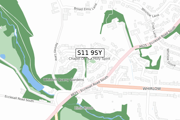
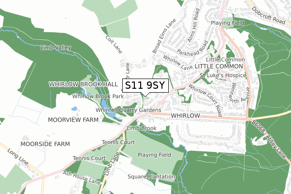
S11 9SY is located in the Dore and Totley electoral ward, within the metropolitan district of Sheffield and the English Parliamentary constituency of Sheffield, Hallam. The Sub Integrated Care Board (ICB) Location is NHS South Yorkshire ICB - 03N and the police force is South Yorkshire. This postcode has been in use since November 2018.


GetTheData
Source: OS Open Zoomstack (Ordnance Survey)
Licence: Open Government Licence (requires attribution)
Attribution: Contains OS data © Crown copyright and database right 2025
Source: Open Postcode Geo
Licence: Open Government Licence (requires attribution)
Attribution: Contains OS data © Crown copyright and database right 2025; Contains Royal Mail data © Royal Mail copyright and database right 2025; Source: Office for National Statistics licensed under the Open Government Licence v.3.0
| Easting | 431250 |
| Northing | 382819 |
| Latitude | 53.341371 |
| Longitude | -1.532113 |
GetTheData
Source: Open Postcode Geo
Licence: Open Government Licence
| Country | England |
| Postcode District | S11 |
➜ See where S11 is on a map ➜ Where is Sheffield? | |
GetTheData
Source: Land Registry Price Paid Data
Licence: Open Government Licence
| Ward | Dore And Totley |
| Constituency | Sheffield, Hallam |
GetTheData
Source: ONS Postcode Database
Licence: Open Government Licence
5, WHIRLOW GRANGE CLOSE, SHEFFIELD, S11 9SY 2021 10 JUN £1,350,000 |
4, WHIRLOW GRANGE CLOSE, SHEFFIELD, S11 9SY 2021 17 MAY £1,270,000 |
3, WHIRLOW GRANGE CLOSE, SHEFFIELD, S11 9SY 2021 5 FEB £1,350,000 |
2, WHIRLOW GRANGE CLOSE, SHEFFIELD, S11 9SY 2019 22 AUG £1,280,000 |
GetTheData
Source: HM Land Registry Price Paid Data
Licence: Contains HM Land Registry data © Crown copyright and database right 2025. This data is licensed under the Open Government Licence v3.0.
| Whirlowdale Road (Ecclesall Road South) | Whirlow | 98m |
| Whirlowdale Road (Ecclesall Road South) | Whirlow | 108m |
| Whinfell Court (Ecclesall Road South) | Whirlow | 156m |
| Limb Lane (Ecclesall Road South) | Whirlow | 275m |
| Whirlow Court Road (Ecclesall Road South) | Whirlow | 374m |
| Dore & Totley Station | 1.9km |
| Dronfield Station | 6.1km |
| Sheffield Station | 6.2km |
GetTheData
Source: NaPTAN
Licence: Open Government Licence
| Percentage of properties with Next Generation Access | 100.0% |
| Percentage of properties with Superfast Broadband | 100.0% |
| Percentage of properties with Ultrafast Broadband | 0.0% |
| Percentage of properties with Full Fibre Broadband | 0.0% |
Superfast Broadband is between 30Mbps and 300Mbps
Ultrafast Broadband is > 300Mbps
| Percentage of properties unable to receive 2Mbps | 0.0% |
| Percentage of properties unable to receive 5Mbps | 0.0% |
| Percentage of properties unable to receive 10Mbps | 0.0% |
| Percentage of properties unable to receive 30Mbps | 0.0% |
GetTheData
Source: Ofcom
Licence: Ofcom Terms of Use (requires attribution)
GetTheData
Source: ONS Postcode Database
Licence: Open Government Licence


➜ Get more ratings from the Food Standards Agency
GetTheData
Source: Food Standards Agency
Licence: FSA terms & conditions
| Last Collection | |||
|---|---|---|---|
| Location | Mon-Fri | Sat | Distance |
| 73 Park Head Road | 17:30 | 10:00 | 535m |
| Ecclesall Road South | 17:30 | 10:00 | 649m |
| Whirlowdale Road | 17:30 | 10:00 | 651m |
GetTheData
Source: Dracos
Licence: Creative Commons Attribution-ShareAlike
The below table lists the International Territorial Level (ITL) codes (formerly Nomenclature of Territorial Units for Statistics (NUTS) codes) and Local Administrative Units (LAU) codes for S11 9SY:
| ITL 1 Code | Name |
|---|---|
| TLE | Yorkshire and The Humber |
| ITL 2 Code | Name |
| TLE3 | South Yorkshire |
| ITL 3 Code | Name |
| TLE32 | Sheffield |
| LAU 1 Code | Name |
| E08000019 | Sheffield |
GetTheData
Source: ONS Postcode Directory
Licence: Open Government Licence
The below table lists the Census Output Area (OA), Lower Layer Super Output Area (LSOA), and Middle Layer Super Output Area (MSOA) for S11 9SY:
| Code | Name | |
|---|---|---|
| OA | E00040165 | |
| LSOA | E01007933 | Sheffield 068F |
| MSOA | E02001678 | Sheffield 068 |
GetTheData
Source: ONS Postcode Directory
Licence: Open Government Licence
| S11 9RX | Whirlow Grange Drive | 83m |
| S11 9QA | Whinfell Court | 106m |
| S11 9RW | Whirlow Grange Avenue | 133m |
| S11 9QB | Whinfell Cottages | 155m |
| S11 9NY | Whirlow Green | 200m |
| S11 9NH | Whirlowdale Road | 246m |
| S11 9QD | Ecclesall Road South | 261m |
| S11 9LS | Whirlowdale Rise | 277m |
| S11 9PZ | Ecclesall Road South | 296m |
| S11 9NQ | Whirlowdale Close | 311m |
GetTheData
Source: Open Postcode Geo; Land Registry Price Paid Data
Licence: Open Government Licence