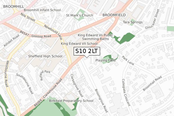
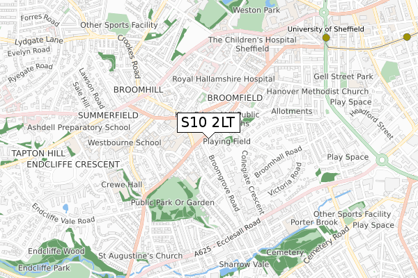
S10 2LT is located in the Broomhill and Sharrow Vale electoral ward, within the metropolitan district of Sheffield and the English Parliamentary constituency of Sheffield Central. The Sub Integrated Care Board (ICB) Location is NHS South Yorkshire ICB - 03N and the police force is South Yorkshire. This postcode has been in use since November 2017.


GetTheData
Source: OS Open Zoomstack (Ordnance Survey)
Licence: Open Government Licence (requires attribution)
Attribution: Contains OS data © Crown copyright and database right 2025
Source: Open Postcode Geo
Licence: Open Government Licence (requires attribution)
Attribution: Contains OS data © Crown copyright and database right 2025; Contains Royal Mail data © Royal Mail copyright and database right 2025; Source: Office for National Statistics licensed under the Open Government Licence v.3.0
| Easting | 433717 |
| Northing | 386610 |
| Latitude | 53.375295 |
| Longitude | -1.494660 |
GetTheData
Source: Open Postcode Geo
Licence: Open Government Licence
| Country | England |
| Postcode District | S10 |
➜ See where S10 is on a map ➜ Where is Sheffield? | |
GetTheData
Source: Land Registry Price Paid Data
Licence: Open Government Licence
| Ward | Broomhill And Sharrow Vale |
| Constituency | Sheffield Central |
GetTheData
Source: ONS Postcode Database
Licence: Open Government Licence
| Broomgrove Road (Clarkehouse Road) | Broomhill | 58m |
| Clarkehouse Road (Newbould Lane) | Broomhill | 93m |
| Glossop Road (Newbould Lane) | Broomhill | 151m |
| Newbould Lane (Glossop Road) | Broomhill | 156m |
| Ash Grove (Clarkehouse Road) | Broomhill | 163m |
| University Of Sheffield (Sheffield Supertram) (Hanover Street) | Western Bank | 927m |
| West Street (Sheffield Supertram) (West Street) | Sheffield Centre | 1,285m |
| Netherthorpe Road (Sheffield Supertram) (Netherthorpe Road) | Netherthorpe | 1,326m |
| City Hall (Sheffield Supertram) (West Street) | Sheffield Centre | 1,620m |
| Shalesmoor (Sheffield Supertram) (Corner Of Netherthorpe Rd And Shalesmoor) | Shalesmoor | 1,860m |
| Sheffield Station | 2.2km |
GetTheData
Source: NaPTAN
Licence: Open Government Licence
| Percentage of properties with Next Generation Access | 100.0% |
| Percentage of properties with Superfast Broadband | 100.0% |
| Percentage of properties with Ultrafast Broadband | 100.0% |
| Percentage of properties with Full Fibre Broadband | 0.0% |
Superfast Broadband is between 30Mbps and 300Mbps
Ultrafast Broadband is > 300Mbps
| Median download speed | 100.0Mbps |
| Average download speed | 115.4Mbps |
| Maximum download speed | 200.00Mbps |
Ofcom does not currently provide upload speed data for S10 2LT. This is because there are less than four broadband connections in this postcode.
| Percentage of properties unable to receive 2Mbps | 0.0% |
| Percentage of properties unable to receive 5Mbps | 0.0% |
| Percentage of properties unable to receive 10Mbps | 0.0% |
| Percentage of properties unable to receive 30Mbps | 0.0% |
GetTheData
Source: Ofcom
Licence: Ofcom Terms of Use (requires attribution)
GetTheData
Source: ONS Postcode Database
Licence: Open Government Licence


➜ Get more ratings from the Food Standards Agency
GetTheData
Source: Food Standards Agency
Licence: FSA terms & conditions
| Last Collection | |||
|---|---|---|---|
| Location | Mon-Fri | Sat | Distance |
| Clarkehouse Road | 18:30 | 62m | |
| Clarkhouse Road | 17:30 | 10:00 | 65m |
| 445 Glossop Road | 18:00 | 09:30 | 209m |
GetTheData
Source: Dracos
Licence: Creative Commons Attribution-ShareAlike
The below table lists the International Territorial Level (ITL) codes (formerly Nomenclature of Territorial Units for Statistics (NUTS) codes) and Local Administrative Units (LAU) codes for S10 2LT:
| ITL 1 Code | Name |
|---|---|
| TLE | Yorkshire and The Humber |
| ITL 2 Code | Name |
| TLE3 | South Yorkshire |
| ITL 3 Code | Name |
| TLE32 | Sheffield |
| LAU 1 Code | Name |
| E08000019 | Sheffield |
GetTheData
Source: ONS Postcode Directory
Licence: Open Government Licence
The below table lists the Census Output Area (OA), Lower Layer Super Output Area (LSOA), and Middle Layer Super Output Area (MSOA) for S10 2LT:
| Code | Name | |
|---|---|---|
| OA | E00041104 | |
| LSOA | E01008104 | Sheffield 036E |
| MSOA | E02001646 | Sheffield 036 |
GetTheData
Source: ONS Postcode Directory
Licence: Open Government Licence
| S10 2LE | Clarkehouse Road | 12m |
| S10 2LQ | Broomgrove Crescent | 48m |
| S10 2PJ | Newbould Lane | 119m |
| S10 2PA | Ash Grove | 134m |
| S10 2NH | Clarkegrove Road | 141m |
| S10 2LG | Clarkehouse Road | 156m |
| S10 2PH | College Street | 156m |
| S10 2DW | Park Lane | 164m |
| S10 2PT | Glossop Road | 168m |
| S10 2LA | Clarkehouse Road | 175m |
GetTheData
Source: Open Postcode Geo; Land Registry Price Paid Data
Licence: Open Government Licence