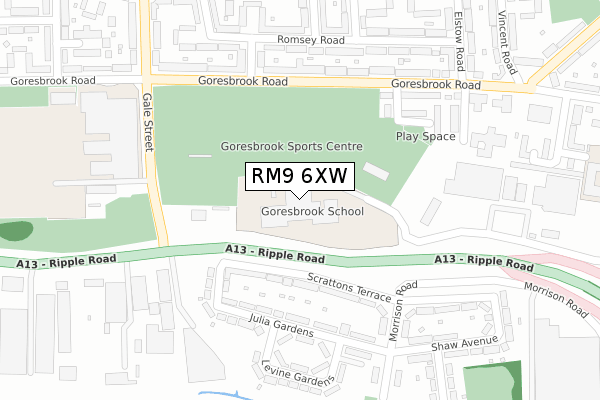
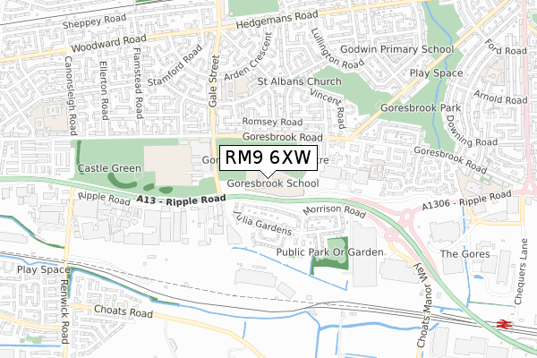
RM9 6XW is located in the Goresbrook electoral ward, within the London borough of Barking and Dagenham and the English Parliamentary constituency of Barking. The Sub Integrated Care Board (ICB) Location is NHS North East London ICB - A3A8R and the police force is Metropolitan Police. This postcode has been in use since February 2018.


GetTheData
Source: OS Open Zoomstack (Ordnance Survey)
Licence: Open Government Licence (requires attribution)
Attribution: Contains OS data © Crown copyright and database right 2025
Source: Open Postcode Geo
Licence: Open Government Licence (requires attribution)
Attribution: Contains OS data © Crown copyright and database right 2025; Contains Royal Mail data © Royal Mail copyright and database right 2025; Source: Office for National Statistics licensed under the Open Government Licence v.3.0
| Easting | 548012 |
| Northing | 183705 |
| Latitude | 51.532856 |
| Longitude | 0.132564 |
GetTheData
Source: Open Postcode Geo
Licence: Open Government Licence
| Country | England |
| Postcode District | RM9 |
➜ See where RM9 is on a map ➜ Where is Barking? | |
GetTheData
Source: Land Registry Price Paid Data
Licence: Open Government Licence
| Ward | Goresbrook |
| Constituency | Barking |
GetTheData
Source: ONS Postcode Database
Licence: Open Government Licence
| Dagenham Leisure Park | Dagenham | 167m |
| Gale St Goresbrook Leisure C | Dagenham | 232m |
| Dagenham Leisure Park | Dagenham | 247m |
| Gale St Goresbrook Leisure C | Dagenham | 401m |
| Pooles Lane | Dagenham | 464m |
| Becontree Underground Station | Dagenham | 915m |
| Dagenham Heathway Underground Station | Dagenham | 1,427m |
| Dagenham Dock Station | 1.2km |
| Barking Station | 3.7km |
| Chadwell Heath Station | 3.9km |
GetTheData
Source: NaPTAN
Licence: Open Government Licence
GetTheData
Source: ONS Postcode Database
Licence: Open Government Licence


➜ Get more ratings from the Food Standards Agency
GetTheData
Source: Food Standards Agency
Licence: FSA terms & conditions
| Last Collection | |||
|---|---|---|---|
| Location | Mon-Fri | Sat | Distance |
| Woodward Road Post Office | 17:30 | 12:30 | 761m |
| Goresbrook Road Post Office | 17:00 | 12:00 | 901m |
| Valence Wood Road | 17:00 | 12:00 | 1,211m |
GetTheData
Source: Dracos
Licence: Creative Commons Attribution-ShareAlike
The below table lists the International Territorial Level (ITL) codes (formerly Nomenclature of Territorial Units for Statistics (NUTS) codes) and Local Administrative Units (LAU) codes for RM9 6XW:
| ITL 1 Code | Name |
|---|---|
| TLI | London |
| ITL 2 Code | Name |
| TLI5 | Outer London - East and North East |
| ITL 3 Code | Name |
| TLI52 | Barking & Dagenham and Havering |
| LAU 1 Code | Name |
| E09000002 | Barking and Dagenham |
GetTheData
Source: ONS Postcode Directory
Licence: Open Government Licence
The below table lists the Census Output Area (OA), Lower Layer Super Output Area (LSOA), and Middle Layer Super Output Area (MSOA) for RM9 6XW:
| Code | Name | |
|---|---|---|
| OA | E00000464 | |
| LSOA | E01000095 | Barking and Dagenham 018E |
| MSOA | E02000019 | Barking and Dagenham 018 |
GetTheData
Source: ONS Postcode Directory
Licence: Open Government Licence
| RM9 6XU | Goresbrook Road | 168m |
| RM9 6XG | Goresbrook Road | 203m |
| RM9 6BB | Romsey Road | 207m |
| IG11 0TY | Scrattons Terrace | 225m |
| RM9 6XS | Goresbrook Road | 236m |
| RM9 6BD | Romsey Road | 238m |
| RM9 6XH | Goresbrook Road | 242m |
| RM9 6AU | Elstow Road | 245m |
| IG11 0UB | Scrattons Terrace | 262m |
| RM9 6AR | Thetford Gardens | 266m |
GetTheData
Source: Open Postcode Geo; Land Registry Price Paid Data
Licence: Open Government Licence