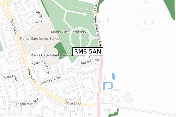
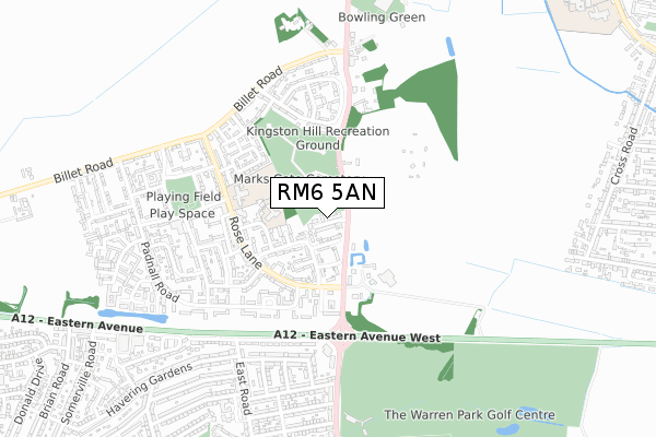
RM6 5AN is located in the Chadwell Heath electoral ward, within the London borough of Barking and Dagenham and the English Parliamentary constituency of Dagenham and Rainham. The Sub Integrated Care Board (ICB) Location is NHS North East London ICB - A3A8R and the police force is Metropolitan Police. This postcode has been in use since January 2018.


GetTheData
Source: OS Open Zoomstack (Ordnance Survey)
Licence: Open Government Licence (requires attribution)
Attribution: Contains OS data © Crown copyright and database right 2025
Source: Open Postcode Geo
Licence: Open Government Licence (requires attribution)
Attribution: Contains OS data © Crown copyright and database right 2025; Contains Royal Mail data © Royal Mail copyright and database right 2025; Source: Office for National Statistics licensed under the Open Government Licence v.3.0
| Easting | 548407 |
| Northing | 189526 |
| Latitude | 51.585056 |
| Longitude | 0.140708 |
GetTheData
Source: Open Postcode Geo
Licence: Open Government Licence
| Country | England |
| Postcode District | RM6 |
➜ See where RM6 is on a map ➜ Where is London? | |
GetTheData
Source: Land Registry Price Paid Data
Licence: Open Government Licence
| Ward | Chadwell Heath |
| Constituency | Dagenham And Rainham |
GetTheData
Source: ONS Postcode Database
Licence: Open Government Licence
| Whalebone Lane Northrose Lane (Rose Lane) | Chadwell Heath | 244m |
| Padnall Road Whalebone Ln Nth | Chadwell Heath | 273m |
| Lawn Farm Grove (Rose Lane) | Chadwell Heath | 337m |
| Lawn Farm Grove | Chadwell Heath | 361m |
| Whalebone Ln Nththe Moby Dick (Eastern Avenue) | Chadwell Heath | 434m |
| Chadwell Heath Station | 2.1km |
| Goodmayes Station | 3km |
| Romford Station | 3.2km |
GetTheData
Source: NaPTAN
Licence: Open Government Licence
| Percentage of properties with Next Generation Access | 100.0% |
| Percentage of properties with Superfast Broadband | 100.0% |
| Percentage of properties with Ultrafast Broadband | 100.0% |
| Percentage of properties with Full Fibre Broadband | 100.0% |
Superfast Broadband is between 30Mbps and 300Mbps
Ultrafast Broadband is > 300Mbps
| Percentage of properties unable to receive 2Mbps | 0.0% |
| Percentage of properties unable to receive 5Mbps | 0.0% |
| Percentage of properties unable to receive 10Mbps | 0.0% |
| Percentage of properties unable to receive 30Mbps | 0.0% |
GetTheData
Source: Ofcom
Licence: Ofcom Terms of Use (requires attribution)
GetTheData
Source: ONS Postcode Database
Licence: Open Government Licence


➜ Get more ratings from the Food Standards Agency
GetTheData
Source: Food Standards Agency
Licence: FSA terms & conditions
| Last Collection | |||
|---|---|---|---|
| Location | Mon-Fri | Sat | Distance |
| Brian Road | 16:45 | 11:15 | 1,234m |
| Whitehart Lane Shops | 16:45 | 11:15 | 1,384m |
| Collier Row Bo | 1,476m | ||
GetTheData
Source: Dracos
Licence: Creative Commons Attribution-ShareAlike
The below table lists the International Territorial Level (ITL) codes (formerly Nomenclature of Territorial Units for Statistics (NUTS) codes) and Local Administrative Units (LAU) codes for RM6 5AN:
| ITL 1 Code | Name |
|---|---|
| TLI | London |
| ITL 2 Code | Name |
| TLI5 | Outer London - East and North East |
| ITL 3 Code | Name |
| TLI52 | Barking & Dagenham and Havering |
| LAU 1 Code | Name |
| E09000002 | Barking and Dagenham |
GetTheData
Source: ONS Postcode Directory
Licence: Open Government Licence
The below table lists the Census Output Area (OA), Lower Layer Super Output Area (LSOA), and Middle Layer Super Output Area (MSOA) for RM6 5AN:
| Code | Name | |
|---|---|---|
| OA | E00000159 | |
| LSOA | E01000030 | Barking and Dagenham 001D |
| MSOA | E02000002 | Barking and Dagenham 001 |
GetTheData
Source: ONS Postcode Directory
Licence: Open Government Licence
| RM6 5LD | Bagleys Spring | 78m |
| RM6 5LH | Thatches Grove | 161m |
| RM6 5LA | Thatches Grove | 190m |
| RM6 5LB | Rams Grove | 208m |
| RM6 5LJ | Thatches Grove | 253m |
| RM6 5LL | Lawn Farm Grove | 257m |
| RM6 5JU | Rose Lane | 262m |
| RM6 5LP | Rose Lane | 297m |
| RM6 5JT | Rose Lane | 312m |
| RM6 5NS | Hatch Grove | 316m |
GetTheData
Source: Open Postcode Geo; Land Registry Price Paid Data
Licence: Open Government Licence