RM4 1DW maps, stats, and open data
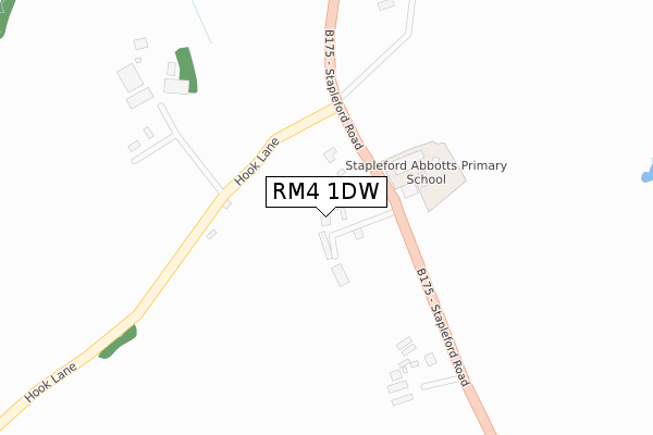
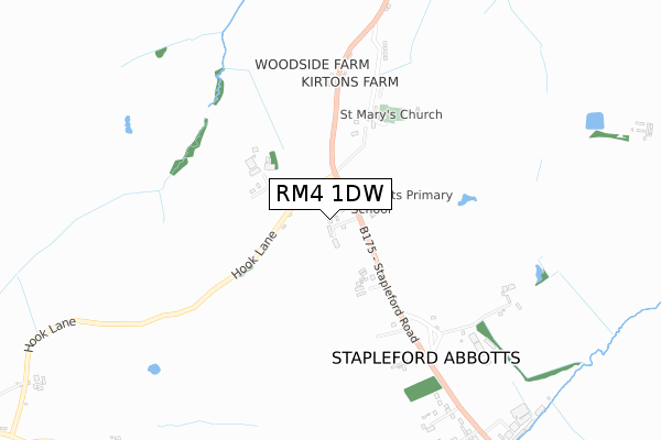
RM4 1DW is located in the Passingford electoral ward, within the local authority district of Epping Forest and the English Parliamentary constituency of Brentwood and Ongar. The Sub Integrated Care Board (ICB) Location is NHS Hertfordshire and West Essex ICB - 07H and the police force is Essex. This postcode has been in use since November 2019.
RM4 1DW maps


Licence: Open Government Licence (requires attribution)
Attribution: Contains OS data © Crown copyright and database right 2025
Source: Open Postcode Geo
Licence: Open Government Licence (requires attribution)
Attribution: Contains OS data © Crown copyright and database right 2025; Contains Royal Mail data © Royal Mail copyright and database right 2025; Source: Office for National Statistics licensed under the Open Government Licence v.3.0
RM4 1DW geodata
| Easting | 549895 |
| Northing | 195735 |
| Latitude | 51.640451 |
| Longitude | 0.164823 |
Where is RM4 1DW?
| Country | England |
| Postcode District | RM4 |
Politics
| Ward | Passingford |
|---|---|
| Constituency | Brentwood And Ongar |
House Prices
Sales of detached houses in RM4 1DW
2023 31 JUL £725,000 |
3, STABLE CLOSE, STAPLEFORD ABBOTTS, ROMFORD, RM4 1DW 2020 25 MAR £950,000 |
1, STABLE CLOSE, STAPLEFORD ABBOTTS, ROMFORD, RM4 1DW 2019 16 DEC £950,000 |
➜ Stapleford Abbotts house prices
Licence: Contains HM Land Registry data © Crown copyright and database right 2025. This data is licensed under the Open Government Licence v3.0.
Transport
Nearest bus stops to RM4 1DW
| School (Stapleford Road) | Stapleford Abbotts | 112m |
| School (Stapleford Road) | Stapleford Abbotts | 112m |
| Gordon Cottages (Stapleford Road) | Stapleford Abbotts | 475m |
| Gordon Cottages (Stapleford Road) | Stapleford Abbotts | 525m |
| The Nursery (Stapleford Road) | Stapleford Abbotts | 815m |
Broadband
Broadband access in RM4 1DW (2020 data)
| Percentage of properties with Next Generation Access | 0.0% |
| Percentage of properties with Superfast Broadband | 0.0% |
| Percentage of properties with Ultrafast Broadband | 0.0% |
| Percentage of properties with Full Fibre Broadband | 0.0% |
Superfast Broadband is between 30Mbps and 300Mbps
Ultrafast Broadband is > 300Mbps
Broadband limitations in RM4 1DW (2020 data)
| Percentage of properties unable to receive 2Mbps | 0.0% |
| Percentage of properties unable to receive 5Mbps | 0.0% |
| Percentage of properties unable to receive 10Mbps | 0.0% |
| Percentage of properties unable to receive 30Mbps | 100.0% |
Deprivation
72% of English postcodes are less deprived than RM4 1DW:Food Standards Agency
Three nearest food hygiene ratings to RM4 1DW (metres)

➜ Get more ratings from the Food Standards Agency
Nearest post box to RM4 1DW
| Last Collection | |||
|---|---|---|---|
| Location | Mon-Fri | Sat | Distance |
| Bournebridge Lane | 17:15 | 11:45 | 1,117m |
| Southend Road | 17:30 | 11:30 | 1,504m |
| Carter Drive | 17:00 | 11:30 | 3,666m |
RM4 1DW ITL and RM4 1DW LAU
The below table lists the International Territorial Level (ITL) codes (formerly Nomenclature of Territorial Units for Statistics (NUTS) codes) and Local Administrative Units (LAU) codes for RM4 1DW:
| ITL 1 Code | Name |
|---|---|
| TLH | East |
| ITL 2 Code | Name |
| TLH3 | Essex |
| ITL 3 Code | Name |
| TLH35 | West Essex |
| LAU 1 Code | Name |
| E07000072 | Epping Forest |
RM4 1DW census areas
The below table lists the Census Output Area (OA), Lower Layer Super Output Area (LSOA), and Middle Layer Super Output Area (MSOA) for RM4 1DW:
| Code | Name | |
|---|---|---|
| OA | E00110741 | |
| LSOA | E01021800 | Epping Forest 003C |
| MSOA | E02004529 | Epping Forest 003 |
Nearest postcodes to RM4 1DW
| RM4 1EL | Hook Lane | 298m |
| RM4 1ER | Stapleford Road | 532m |
| RM4 1ES | Church Terrace | 642m |
| RM4 1EJ | Stapleford Road | 832m |
| RM4 1RP | Stapleford Road | 1056m |
| RM4 1LU | Bournebridge Lane | 1072m |
| RM4 1LT | Bournebridge Lane | 1272m |
| RM4 1LX | Manor Road | 1483m |
| RM4 1EH | Oak Hill Road | 1490m |
| RM4 1NA | Tuttleby Cottages | 1633m |