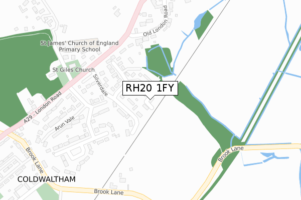
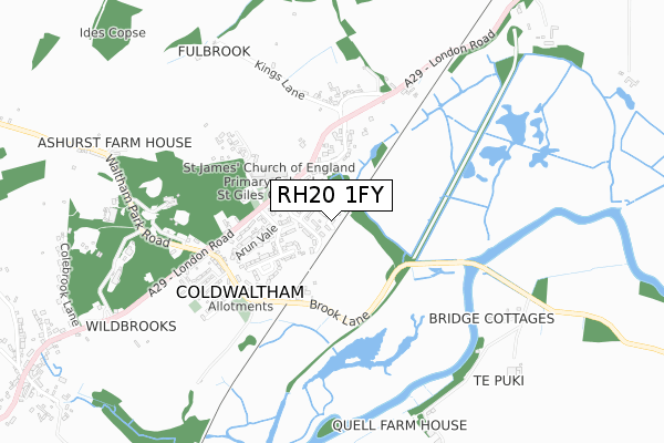
RH20 1FY is located in the Pulborough, Coldwaltham & Amberley electoral ward, within the local authority district of Horsham and the English Parliamentary constituency of Arundel and South Downs. The Sub Integrated Care Board (ICB) Location is NHS Sussex ICB - 70F and the police force is Sussex. This postcode has been in use since October 2018.


GetTheData
Source: OS Open Zoomstack (Ordnance Survey)
Licence: Open Government Licence (requires attribution)
Attribution: Contains OS data © Crown copyright and database right 2025
Source: Open Postcode Geo
Licence: Open Government Licence (requires attribution)
Attribution: Contains OS data © Crown copyright and database right 2025; Contains Royal Mail data © Royal Mail copyright and database right 2025; Source: Office for National Statistics licensed under the Open Government Licence v.3.0
| Easting | 502605 |
| Northing | 116424 |
| Latitude | 50.938136 |
| Longitude | -0.541058 |
GetTheData
Source: Open Postcode Geo
Licence: Open Government Licence
| Country | England |
| Postcode District | RH20 |
➜ See where RH20 is on a map | |
GetTheData
Source: Land Registry Price Paid Data
Licence: Open Government Licence
| Ward | Pulborough, Coldwaltham & Amberley |
| Constituency | Arundel And South Downs |
GetTheData
Source: ONS Postcode Database
Licence: Open Government Licence
| Church (London Road) | Coldwaltham | 231m |
| Church (London Road) | Coldwaltham | 271m |
| Brookview (London Road) | Coldwaltham | 548m |
| Old London Road (London Road) | Coldwaltham | 551m |
| Old London Road (London Road) | Coldwaltham | 579m |
| Pulborough Station | 2.7km |
| Amberley Station | 4.6km |
GetTheData
Source: NaPTAN
Licence: Open Government Licence
| Percentage of properties with Next Generation Access | 0.0% |
| Percentage of properties with Superfast Broadband | 0.0% |
| Percentage of properties with Ultrafast Broadband | 0.0% |
| Percentage of properties with Full Fibre Broadband | 0.0% |
Superfast Broadband is between 30Mbps and 300Mbps
Ultrafast Broadband is > 300Mbps
| Median download speed | 4.8Mbps |
| Average download speed | 4.5Mbps |
| Maximum download speed | 5.61Mbps |
| Median upload speed | 0.8Mbps |
| Average upload speed | 0.7Mbps |
| Maximum upload speed | 0.97Mbps |
| Percentage of properties unable to receive 2Mbps | 0.0% |
| Percentage of properties unable to receive 5Mbps | 100.0% |
| Percentage of properties unable to receive 10Mbps | 100.0% |
| Percentage of properties unable to receive 30Mbps | 100.0% |
GetTheData
Source: Ofcom
Licence: Ofcom Terms of Use (requires attribution)
GetTheData
Source: ONS Postcode Database
Licence: Open Government Licence


➜ Get more ratings from the Food Standards Agency
GetTheData
Source: Food Standards Agency
Licence: FSA terms & conditions
| Last Collection | |||
|---|---|---|---|
| Location | Mon-Fri | Sat | Distance |
| Barn Owls | 16:30 | 10:15 | 302m |
| Bury Gate | 16:00 | 10:00 | 1,954m |
| Stopham House | 17:00 | 10:30 | 2,024m |
GetTheData
Source: Dracos
Licence: Creative Commons Attribution-ShareAlike
The below table lists the International Territorial Level (ITL) codes (formerly Nomenclature of Territorial Units for Statistics (NUTS) codes) and Local Administrative Units (LAU) codes for RH20 1FY:
| ITL 1 Code | Name |
|---|---|
| TLJ | South East (England) |
| ITL 2 Code | Name |
| TLJ2 | Surrey, East and West Sussex |
| ITL 3 Code | Name |
| TLJ28 | West Sussex (North East) |
| LAU 1 Code | Name |
| E07000227 | Horsham |
GetTheData
Source: ONS Postcode Directory
Licence: Open Government Licence
The below table lists the Census Output Area (OA), Lower Layer Super Output Area (LSOA), and Middle Layer Super Output Area (MSOA) for RH20 1FY:
| Code | Name | |
|---|---|---|
| OA | E00161461 | |
| LSOA | E01031665 | Horsham 013F |
| MSOA | E02006600 | Horsham 013 |
GetTheData
Source: ONS Postcode Directory
Licence: Open Government Licence
| RH20 1LJ | Silverdale | 83m |
| RH20 1LN | Mapleleaf | 174m |
| RH20 1LQ | London Road | 186m |
| RH20 1LH | London Road | 212m |
| RH20 1LG | London Road | 239m |
| RH20 1LP | Arun Vale | 269m |
| RH20 1LF | Old London Road | 315m |
| RH20 1LR | London Road | 335m |
| RH20 1LS | Brook Lane | 381m |
| RH20 1LL | London Road | 389m |
GetTheData
Source: Open Postcode Geo; Land Registry Price Paid Data
Licence: Open Government Licence