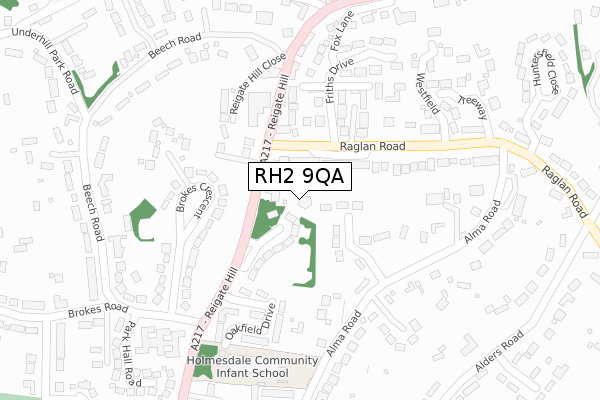
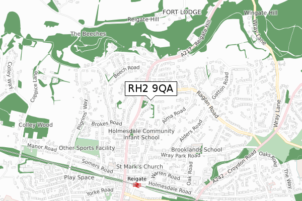
RH2 9QA is located in the Reigate electoral ward, within the local authority district of Reigate and Banstead and the English Parliamentary constituency of Reigate. The Sub Integrated Care Board (ICB) Location is NHS Surrey Heartlands ICB - 92A and the police force is Surrey. This postcode has been in use since July 2019.


GetTheData
Source: OS Open Zoomstack (Ordnance Survey)
Licence: Open Government Licence (requires attribution)
Attribution: Contains OS data © Crown copyright and database right 2025
Source: Open Postcode Geo
Licence: Open Government Licence (requires attribution)
Attribution: Contains OS data © Crown copyright and database right 2025; Contains Royal Mail data © Royal Mail copyright and database right 2025; Source: Office for National Statistics licensed under the Open Government Licence v.3.0
| Easting | 525602 |
| Northing | 151420 |
| Latitude | 51.248129 |
| Longitude | -0.201754 |
GetTheData
Source: Open Postcode Geo
Licence: Open Government Licence
| Country | England |
| Postcode District | RH2 |
➜ See where RH2 is on a map ➜ Where is Reigate? | |
GetTheData
Source: Land Registry Price Paid Data
Licence: Open Government Licence
| Ward | Reigate |
| Constituency | Reigate |
GetTheData
Source: ONS Postcode Database
Licence: Open Government Licence
| Reigate Manor Hotel (Reigate Hill) | Reigate | 172m |
| Reigate Manor Hotel (Reigate Hill) | Reigate | 223m |
| Brokes Road (Reigate Hill) | Reigate | 226m |
| Brokes Road (Reigate Hill) | Reigate | 322m |
| Priory Gate Mews (Reigate Hill) | Reigate | 439m |
| Reigate Station | 0.7km |
| Redhill Station | 2.7km |
| Earlswood (Surrey) Station | 3.2km |
GetTheData
Source: NaPTAN
Licence: Open Government Licence
GetTheData
Source: ONS Postcode Database
Licence: Open Government Licence


➜ Get more ratings from the Food Standards Agency
GetTheData
Source: Food Standards Agency
Licence: FSA terms & conditions
| Last Collection | |||
|---|---|---|---|
| Location | Mon-Fri | Sat | Distance |
| Reigate Hill | 17:00 | 12:15 | 94m |
| Raglan Road | 17:00 | 12:15 | 355m |
| Beech Road | 17:15 | 12:00 | 386m |
GetTheData
Source: Dracos
Licence: Creative Commons Attribution-ShareAlike
The below table lists the International Territorial Level (ITL) codes (formerly Nomenclature of Territorial Units for Statistics (NUTS) codes) and Local Administrative Units (LAU) codes for RH2 9QA:
| ITL 1 Code | Name |
|---|---|
| TLJ | South East (England) |
| ITL 2 Code | Name |
| TLJ2 | Surrey, East and West Sussex |
| ITL 3 Code | Name |
| TLJ26 | East Surrey |
| LAU 1 Code | Name |
| E07000211 | Reigate and Banstead |
GetTheData
Source: ONS Postcode Directory
Licence: Open Government Licence
The below table lists the Census Output Area (OA), Lower Layer Super Output Area (LSOA), and Middle Layer Super Output Area (MSOA) for RH2 9QA:
| Code | Name | |
|---|---|---|
| OA | E00156186 | |
| LSOA | E01030626 | Reigate and Banstead 009E |
| MSOA | E02006383 | Reigate and Banstead 009 |
GetTheData
Source: ONS Postcode Directory
Licence: Open Government Licence
| RH2 9PB | Reigate Hill | 43m |
| RH2 0DL | Beverley Heights | 77m |
| RH2 9PA | Merrywood Park | 91m |
| RH2 9PF | Reigate Hill | 128m |
| RH2 9PD | Reigate Hill | 153m |
| RH2 0DP | Raglan Road | 153m |
| RH2 9NY | Oakfield Drive | 173m |
| RH2 0DR | Raglan Road | 176m |
| RH2 9NX | Oakfield Drive | 181m |
| RH2 9NZ | Oakfield Drive | 183m |
GetTheData
Source: Open Postcode Geo; Land Registry Price Paid Data
Licence: Open Government Licence