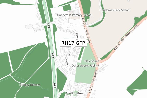
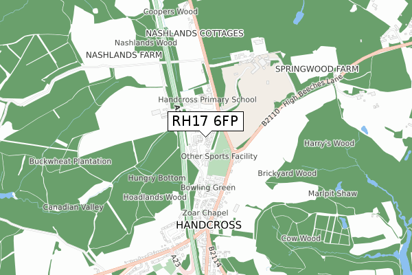
RH17 6FP is located in the Handcross & Pease Pottage electoral ward, within the local authority district of Mid Sussex and the English Parliamentary constituency of Horsham. The Sub Integrated Care Board (ICB) Location is NHS Sussex ICB - 70F and the police force is Sussex. This postcode has been in use since March 2019.


GetTheData
Source: OS Open Zoomstack (Ordnance Survey)
Licence: Open Government Licence (requires attribution)
Attribution: Contains OS data © Crown copyright and database right 2025
Source: Open Postcode Geo
Licence: Open Government Licence (requires attribution)
Attribution: Contains OS data © Crown copyright and database right 2025; Contains Royal Mail data © Royal Mail copyright and database right 2025; Source: Office for National Statistics licensed under the Open Government Licence v.3.0
| Easting | 526210 |
| Northing | 130318 |
| Latitude | 51.058337 |
| Longitude | -0.200438 |
GetTheData
Source: Open Postcode Geo
Licence: Open Government Licence
| Country | England |
| Postcode District | RH17 |
➜ See where RH17 is on a map ➜ Where is Handcross? | |
GetTheData
Source: Land Registry Price Paid Data
Licence: Open Government Licence
| Ward | Handcross & Pease Pottage |
| Constituency | Horsham |
GetTheData
Source: ONS Postcode Database
Licence: Open Government Licence
3, BUCKINGHAM GATE, HANDCROSS, HAYWARDS HEATH, RH17 6FP 2020 14 AUG £600,000 |
5, BUCKINGHAM GATE, HANDCROSS, HAYWARDS HEATH, RH17 6FP 2020 14 FEB £599,950 |
2, BUCKINGHAM GATE, HANDCROSS, HAYWARDS HEATH, RH17 6FP 2019 27 JUN £450,000 |
7, BUCKINGHAM GATE, HANDCROSS, HAYWARDS HEATH, RH17 6FP 2019 26 APR £474,950 |
1, BUCKINGHAM GATE, HANDCROSS, HAYWARDS HEATH, RH17 6FP 2019 22 FEB £479,950 |
GetTheData
Source: HM Land Registry Price Paid Data
Licence: Contains HM Land Registry data © Crown copyright and database right 2025. This data is licensed under the Open Government Licence v3.0.
| Primary School (B2114) | Handcross | 245m |
| High Street | Handcross | 363m |
| High Street | Handcross | 410m |
| Red Lion (B2114) | Handcross | 580m |
| High Beeches Lane (B2110) | Handcross | 592m |
| Balcombe Station | 4.5km |
| Faygate Station | 6.1km |
GetTheData
Source: NaPTAN
Licence: Open Government Licence
| Percentage of properties with Next Generation Access | 100.0% |
| Percentage of properties with Superfast Broadband | 100.0% |
| Percentage of properties with Ultrafast Broadband | 100.0% |
| Percentage of properties with Full Fibre Broadband | 100.0% |
Superfast Broadband is between 30Mbps and 300Mbps
Ultrafast Broadband is > 300Mbps
| Percentage of properties unable to receive 2Mbps | 0.0% |
| Percentage of properties unable to receive 5Mbps | 0.0% |
| Percentage of properties unable to receive 10Mbps | 0.0% |
| Percentage of properties unable to receive 30Mbps | 0.0% |
GetTheData
Source: Ofcom
Licence: Ofcom Terms of Use (requires attribution)
GetTheData
Source: ONS Postcode Database
Licence: Open Government Licence


➜ Get more ratings from the Food Standards Agency
GetTheData
Source: Food Standards Agency
Licence: FSA terms & conditions
| Last Collection | |||
|---|---|---|---|
| Location | Mon-Fri | Sat | Distance |
| Tilgate Forest Row | 16:30 | 07:30 | 2,030m |
| Staplefield | 16:30 | 10:15 | 2,526m |
| Handcross Road | 16:00 | 09:00 | 3,182m |
GetTheData
Source: Dracos
Licence: Creative Commons Attribution-ShareAlike
The below table lists the International Territorial Level (ITL) codes (formerly Nomenclature of Territorial Units for Statistics (NUTS) codes) and Local Administrative Units (LAU) codes for RH17 6FP:
| ITL 1 Code | Name |
|---|---|
| TLJ | South East (England) |
| ITL 2 Code | Name |
| TLJ2 | Surrey, East and West Sussex |
| ITL 3 Code | Name |
| TLJ28 | West Sussex (North East) |
| LAU 1 Code | Name |
| E07000228 | Mid Sussex |
GetTheData
Source: ONS Postcode Directory
Licence: Open Government Licence
The below table lists the Census Output Area (OA), Lower Layer Super Output Area (LSOA), and Middle Layer Super Output Area (MSOA) for RH17 6FP:
| Code | Name | |
|---|---|---|
| OA | E00161619 | |
| LSOA | E01031692 | Mid Sussex 007A |
| MSOA | E02006610 | Mid Sussex 007 |
GetTheData
Source: ONS Postcode Directory
Licence: Open Government Licence
| RH17 6HB | Hoadlands Cottages | 229m |
| RH17 6DU | Water Lane | 260m |
| RH17 6BH | Fountain Mews | 274m |
| RH17 6BS | The Forge | 344m |
| RH17 6BJ | High Street | 387m |
| RH17 6BT | Windmill Platt | 399m |
| RH17 6BL | High Street | 404m |
| RH17 6BF | High Street | 434m |
| RH17 6BQ | Smugglers End | 477m |
| RH17 6DY | Truggers Court | 488m |
GetTheData
Source: Open Postcode Geo; Land Registry Price Paid Data
Licence: Open Government Licence