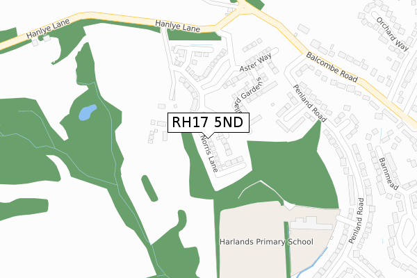
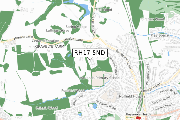
RH17 5ND is located in the Haywards Heath North electoral ward, within the local authority district of Mid Sussex and the English Parliamentary constituency of Mid Sussex. The Sub Integrated Care Board (ICB) Location is NHS Sussex ICB - 70F and the police force is Sussex. This postcode has been in use since September 2019.


GetTheData
Source: OS Open Zoomstack (Ordnance Survey)
Licence: Open Government Licence (requires attribution)
Attribution: Contains OS data © Crown copyright and database right 2025
Source: Open Postcode Geo
Licence: Open Government Licence (requires attribution)
Attribution: Contains OS data © Crown copyright and database right 2025; Contains Royal Mail data © Royal Mail copyright and database right 2025; Source: Office for National Statistics licensed under the Open Government Licence v.3.0
| Easting | 532390 |
| Northing | 125426 |
| Latitude | 51.012981 |
| Longitude | -0.114091 |
GetTheData
Source: Open Postcode Geo
Licence: Open Government Licence
| Country | England |
| Postcode District | RH17 |
➜ See where RH17 is on a map ➜ Where is Haywards Heath? | |
GetTheData
Source: Land Registry Price Paid Data
Licence: Open Government Licence
| Ward | Haywards Heath North |
| Constituency | Mid Sussex |
GetTheData
Source: ONS Postcode Database
Licence: Open Government Licence
2023 8 DEC £865,000 |
2023 30 OCT £871,500 |
2022 25 OCT £962,500 |
25, NORRIS LANE, HAYWARDS HEATH, RH17 5ND 2020 16 NOV £800,000 |
2020 30 OCT £804,950 |
4, NORRIS LANE, HAYWARDS HEATH, RH17 5ND 2020 20 AUG £859,995 |
2020 23 JUL £789,950 |
23, NORRIS LANE, HAYWARDS HEATH, RH17 5ND 2020 17 JUL £784,995 |
3, NORRIS LANE, HAYWARDS HEATH, RH17 5ND 2020 28 APR £729,950 |
17, NORRIS LANE, HAYWARDS HEATH, RH17 5ND 2020 24 APR £649,995 |
GetTheData
Source: HM Land Registry Price Paid Data
Licence: Contains HM Land Registry data © Crown copyright and database right 2025. This data is licensed under the Open Government Licence v3.0.
| The Spinney (Penland Road) | Haywards Heath | 258m |
| Turners Mill Road (Penland Road) | Haywards Heath | 429m |
| Gravelye Farm (Hanlye Lane) | Haywards Heath | 467m |
| Gravelye Farm (Hanlye Lane) | Haywards Heath | 475m |
| Harland Close (Penland Road) | Haywards Heath | 546m |
| Haywards Heath Station | 1km |
| Balcombe Station | 5km |
GetTheData
Source: NaPTAN
Licence: Open Government Licence
GetTheData
Source: ONS Postcode Database
Licence: Open Government Licence


➜ Get more ratings from the Food Standards Agency
GetTheData
Source: Food Standards Agency
Licence: FSA terms & conditions
| Last Collection | |||
|---|---|---|---|
| Location | Mon-Fri | Sat | Distance |
| The Spinney | 17:15 | 11:30 | 273m |
| Penland Road | 17:15 | 11:30 | 398m |
| Balcombe Road | 17:15 | 11:30 | 537m |
GetTheData
Source: Dracos
Licence: Creative Commons Attribution-ShareAlike
The below table lists the International Territorial Level (ITL) codes (formerly Nomenclature of Territorial Units for Statistics (NUTS) codes) and Local Administrative Units (LAU) codes for RH17 5ND:
| ITL 1 Code | Name |
|---|---|
| TLJ | South East (England) |
| ITL 2 Code | Name |
| TLJ2 | Surrey, East and West Sussex |
| ITL 3 Code | Name |
| TLJ28 | West Sussex (North East) |
| LAU 1 Code | Name |
| E07000228 | Mid Sussex |
GetTheData
Source: ONS Postcode Directory
Licence: Open Government Licence
The below table lists the Census Output Area (OA), Lower Layer Super Output Area (LSOA), and Middle Layer Super Output Area (MSOA) for RH17 5ND:
| Code | Name | |
|---|---|---|
| OA | E00161959 | |
| LSOA | E01031763 | Mid Sussex 011F |
| MSOA | E02006614 | Mid Sussex 011 |
GetTheData
Source: ONS Postcode Directory
Licence: Open Government Licence
| RH16 1PL | The Spinney | 182m |
| RH16 1PJ | Penland Road | 332m |
| RH16 1PN | Sugworth Close | 345m |
| RH16 1PE | Balcombe Road | 356m |
| RH16 1PH | Penland Road | 363m |
| RH16 1PF | Balcombe Road | 392m |
| RH16 1XA | Barnmead | 410m |
| RH16 1PP | Penland Road | 418m |
| RH16 1PS | Harlands Close | 435m |
| RH16 1XB | Barnmead | 449m |
GetTheData
Source: Open Postcode Geo; Land Registry Price Paid Data
Licence: Open Government Licence