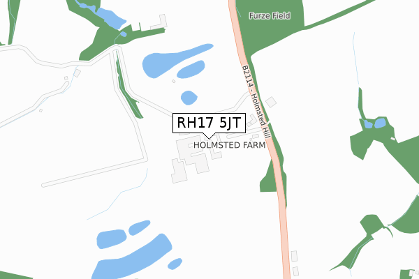
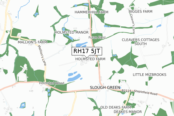
RH17 5JT is located in the Ardingly, Balcombe & Turners Hill electoral ward, within the local authority district of Mid Sussex and the English Parliamentary constituency of Mid Sussex. The Sub Integrated Care Board (ICB) Location is NHS Sussex ICB - 70F and the police force is Sussex. This postcode has been in use since September 2019.


GetTheData
Source: OS Open Zoomstack (Ordnance Survey)
Licence: Open Government Licence (requires attribution)
Attribution: Contains OS data © Crown copyright and database right 2025
Source: Open Postcode Geo
Licence: Open Government Licence (requires attribution)
Attribution: Contains OS data © Crown copyright and database right 2025; Contains Royal Mail data © Royal Mail copyright and database right 2025; Source: Office for National Statistics licensed under the Open Government Licence v.3.0
| Easting | 528211 |
| Northing | 126420 |
| Latitude | 51.022861 |
| Longitude | -0.173279 |
GetTheData
Source: Open Postcode Geo
Licence: Open Government Licence
| Country | England |
| Postcode District | RH17 |
➜ See where RH17 is on a map | |
GetTheData
Source: Land Registry Price Paid Data
Licence: Open Government Licence
| Ward | Ardingly, Balcombe & Turners Hill |
| Constituency | Mid Sussex |
GetTheData
Source: ONS Postcode Database
Licence: Open Government Licence
| Sloughgreen (B2114 Cuckfield Road) | Slough Green | 367m |
| Sloughgreen (B2114 Cuckfield Road) | Slough Green | 440m |
| Whitehouse Cottage (Staplefield Road) | Staplefield | 1,230m |
| Whitehouse Cottage (Staplefield Lane) | Staplefield | 1,250m |
| Staplefield Road (Staplefield Lane) | Staplefield | 1,314m |
| Balcombe Station | 4.4km |
| Haywards Heath Station | 5.2km |
GetTheData
Source: NaPTAN
Licence: Open Government Licence
GetTheData
Source: ONS Postcode Database
Licence: Open Government Licence


➜ Get more ratings from the Food Standards Agency
GetTheData
Source: Food Standards Agency
Licence: FSA terms & conditions
| Last Collection | |||
|---|---|---|---|
| Location | Mon-Fri | Sat | Distance |
| Staplefield | 16:30 | 10:15 | 1,880m |
| Whitemans Green P O | 17:00 | 12:15 | 2,341m |
| Brook Street | 16:45 | 09:15 | 2,346m |
GetTheData
Source: Dracos
Licence: Creative Commons Attribution-ShareAlike
The below table lists the International Territorial Level (ITL) codes (formerly Nomenclature of Territorial Units for Statistics (NUTS) codes) and Local Administrative Units (LAU) codes for RH17 5JT:
| ITL 1 Code | Name |
|---|---|
| TLJ | South East (England) |
| ITL 2 Code | Name |
| TLJ2 | Surrey, East and West Sussex |
| ITL 3 Code | Name |
| TLJ28 | West Sussex (North East) |
| LAU 1 Code | Name |
| E07000228 | Mid Sussex |
GetTheData
Source: ONS Postcode Directory
Licence: Open Government Licence
The below table lists the Census Output Area (OA), Lower Layer Super Output Area (LSOA), and Middle Layer Super Output Area (MSOA) for RH17 5JT:
| Code | Name | |
|---|---|---|
| OA | E00161785 | |
| LSOA | E01031727 | Mid Sussex 007D |
| MSOA | E02006610 | Mid Sussex 007 |
GetTheData
Source: ONS Postcode Directory
Licence: Open Government Licence
| RH17 5JF | Holmsted Farm Bungalows | 51m |
| RH17 5JE | Staplefield Road | 378m |
| RH17 5JG | Slough Green Lane | 501m |
| RH17 5JD | Staplefield Road | 602m |
| RH17 6AT | Keepers Cottages | 808m |
| RH17 5HZ | Cleavers Lane | 834m |
| RH17 5JA | Deaks Lane | 852m |
| RH17 5SL | Slough Green Lane | 911m |
| RH17 6ES | Cuckfield Road | 1257m |
| RH17 5HY | Staplefield Road | 1287m |
GetTheData
Source: Open Postcode Geo; Land Registry Price Paid Data
Licence: Open Government Licence