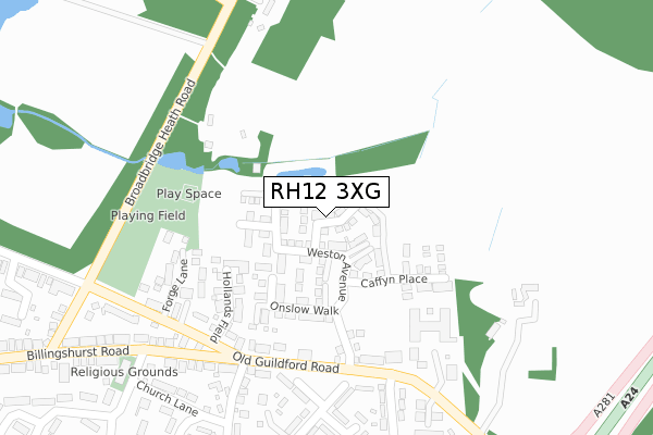
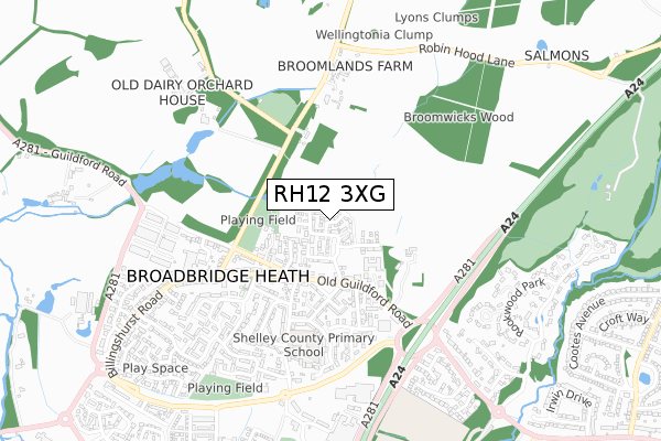
RH12 3XG maps, stats, and open data
RH12 3XG is located in the Broadbridge Heath electoral ward, within the local authority district of Horsham and the English Parliamentary constituency of Horsham. The Sub Integrated Care Board (ICB) Location is NHS Sussex ICB - 70F and the police force is Sussex. This postcode has been in use since June 2018.
RH12 3XG maps


Licence: Open Government Licence (requires attribution)
Attribution: Contains OS data © Crown copyright and database right 2025
Source: Open Postcode Geo
Licence: Open Government Licence (requires attribution)
Attribution: Contains OS data © Crown copyright and database right 2025; Contains Royal Mail data © Royal Mail copyright and database right 2025; Source: Office for National Statistics licensed under the Open Government Licence v.3.0
RH12 3XG geodata
| Easting | 515195 |
| Northing | 131721 |
| Latitude | 51.073261 |
| Longitude | -0.357095 |
Where is RH12 3XG?
| Country | England |
| Postcode District | RH12 |
Politics
| Ward | Broadbridge Heath |
|---|---|
| Constituency | Horsham |
House Prices
Sales of detached houses in RH12 3XG
2024 27 MAR £1,030,000 |
2023 8 FEB £714,400 |
15, BENTLEY GARDENS, BROADBRIDGE HEATH, HORSHAM, RH12 3XG 2020 17 FEB £700,000 |
16, BENTLEY GARDENS, BROADBRIDGE HEATH, HORSHAM, RH12 3XG 2020 23 JAN £662,000 |
2019 31 JUL £793,000 |
12, BENTLEY GARDENS, BROADBRIDGE HEATH, HORSHAM, RH12 3XG 2019 25 JUL £676,500 |
13, BENTLEY GARDENS, BROADBRIDGE HEATH, HORSHAM, RH12 3XG 2019 19 JUL £695,000 |
23, BENTLEY GARDENS, BROADBRIDGE HEATH, HORSHAM, RH12 3XG 2019 28 JUN £722,500 |
8, BENTLEY GARDENS, BROADBRIDGE HEATH, HORSHAM, RH12 3XG 2019 28 JUN £498,000 |
2019 28 JUN £630,000 |
➜ Broadbridge Heath house prices
Licence: Contains HM Land Registry data © Crown copyright and database right 2025. This data is licensed under the Open Government Licence v3.0.
Transport
Nearest bus stops to RH12 3XG
| Shelley Arms Ph (Old Guildford Road) | Broadbridge Heath | 228m |
| Shelley Arms Ph (Old Guildford Road) | Broadbridge Heath | 240m |
| Church Road (Billinghurst Road) | Broadbridge Heath | 315m |
| Forge Close (Old Guildford Road) | Broadbridge Heath | 340m |
| Broadbridge Heath Road | Broadbridge Heath | 342m |
Nearest railway stations to RH12 3XG
| Christs Hospital Station | 2.6km |
| Horsham Station | 2.8km |
| Warnham Station | 2.9km |
Broadband
Broadband access in RH12 3XG (2020 data)
| Percentage of properties with Next Generation Access | 100.0% |
| Percentage of properties with Superfast Broadband | 100.0% |
| Percentage of properties with Ultrafast Broadband | 100.0% |
| Percentage of properties with Full Fibre Broadband | 100.0% |
Superfast Broadband is between 30Mbps and 300Mbps
Ultrafast Broadband is > 300Mbps
Broadband speed in RH12 3XG (2019 data)
Download
Ofcom does not currently provide download speed data for RH12 3XG. This is because there are less than four broadband connections in this postcode.
Upload
Ofcom does not currently provide upload speed data for RH12 3XG. This is because there are less than four broadband connections in this postcode.
Broadband limitations in RH12 3XG (2020 data)
| Percentage of properties unable to receive 2Mbps | 0.0% |
| Percentage of properties unable to receive 5Mbps | 0.0% |
| Percentage of properties unable to receive 10Mbps | 0.0% |
| Percentage of properties unable to receive 30Mbps | 0.0% |
Deprivation
26.5% of English postcodes are less deprived than RH12 3XG:Food Standards Agency
Three nearest food hygiene ratings to RH12 3XG (metres)


➜ Get more ratings from the Food Standards Agency
Nearest post box to RH12 3XG
| Last Collection | |||
|---|---|---|---|
| Location | Mon-Fri | Sat | Distance |
| Broadbridge Heath P O | 17:00 | 09:30 | 451m |
| Wickhurst Lane | 16:45 | 08:30 | 503m |
| Homemead | 16:45 | 09:00 | 795m |
RH12 3XG ITL and RH12 3XG LAU
The below table lists the International Territorial Level (ITL) codes (formerly Nomenclature of Territorial Units for Statistics (NUTS) codes) and Local Administrative Units (LAU) codes for RH12 3XG:
| ITL 1 Code | Name |
|---|---|
| TLJ | South East (England) |
| ITL 2 Code | Name |
| TLJ2 | Surrey, East and West Sussex |
| ITL 3 Code | Name |
| TLJ28 | West Sussex (North East) |
| LAU 1 Code | Name |
| E07000227 | Horsham |
RH12 3XG census areas
The below table lists the Census Output Area (OA), Lower Layer Super Output Area (LSOA), and Middle Layer Super Output Area (MSOA) for RH12 3XG:
| Code | Name | |
|---|---|---|
| OA | E00161247 | |
| LSOA | E01031620 | Horsham 003A |
| MSOA | E02006590 | Horsham 003 |
Nearest postcodes to RH12 3XG
| RH12 3HQ | Hollands Field | 193m |
| RH12 3JU | Old Guildford Road | 229m |
| RH12 3JA | Forge Lane | 252m |
| RH12 3JT | Old Guildford Road | 254m |
| RH12 3JX | Forge Close | 266m |
| RH12 3SU | The Mews | 277m |
| RH12 3LB | Billingshurst Road | 298m |
| RH12 3LA | Old Post Office Cottages | 303m |
| RH12 3NW | Sullington Mead | 309m |
| RH12 3NN | Sullington Mead | 316m |