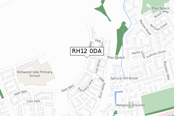
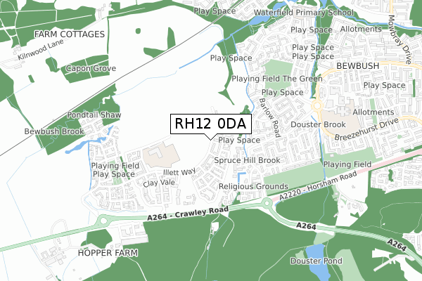
RH12 0DA is located in the Colgate & Rusper electoral ward, within the local authority district of Horsham and the English Parliamentary constituency of Horsham. The Sub Integrated Care Board (ICB) Location is NHS Sussex ICB - 70F and the police force is Sussex. This postcode has been in use since April 2020.


GetTheData
Source: OS Open Zoomstack (Ordnance Survey)
Licence: Open Government Licence (requires attribution)
Attribution: Contains OS data © Crown copyright and database right 2025
Source: Open Postcode Geo
Licence: Open Government Licence (requires attribution)
Attribution: Contains OS data © Crown copyright and database right 2025; Contains Royal Mail data © Royal Mail copyright and database right 2025; Source: Office for National Statistics licensed under the Open Government Licence v.3.0
| Easting | 523821 |
| Northing | 135035 |
| Latitude | 51.101252 |
| Longitude | -0.232894 |
GetTheData
Source: Open Postcode Geo
Licence: Open Government Licence
| Country | England |
| Postcode District | RH12 |
➜ See where RH12 is on a map ➜ Where is Crawley? | |
GetTheData
Source: Land Registry Price Paid Data
Licence: Open Government Licence
| Ward | Colgate & Rusper |
| Constituency | Horsham |
GetTheData
Source: ONS Postcode Database
Licence: Open Government Licence
1, BREWERS WAY, FAYGATE, HORSHAM, RH12 0DA 2020 9 APR £304,950 |
GetTheData
Source: HM Land Registry Price Paid Data
Licence: Contains HM Land Registry data © Crown copyright and database right 2025. This data is licensed under the Open Government Licence v3.0.
| Francis Edwards Way (Sullivan Drive) | Bewbush | 285m |
| Warrington Close (Sullivan Drive) | Bewbush | 310m |
| Redditch Close (Sullivan Drive) | Bewbush | 346m |
| Barlow Road (Sullivan Drive) | Bewbush | 368m |
| Sullivan Drive (Barlow Road) | Bewbush | 404m |
| Ifield Station | 2km |
| Faygate Station | 2.2km |
| Crawley Station | 3.5km |
GetTheData
Source: NaPTAN
Licence: Open Government Licence
GetTheData
Source: ONS Postcode Database
Licence: Open Government Licence


➜ Get more ratings from the Food Standards Agency
GetTheData
Source: Food Standards Agency
Licence: FSA terms & conditions
| Last Collection | |||
|---|---|---|---|
| Location | Mon-Fri | Sat | Distance |
| Basildon Way | 17:30 | 11:30 | 469m |
| Waterfield Gardens | 17:30 | 11:15 | 822m |
| Stoneycroft Walk | 17:30 | 11:45 | 948m |
GetTheData
Source: Dracos
Licence: Creative Commons Attribution-ShareAlike
The below table lists the International Territorial Level (ITL) codes (formerly Nomenclature of Territorial Units for Statistics (NUTS) codes) and Local Administrative Units (LAU) codes for RH12 0DA:
| ITL 1 Code | Name |
|---|---|
| TLJ | South East (England) |
| ITL 2 Code | Name |
| TLJ2 | Surrey, East and West Sussex |
| ITL 3 Code | Name |
| TLJ28 | West Sussex (North East) |
| LAU 1 Code | Name |
| E07000227 | Horsham |
GetTheData
Source: ONS Postcode Directory
Licence: Open Government Licence
The below table lists the Census Output Area (OA), Lower Layer Super Output Area (LSOA), and Middle Layer Super Output Area (MSOA) for RH12 0DA:
| Code | Name | |
|---|---|---|
| OA | E00161531 | |
| LSOA | E01031676 | Horsham 001D |
| MSOA | E02006588 | Horsham 001 |
GetTheData
Source: ONS Postcode Directory
Licence: Open Government Licence
| RH11 8GN | Manorfields | 199m |
| RH11 6AP | Masefield Road | 249m |
| RH11 8GD | Chetwood Road | 251m |
| RH11 8GH | Shirley Close | 277m |
| RH11 6ES | Warrington Close | 297m |
| RH11 6AL | Henty Close | 307m |
| RH11 6AN | Allcot Close | 329m |
| RH11 8GF | Howard Road | 344m |
| RH11 6ED | Peterlee Walk | 344m |
| RH11 8GJ | Norfolk Close | 346m |
GetTheData
Source: Open Postcode Geo; Land Registry Price Paid Data
Licence: Open Government Licence