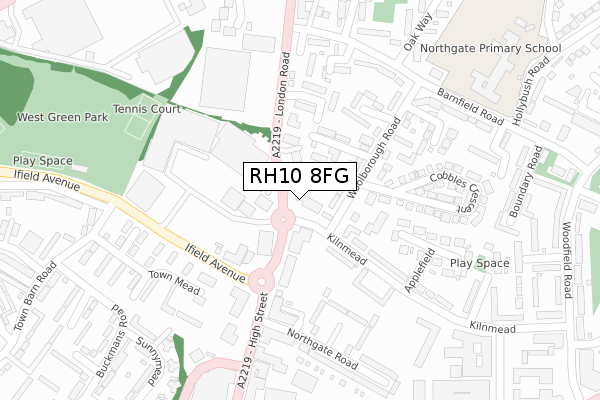
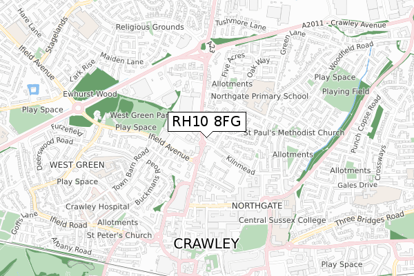
RH10 8FG is located in the Northgate & West Green electoral ward, within the local authority district of Crawley and the English Parliamentary constituency of Crawley. The Sub Integrated Care Board (ICB) Location is NHS Sussex ICB - 70F and the police force is Sussex. This postcode has been in use since August 2019.


GetTheData
Source: OS Open Zoomstack (Ordnance Survey)
Licence: Open Government Licence (requires attribution)
Attribution: Contains OS data © Crown copyright and database right 2025
Source: Open Postcode Geo
Licence: Open Government Licence (requires attribution)
Attribution: Contains OS data © Crown copyright and database right 2025; Contains Royal Mail data © Royal Mail copyright and database right 2025; Source: Office for National Statistics licensed under the Open Government Licence v.3.0
| Easting | 526918 |
| Northing | 137217 |
| Latitude | 51.120186 |
| Longitude | -0.187919 |
GetTheData
Source: Open Postcode Geo
Licence: Open Government Licence
| Country | England |
| Postcode District | RH10 |
➜ See where RH10 is on a map ➜ Where is Crawley? | |
GetTheData
Source: Land Registry Price Paid Data
Licence: Open Government Licence
| Ward | Northgate & West Green |
| Constituency | Crawley |
GetTheData
Source: ONS Postcode Database
Licence: Open Government Licence
| Multiplex (A2219) | Crawley | 70m |
| Multiplex (Ifield Avenue) | Crawley | 174m |
| London Road South (A2219 London Road) | Northgate | 178m |
| Multiplex (High Street) | Crawley | 201m |
| London Road South (A2219 London Road) | Northgate | 249m |
| Crawley Station | 0.9km |
| Three Bridges Station | 1.9km |
| Ifield Station | 1.9km |
GetTheData
Source: NaPTAN
Licence: Open Government Licence
GetTheData
Source: ONS Postcode Database
Licence: Open Government Licence


➜ Get more ratings from the Food Standards Agency
GetTheData
Source: Food Standards Agency
Licence: FSA terms & conditions
| Last Collection | |||
|---|---|---|---|
| Location | Mon-Fri | Sat | Distance |
| Woolborough Road | 17:30 | 11:00 | 82m |
| The Boulevard P O | 19:00 | 12:30 | 384m |
| Town Mead | 17:30 | 12:15 | 391m |
GetTheData
Source: Dracos
Licence: Creative Commons Attribution-ShareAlike
The below table lists the International Territorial Level (ITL) codes (formerly Nomenclature of Territorial Units for Statistics (NUTS) codes) and Local Administrative Units (LAU) codes for RH10 8FG:
| ITL 1 Code | Name |
|---|---|
| TLJ | South East (England) |
| ITL 2 Code | Name |
| TLJ2 | Surrey, East and West Sussex |
| ITL 3 Code | Name |
| TLJ28 | West Sussex (North East) |
| LAU 1 Code | Name |
| E07000226 | Crawley |
GetTheData
Source: ONS Postcode Directory
Licence: Open Government Licence
The below table lists the Census Output Area (OA), Lower Layer Super Output Area (LSOA), and Middle Layer Super Output Area (MSOA) for RH10 8FG:
| Code | Name | |
|---|---|---|
| OA | E00161073 | |
| LSOA | E01031585 | Crawley 004C |
| MSOA | E02006578 | Crawley 004 |
GetTheData
Source: ONS Postcode Directory
Licence: Open Government Licence
| RH10 8BE | Kilnmead | 54m |
| RH10 8EY | Woolborough Road | 60m |
| RH10 8EZ | Woolborough Road | 103m |
| RH10 8HB | Clappers Gate | 123m |
| RH10 1DQ | High Street | 125m |
| RH10 8XG | Bowman Court | 135m |
| RH10 8BD | Kilnmead | 165m |
| RH10 8HF | Glebe Close | 184m |
| RH10 8JF | Marlow Court | 186m |
| RH11 7EH | Town Mead | 208m |
GetTheData
Source: Open Postcode Geo; Land Registry Price Paid Data
Licence: Open Government Licence