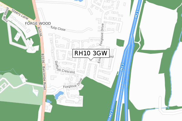
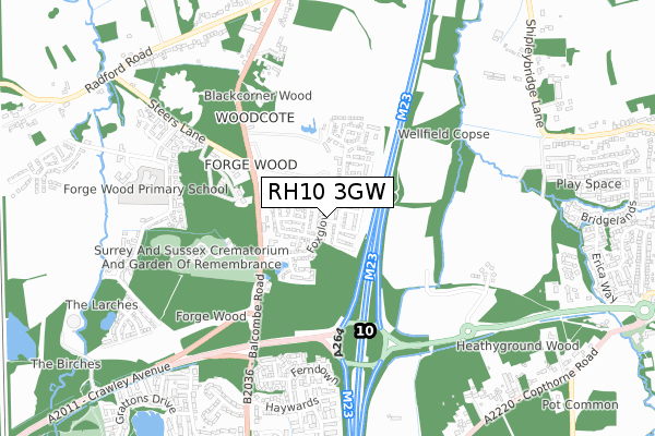
RH10 3GW is located in the Pound Hill North & Forge Wood electoral ward, within the local authority district of Crawley and the English Parliamentary constituency of Crawley. The Sub Integrated Care Board (ICB) Location is NHS Sussex ICB - 70F and the police force is Sussex. This postcode has been in use since November 2018.


GetTheData
Source: OS Open Zoomstack (Ordnance Survey)
Licence: Open Government Licence (requires attribution)
Attribution: Contains OS data © Crown copyright and database right 2025
Source: Open Postcode Geo
Licence: Open Government Licence (requires attribution)
Attribution: Contains OS data © Crown copyright and database right 2025; Contains Royal Mail data © Royal Mail copyright and database right 2025; Source: Office for National Statistics licensed under the Open Government Licence v.3.0
| Easting | 530026 |
| Northing | 139200 |
| Latitude | 51.137312 |
| Longitude | -0.142821 |
GetTheData
Source: Open Postcode Geo
Licence: Open Government Licence
| Country | England |
| Postcode District | RH10 |
➜ See where RH10 is on a map ➜ Where is Crawley? | |
GetTheData
Source: Land Registry Price Paid Data
Licence: Open Government Licence
| Ward | Pound Hill North & Forge Wood |
| Constituency | Crawley |
GetTheData
Source: ONS Postcode Database
Licence: Open Government Licence
2021 21 JUN £530,000 |
68, FOXGLOVE DRIVE, CRAWLEY, RH10 3GW 2020 11 DEC £470,000 |
46, FOXGLOVE DRIVE, CRAWLEY, RH10 3GW 2019 23 AUG £529,950 |
30, FOXGLOVE DRIVE, CRAWLEY, RH10 3GW 2019 18 APR £550,000 |
2019 22 FEB £499,950 |
22, FOXGLOVE DRIVE, CRAWLEY, RH10 3GW 2018 21 DEC £499,950 |
GetTheData
Source: HM Land Registry Price Paid Data
Licence: Contains HM Land Registry data © Crown copyright and database right 2025. This data is licensed under the Open Government Licence v3.0.
| Crematorium (Balcombe Road) | Tinsley Green | 302m |
| Crematorium (Balcombe Road) | Tinsley Green | 310m |
| Forge Wood (Steers Lane) | Tinsley Green | 539m |
| Forge Wood (Steers Lane) | Tinsley Green | 634m |
| Haywards | Wakehams Green | 794m |
| Gatwick Airport Station | 2.5km |
| Three Bridges Station | 2.6km |
| Horley Station | 3.7km |
GetTheData
Source: NaPTAN
Licence: Open Government Licence
| Percentage of properties with Next Generation Access | 100.0% |
| Percentage of properties with Superfast Broadband | 100.0% |
| Percentage of properties with Ultrafast Broadband | 67.6% |
| Percentage of properties with Full Fibre Broadband | 67.6% |
Superfast Broadband is between 30Mbps and 300Mbps
Ultrafast Broadband is > 300Mbps
| Median download speed | 360.0Mbps |
| Average download speed | 325.1Mbps |
| Maximum download speed | 360.00Mbps |
| Median upload speed | 360.0Mbps |
| Average upload speed | 321.1Mbps |
| Maximum upload speed | 360.00Mbps |
| Percentage of properties unable to receive 2Mbps | 0.0% |
| Percentage of properties unable to receive 5Mbps | 0.0% |
| Percentage of properties unable to receive 10Mbps | 0.0% |
| Percentage of properties unable to receive 30Mbps | 0.0% |
GetTheData
Source: Ofcom
Licence: Ofcom Terms of Use (requires attribution)
GetTheData
Source: ONS Postcode Database
Licence: Open Government Licence


➜ Get more ratings from the Food Standards Agency
GetTheData
Source: Food Standards Agency
Licence: FSA terms & conditions
| Last Collection | |||
|---|---|---|---|
| Location | Mon-Fri | Sat | Distance |
| Orde Close | 17:45 | 11:15 | 858m |
| Radford Road | 17:45 | 11:15 | 1,059m |
| Wakehams Green Drive | 17:45 | 11:15 | 1,086m |
GetTheData
Source: Dracos
Licence: Creative Commons Attribution-ShareAlike
The below table lists the International Territorial Level (ITL) codes (formerly Nomenclature of Territorial Units for Statistics (NUTS) codes) and Local Administrative Units (LAU) codes for RH10 3GW:
| ITL 1 Code | Name |
|---|---|
| TLJ | South East (England) |
| ITL 2 Code | Name |
| TLJ2 | Surrey, East and West Sussex |
| ITL 3 Code | Name |
| TLJ28 | West Sussex (North East) |
| LAU 1 Code | Name |
| E07000226 | Crawley |
GetTheData
Source: ONS Postcode Directory
Licence: Open Government Licence
The below table lists the Census Output Area (OA), Lower Layer Super Output Area (LSOA), and Middle Layer Super Output Area (MSOA) for RH10 3GW:
| Code | Name | |
|---|---|---|
| OA | E00161081 | |
| LSOA | E01031587 | Crawley 002B |
| MSOA | E02006576 | Crawley 002 |
GetTheData
Source: ONS Postcode Directory
Licence: Open Government Licence
| RH10 3JY | 348m | |
| RH10 3NQ | Balcombe Road | 377m |
| RH10 3NH | Forge Wood | 398m |
| RH10 3NJ | Balcombe Road | 447m |
| RH10 3ZJ | Watersfield Road | 574m |
| RH10 3SE | Rossmore Close | 588m |
| RH10 3SU | Somerley Drive | 602m |
| RH10 3ZN | Barnham Close | 623m |
| RH10 3SB | Ferndown | 642m |
| RH10 3SD | Knighton Close | 657m |
GetTheData
Source: Open Postcode Geo; Land Registry Price Paid Data
Licence: Open Government Licence