RH10 3GF maps, stats, and open data
- Home
- Postcode
- RH
- RH10
- RH10 3
RH10 3GF is located in the Burstow, Horne and Outwood electoral ward, within the local authority district of Tandridge and the English Parliamentary constituency of East Surrey. The Sub Integrated Care Board (ICB) Location is NHS Surrey Heartlands ICB - 92A and the police force is Surrey. This postcode has been in use since May 2018.
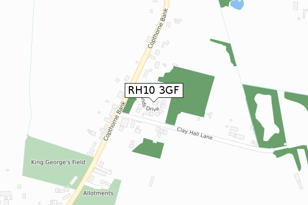
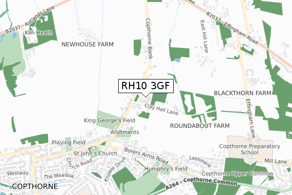
RH10 3GF maps


Source: OS Open Zoomstack (Ordnance Survey)
Licence: Open Government Licence (requires attribution)
Attribution: Contains OS data © Crown copyright and database right 2025
Source: Open Postcode GeoLicence: Open Government Licence (requires attribution)
Attribution: Contains OS data © Crown copyright and database right 2025; Contains Royal Mail data © Royal Mail copyright and database right 2025; Source: Office for National Statistics licensed under the Open Government Licence v.3.0
RH10 3GF geodata
| Easting | 532231 |
| Northing | 139959 |
| Latitude | 51.143629 |
| Longitude | -0.111044 |
Where is RH10 3GF?
| Country | England |
| Postcode District | RH10 |
Politics
| Ward | Burstow, Horne And Outwood |
|---|
| Constituency | East Surrey |
|---|
Transport
Nearest bus stops to RH10 3GF
| Cherry Tree (Copthorne Bank) | Copthorne Bank | 99m |
| Cherry Tree (Copthorne Bank) | Copthorne Bank | 105m |
| Borers Close (Borers Arms Road) | Copthorne | 477m |
| Borers Close (Borers Arms Road) | Copthorne | 490m |
| Borers Arms Road (Copthorne Bank) | Copthorne | 525m |
Nearest railway stations to RH10 3GF
| Gatwick Airport Station | 3.8km |
| Horley Station | 4.5km |
| Three Bridges Station | 4.6km |
Broadband
Broadband access in RH10 3GF (2020 data)
| Percentage of properties with Next Generation Access | 100.0% |
| Percentage of properties with Superfast Broadband | 100.0% |
| Percentage of properties with Ultrafast Broadband | 0.0% |
| Percentage of properties with Full Fibre Broadband | 0.0% |
Superfast Broadband is between 30Mbps and 300Mbps
Ultrafast Broadband is > 300Mbps
Broadband speed in RH10 3GF (2019 data)
Download
| Median download speed | 39.1Mbps |
| Average download speed | 32.3Mbps |
| Maximum download speed | 52.61Mbps |
Upload
| Median upload speed | 7.1Mbps |
| Average upload speed | 6.6Mbps |
| Maximum upload speed | 11.48Mbps |
Broadband limitations in RH10 3GF (2020 data)
| Percentage of properties unable to receive 2Mbps | 0.0% |
| Percentage of properties unable to receive 5Mbps | 0.0% |
| Percentage of properties unable to receive 10Mbps | 0.0% |
| Percentage of properties unable to receive 30Mbps | 0.0% |
Deprivation
59.7% of English postcodes are less deprived than
RH10 3GF:
Food Standards Agency
Three nearest food hygiene ratings to RH10 3GF (metres)
KG Tea and Coffee Shop
Pavilion King George V Playing Field
261m
The Cherry Tree
Peter Pan Playgroup
Copthorne Village Hall
512m
➜ Get more ratings from the Food Standards Agency
Nearest post box to RH10 3GF
| | Last Collection | |
|---|
| Location | Mon-Fri | Sat | Distance |
|---|
| Borers Arms Road | 16:00 | 08:00 | 508m |
| Copthorne Bank P O | 16:45 | 11:30 | 1,028m |
| Keepers Corner | 16:30 | 08:45 | 1,120m |
RH10 3GF ITL and RH10 3GF LAU
The below table lists the International Territorial Level (ITL) codes (formerly Nomenclature of Territorial Units for Statistics (NUTS) codes) and Local Administrative Units (LAU) codes for RH10 3GF:
| ITL 1 Code | Name |
|---|
| TLJ | South East (England) |
| ITL 2 Code | Name |
|---|
| TLJ2 | Surrey, East and West Sussex |
| ITL 3 Code | Name |
|---|
| TLJ26 | East Surrey |
| LAU 1 Code | Name |
|---|
| E07000215 | Tandridge |
RH10 3GF census areas
The below table lists the Census Output Area (OA), Lower Layer Super Output Area (LSOA), and Middle Layer Super Output Area (MSOA) for RH10 3GF:
| Code | Name |
|---|
| OA | E00157125 | |
|---|
| LSOA | E01030819 | Tandridge 011D |
|---|
| MSOA | E02006438 | Tandridge 011 |
|---|
Nearest postcodes to RH10 3GF


