RG7 3BW maps, stats, and open data
RG7 3BW is located in the Bradfield electoral ward, within the unitary authority of West Berkshire and the English Parliamentary constituency of Wokingham. The Sub Integrated Care Board (ICB) Location is NHS Buckinghamshire, Oxfordshire and Berkshire West ICB - 15A and the police force is Thames Valley. This postcode has been in use since June 2019.
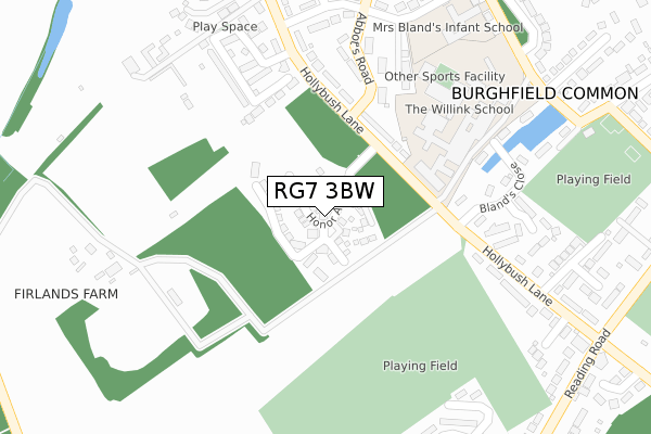
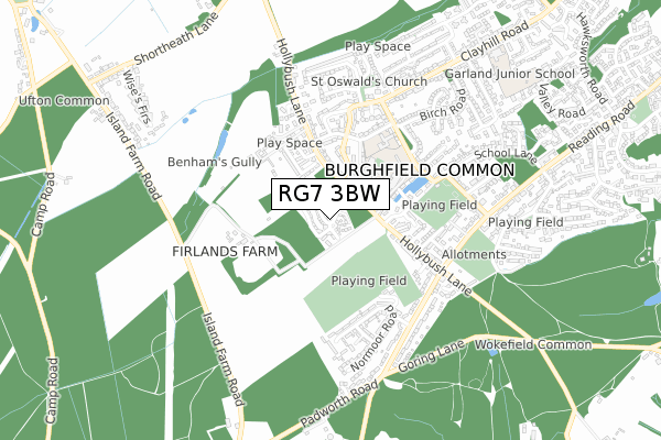
RG7 3BW maps


Licence: Open Government Licence (requires attribution)
Attribution: Contains OS data © Crown copyright and database right 2025
Source: Open Postcode Geo
Licence: Open Government Licence (requires attribution)
Attribution: Contains OS data © Crown copyright and database right 2025; Contains Royal Mail data © Royal Mail copyright and database right 2025; Source: Office for National Statistics licensed under the Open Government Licence v.3.0
RG7 3BW geodata
| Easting | 464593 |
| Northing | 166691 |
| Latitude | 51.395588 |
| Longitude | -1.072943 |
Where is RG7 3BW?
| Country | England |
| Postcode District | RG7 |
Politics
| Ward | Bradfield |
|---|---|
| Constituency | Wokingham |
House Prices
Sales of detached houses in RG7 3BW
2024 31 OCT £475,000 |
22, HONOR AVENUE, BURGHFIELD COMMON, READING, RG7 3BW 2021 30 APR £600,000 |
37, HONOR AVENUE, BURGHFIELD COMMON, READING, RG7 3BW 2021 28 APR £433,000 |
24, HONOR AVENUE, BURGHFIELD COMMON, READING, RG7 3BW 2021 31 MAR £445,000 |
2, HONOR AVENUE, BURGHFIELD COMMON, READING, RG7 3BW 2021 31 MAR £718,000 |
20, HONOR AVENUE, BURGHFIELD COMMON, READING, RG7 3BW 2021 31 MAR £412,000 |
4, HONOR AVENUE, BURGHFIELD COMMON, READING, RG7 3BW 2021 30 MAR £732,000 |
33, HONOR AVENUE, BURGHFIELD COMMON, READING, RG7 3BW 2021 26 FEB £429,000 |
35, HONOR AVENUE, BURGHFIELD COMMON, READING, RG7 3BW 2021 26 FEB £435,000 |
31, HONOR AVENUE, BURGHFIELD COMMON, READING, RG7 3BW 2020 4 DEC £432,000 |
➜ Burghfield Common house prices
Licence: Contains HM Land Registry data © Crown copyright and database right 2025. This data is licensed under the Open Government Licence v3.0.
Transport
Nearest bus stops to RG7 3BW
| Willink School (School Lane) | Burghfield Common | 369m |
| Goodwood Close (School Lane) | Burghfield Common | 401m |
| Goodwood Close (School Lane) | Burghfield Common | 405m |
| Omers Rise (Clayhill Road) | Burghfield Common | 498m |
| Hollybush Lane (Reading Road) | Burghfield Common | 500m |
Nearest railway stations to RG7 3BW
| Mortimer Station | 3.7km |
| Theale Station | 4.2km |
| Aldermaston Station | 4.5km |
Broadband
Broadband access in RG7 3BW (2020 data)
| Percentage of properties with Next Generation Access | 100.0% |
| Percentage of properties with Superfast Broadband | 100.0% |
| Percentage of properties with Ultrafast Broadband | 81.8% |
| Percentage of properties with Full Fibre Broadband | 54.5% |
Superfast Broadband is between 30Mbps and 300Mbps
Ultrafast Broadband is > 300Mbps
Broadband limitations in RG7 3BW (2020 data)
| Percentage of properties unable to receive 2Mbps | 0.0% |
| Percentage of properties unable to receive 5Mbps | 0.0% |
| Percentage of properties unable to receive 10Mbps | 0.0% |
| Percentage of properties unable to receive 30Mbps | 0.0% |
Deprivation
32.3% of English postcodes are less deprived than RG7 3BW:Food Standards Agency
Three nearest food hygiene ratings to RG7 3BW (metres)


➜ Get more ratings from the Food Standards Agency
Nearest post box to RG7 3BW
| Last Collection | |||
|---|---|---|---|
| Location | Mon-Fri | Sat | Distance |
| Bulmershe Road | 16:00 | 11:30 | 514m |
| Benham Firs | 16:45 | 08:30 | 1,007m |
| Ufton Rectory | 16:15 | 08:15 | 1,408m |
RG7 3BW ITL and RG7 3BW LAU
The below table lists the International Territorial Level (ITL) codes (formerly Nomenclature of Territorial Units for Statistics (NUTS) codes) and Local Administrative Units (LAU) codes for RG7 3BW:
| ITL 1 Code | Name |
|---|---|
| TLJ | South East (England) |
| ITL 2 Code | Name |
| TLJ1 | Berkshire, Buckinghamshire and Oxfordshire |
| ITL 3 Code | Name |
| TLJ11 | Berkshire |
| LAU 1 Code | Name |
| E06000037 | West Berkshire |
RG7 3BW census areas
The below table lists the Census Output Area (OA), Lower Layer Super Output Area (LSOA), and Middle Layer Super Output Area (MSOA) for RG7 3BW:
| Code | Name | |
|---|---|---|
| OA | E00082481 | |
| LSOA | E01016328 | West Berkshire 009B |
| MSOA | E02003375 | West Berkshire 009 |
Nearest postcodes to RG7 3BW
| RG7 3JR | Hollybush Lane | 173m |
| RG7 3LD | Abbots Road | 206m |
| RG7 3GN | Acorn Gardens | 225m |
| RG7 3LG | Bannister Road | 282m |
| RG7 3JY | Blands Close | 305m |
| RG7 3ZF | Oakley Drive | 316m |
| RG7 3LP | Jordans Lane | 345m |
| RG7 3LJ | Woodmans Lane | 350m |
| RG7 3JS | Hollybush Lane | 363m |
| RG7 3JF | Oak Drive | 363m |