RG7 1DJ maps, stats, and open data
RG7 1DJ is located in the Shinfield South electoral ward, within the unitary authority of Wokingham and the English Parliamentary constituency of Wokingham. The Sub Integrated Care Board (ICB) Location is NHS Buckinghamshire, Oxfordshire and Berkshire West ICB - 15A and the police force is Thames Valley. This postcode has been in use since May 2019.
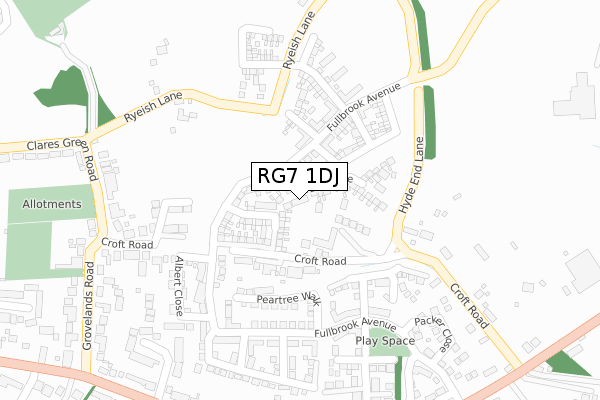
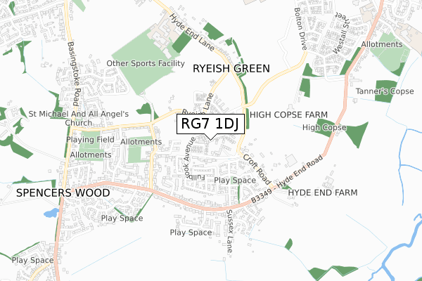
RG7 1DJ maps


Licence: Open Government Licence (requires attribution)
Attribution: Contains OS data © Crown copyright and database right 2025
Source: Open Postcode Geo
Licence: Open Government Licence (requires attribution)
Attribution: Contains OS data © Crown copyright and database right 2025; Contains Royal Mail data © Royal Mail copyright and database right 2025; Source: Office for National Statistics licensed under the Open Government Licence v.3.0
RG7 1DJ geodata
| Easting | 472415 |
| Northing | 166961 |
| Latitude | 51.397073 |
| Longitude | -0.960475 |
Where is RG7 1DJ?
| Country | England |
| Postcode District | RG7 |
Politics
| Ward | Shinfield South |
|---|---|
| Constituency | Wokingham |
House Prices
Sales of detached houses in RG7 1DJ
2022 30 AUG £455,000 |
17, COBHAM DRIVE, SPENCERS WOOD, READING, RG7 1DJ 2021 31 MAR £575,000 |
72, COBHAM DRIVE, SPENCERS WOOD, READING, RG7 1DJ 2021 26 FEB £665,000 |
74, COBHAM DRIVE, SPENCERS WOOD, READING, RG7 1DJ 2021 26 FEB £670,000 |
7, COBHAM DRIVE, SPENCERS WOOD, READING, RG7 1DJ 2021 11 JAN £605,000 |
11, COBHAM DRIVE, SPENCERS WOOD, READING, RG7 1DJ 2021 7 JAN £684,000 |
15, COBHAM DRIVE, SPENCERS WOOD, READING, RG7 1DJ 2020 15 DEC £565,000 |
3, COBHAM DRIVE, SPENCERS WOOD, READING, RG7 1DJ 2020 14 DEC £540,000 |
5, COBHAM DRIVE, SPENCERS WOOD, READING, RG7 1DJ 2020 27 NOV £450,000 |
1, COBHAM DRIVE, SPENCERS WOOD, READING, RG7 1DJ 2020 27 NOV £665,000 |
Licence: Contains HM Land Registry data © Crown copyright and database right 2025. This data is licensed under the Open Government Licence v3.0.
Transport
Nearest bus stops to RG7 1DJ
| Peartree Walk (Fullbrook Avenue) | Spencer's Wood | 237m |
| Peartree Walk (Fullbrook Avenue) | Spencer's Wood | 247m |
| Albert Close (Fullbrook Avenue) | Spencer's Wood | 254m |
| Albert Close (Fullbrook Avenue) | Spencer's Wood | 265m |
| Appletree Lane | Spencer's Wood | 582m |
Nearest railway stations to RG7 1DJ
| Earley Station | 5.7km |
| Winnersh Triangle Station | 6.5km |
Broadband
Broadband access in RG7 1DJ (2020 data)
| Percentage of properties with Next Generation Access | 100.0% |
| Percentage of properties with Superfast Broadband | 82.2% |
| Percentage of properties with Ultrafast Broadband | 46.7% |
| Percentage of properties with Full Fibre Broadband | 46.7% |
Superfast Broadband is between 30Mbps and 300Mbps
Ultrafast Broadband is > 300Mbps
Broadband limitations in RG7 1DJ (2020 data)
| Percentage of properties unable to receive 2Mbps | 0.0% |
| Percentage of properties unable to receive 5Mbps | 0.0% |
| Percentage of properties unable to receive 10Mbps | 0.0% |
| Percentage of properties unable to receive 30Mbps | 17.8% |
Deprivation
13.5% of English postcodes are less deprived than RG7 1DJ:Food Standards Agency
Three nearest food hygiene ratings to RG7 1DJ (metres)


➜ Get more ratings from the Food Standards Agency
Nearest post box to RG7 1DJ
| Last Collection | |||
|---|---|---|---|
| Location | Mon-Fri | Sat | Distance |
| Spencers Wood Post Office | 17:15 | 10:15 | 1,049m |
| Three Mile Cross Post Office | 17:00 | 08:30 | 1,292m |
| Shinfield Church | 17:15 | 08:00 | 1,333m |
RG7 1DJ ITL and RG7 1DJ LAU
The below table lists the International Territorial Level (ITL) codes (formerly Nomenclature of Territorial Units for Statistics (NUTS) codes) and Local Administrative Units (LAU) codes for RG7 1DJ:
| ITL 1 Code | Name |
|---|---|
| TLJ | South East (England) |
| ITL 2 Code | Name |
| TLJ1 | Berkshire, Buckinghamshire and Oxfordshire |
| ITL 3 Code | Name |
| TLJ11 | Berkshire |
| LAU 1 Code | Name |
| E06000041 | Wokingham |
RG7 1DJ census areas
The below table lists the Census Output Area (OA), Lower Layer Super Output Area (LSOA), and Middle Layer Super Output Area (MSOA) for RG7 1DJ:
| Code | Name | |
|---|---|---|
| OA | E00084193 | |
| LSOA | E01016683 | Wokingham 017B |
| MSOA | E02003455 | Wokingham 017 |
Nearest postcodes to RG7 1DJ
| RG2 9EY | Croft Road | 160m |
| RG2 9EX | Croft Road | 165m |
| RG7 1FE | Fullbrook Avenue | 261m |
| RG7 1EL | Ryeish Lane | 277m |
| RG7 1EW | Ryeish Lane | 321m |
| RG7 1DR | Croft Road | 340m |
| RG7 1DU | Clares Green Road | 363m |
| RG7 1EQ | Pither Close | 373m |
| RG7 1DG | Hyde End Road | 392m |
| RG7 1DQ | Elizabeth Rout Close | 412m |