Property/Postcode Data Search:
RG42 4JH maps, stats, and open data
RG42 4JH is located in the Binfield South & Jennett's Park electoral ward, within the unitary authority of Bracknell Forest and the English Parliamentary constituency of Windsor. The Sub Integrated Care Board (ICB) Location is NHS Frimley ICB - D4U1Y and the police force is Thames Valley. This postcode has been in use since July 2019.
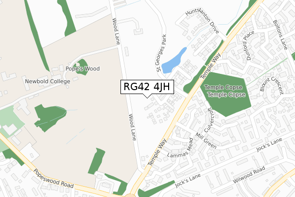
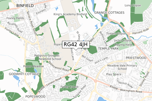
RG42 4JH maps


Source: OS Open Zoomstack (Ordnance Survey)
Licence: Open Government Licence (requires attribution)
Attribution: Contains OS data © Crown copyright and database right 2025
Source: Open Postcode Geo
Licence: Open Government Licence (requires attribution)
Attribution: Contains OS data © Crown copyright and database right 2025; Contains Royal Mail data © Royal Mail copyright and database right 2025; Source: Office for National Statistics licensed under the Open Government Licence v.3.0
Licence: Open Government Licence (requires attribution)
Attribution: Contains OS data © Crown copyright and database right 2025
Source: Open Postcode Geo
Licence: Open Government Licence (requires attribution)
Attribution: Contains OS data © Crown copyright and database right 2025; Contains Royal Mail data © Royal Mail copyright and database right 2025; Source: Office for National Statistics licensed under the Open Government Licence v.3.0
RG42 4JH geodata
| Easting | 485063 |
| Northing | 170204 |
| Latitude | 51.424473 |
| Longitude | -0.777942 |
Where is RG42 4JH?
| Country | England |
| Postcode District | RG42 |
Politics
| Ward | Binfield South & Jennett's Park |
|---|---|
| Constituency | Windsor |
House Prices
Sales of detached houses in RG42 4JH
2022 21 DEC £660,000 |
16, PORTHCAWL DRIVE, BINFIELD, BRACKNELL, RG42 4JH 2021 7 JAN £680,000 |
15, PORTHCAWL DRIVE, BINFIELD, BRACKNELL, RG42 4JH 2020 21 DEC £680,000 |
19, PORTHCAWL DRIVE, BINFIELD, BRACKNELL, RG42 4JH 2020 18 DEC £675,000 |
14, PORTHCAWL DRIVE, BINFIELD, BRACKNELL, RG42 4JH 2020 30 OCT £650,000 |
12, PORTHCAWL DRIVE, BINFIELD, BRACKNELL, RG42 4JH 2020 30 SEP £565,000 |
11, PORTHCAWL DRIVE, BINFIELD, BRACKNELL, RG42 4JH 2020 30 JUN £565,000 |
2, PORTHCAWL DRIVE, BINFIELD, BRACKNELL, RG42 4JH 2020 28 FEB £415,000 |
8, PORTHCAWL DRIVE, BINFIELD, BRACKNELL, RG42 4JH 2020 24 JAN £550,000 |
5, PORTHCAWL DRIVE, BINFIELD, BRACKNELL, RG42 4JH 2019 20 DEC £650,000 |
Source: HM Land Registry Price Paid Data
Licence: Contains HM Land Registry data © Crown copyright and database right 2025. This data is licensed under the Open Government Licence v3.0.
Licence: Contains HM Land Registry data © Crown copyright and database right 2025. This data is licensed under the Open Government Licence v3.0.
Transport
Nearest bus stops to RG42 4JH
| Lammas Mead (Temple Way) | Temple Park | 156m |
| Lammas Mead (Temple Way) | Temple Park | 161m |
| Jocks Lane (Wokingham Road) | Popeswood | 359m |
| Jocks Lane (Wokingham Road) | Popeswood | 372m |
| Lawrence Grove (Popeswood Road) | Popeswood | 383m |
Nearest railway stations to RG42 4JH
| Bracknell Station | 2.2km |
| Martins Heron Station | 4.2km |
| Wokingham Station | 4.7km |
Deprivation
5.1% of English postcodes are less deprived than RG42 4JH:Food Standards Agency
Three nearest food hygiene ratings to RG42 4JH (metres)
Fines Bayliwick Hotel

Fines Bayliwick House Hotel London Road
575m
Choice Care Group

Edwina Place London Road
626m
Charnley Care Homes Ltd

Beech House London Road
637m
➜ Get more ratings from the Food Standards Agency
Nearest post box to RG42 4JH
| Last Collection | |||
|---|---|---|---|
| Location | Mon-Fri | Sat | Distance |
| Temple Way | 17:30 | 11:45 | 460m |
| Moordale Avenue | 16:00 | 12:00 | 519m |
| Turnpike Road | 17:30 | 10:45 | 571m |
RG42 4JH ITL and RG42 4JH LAU
The below table lists the International Territorial Level (ITL) codes (formerly Nomenclature of Territorial Units for Statistics (NUTS) codes) and Local Administrative Units (LAU) codes for RG42 4JH:
| ITL 1 Code | Name |
|---|---|
| TLJ | South East (England) |
| ITL 2 Code | Name |
| TLJ1 | Berkshire, Buckinghamshire and Oxfordshire |
| ITL 3 Code | Name |
| TLJ11 | Berkshire |
| LAU 1 Code | Name |
| E06000036 | Bracknell Forest |
RG42 4JH census areas
The below table lists the Census Output Area (OA), Lower Layer Super Output Area (LSOA), and Middle Layer Super Output Area (MSOA) for RG42 4JH:
| Code | Name | |
|---|---|---|
| OA | E00081813 | |
| LSOA | E01016188 | Bracknell Forest 002E |
| MSOA | E02003353 | Bracknell Forest 002 |
Nearest postcodes to RG42 4JH
| RG42 4PQ | Crisp Gardens | 131m |
| RG42 4BX | Samian Place | 140m |
| RG42 4NF | Lammas Mead | 175m |
| RG42 4DF | Culvercroft | 179m |
| RG42 4EX | Wood Lane | 195m |
| RG42 4NW | Lammas Mead | 198m |
| RG42 4QQ | Hitherhooks Hill | 225m |
| RG42 4UL | Park Lane | 248m |
| RG42 4RA | Woodhouse Street | 258m |
| RG42 4HZ | Webb Close | 259m |