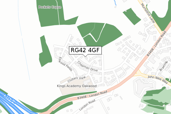
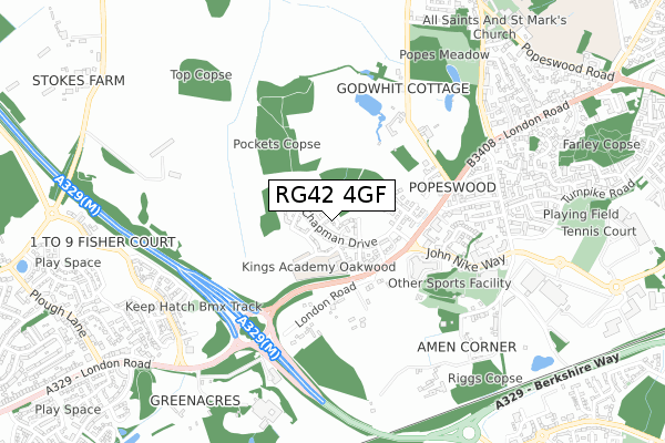
RG42 4GF maps, stats, and open data
RG42 4GF is located in the Binfield South & Jennett's Park electoral ward, within the unitary authority of Bracknell Forest and the English Parliamentary constituency of Windsor. The Sub Integrated Care Board (ICB) Location is NHS Frimley ICB - D4U1Y and the police force is Thames Valley. This postcode has been in use since June 2019.
RG42 4GF maps


Licence: Open Government Licence (requires attribution)
Attribution: Contains OS data © Crown copyright and database right 2025
Source: Open Postcode Geo
Licence: Open Government Licence (requires attribution)
Attribution: Contains OS data © Crown copyright and database right 2025; Contains Royal Mail data © Royal Mail copyright and database right 2025; Source: Office for National Statistics licensed under the Open Government Licence v.3.0
RG42 4GF geodata
| Easting | 483914 |
| Northing | 169332 |
| Latitude | 51.416805 |
| Longitude | -0.794670 |
Where is RG42 4GF?
| Country | England |
| Postcode District | RG42 |
Politics
| Ward | Binfield South & Jennett's Park |
|---|---|
| Constituency | Windsor |
House Prices
Sales of detached houses in RG42 4GF
2, MUIR GATE, BINFIELD, BRACKNELL, RG42 4GF 2020 27 MAR £550,000 |
14, MUIR GATE, BINFIELD, BRACKNELL, RG42 4GF 2019 30 AUG £669,995 |
11, MUIR GATE, BRACKNELL, RG42 4GF 2019 30 AUG £555,000 |
12, MUIR GATE, BRACKNELL, RG42 4GF 2019 30 AUG £685,000 |
15, MUIR GATE, BINFIELD, BRACKNELL, RG42 4GF 2019 30 AUG £549,995 |
10, MUIR GATE, BRACKNELL, RG42 4GF 2019 2 AUG £565,000 |
9, MUIR GATE, BINFIELD, BRACKNELL, RG42 4GF 2019 12 JUL £709,995 |
8, MUIR GATE, BRACKNELL, RG42 4GF 2019 28 JUN £700,000 |
7, MUIR GATE, BRACKNELL, RG42 4GF 2019 28 JUN £684,995 |
Licence: Contains HM Land Registry data © Crown copyright and database right 2025. This data is licensed under the Open Government Licence v3.0.
Transport
Nearest bus stops to RG42 4GF
| Coppid Beech Hill (London Road) | Amen Corner | 217m |
| Coppid Beech Hill (London Road) | Amen Corner | 238m |
| Merydene Court (London Road) | Popeswood | 372m |
| Merydene Court (London Road) | Popeswood | 406m |
| Travelodge (London Road) | Popeswood | 589m |
Nearest railway stations to RG42 4GF
| Bracknell Station | 3km |
| Wokingham Station | 3.4km |
| Martins Heron Station | 5km |
Broadband
Broadband access in RG42 4GF (2020 data)
| Percentage of properties with Next Generation Access | 100.0% |
| Percentage of properties with Superfast Broadband | 100.0% |
| Percentage of properties with Ultrafast Broadband | 100.0% |
| Percentage of properties with Full Fibre Broadband | 100.0% |
Superfast Broadband is between 30Mbps and 300Mbps
Ultrafast Broadband is > 300Mbps
Broadband limitations in RG42 4GF (2020 data)
| Percentage of properties unable to receive 2Mbps | 0.0% |
| Percentage of properties unable to receive 5Mbps | 0.0% |
| Percentage of properties unable to receive 10Mbps | 0.0% |
| Percentage of properties unable to receive 30Mbps | 0.0% |
Deprivation
7.8% of English postcodes are less deprived than RG42 4GF:Food Standards Agency
Three nearest food hygiene ratings to RG42 4GF (metres)


➜ Get more ratings from the Food Standards Agency
Nearest post box to RG42 4GF
| Last Collection | |||
|---|---|---|---|
| Location | Mon-Fri | Sat | Distance |
| Bean Oak Road | 16:45 | 11:15 | 832m |
| Plough Lane | 16:00 | 11:30 | 1,002m |
| Roebuck | 16:15 | 09:00 | 1,178m |
RG42 4GF ITL and RG42 4GF LAU
The below table lists the International Territorial Level (ITL) codes (formerly Nomenclature of Territorial Units for Statistics (NUTS) codes) and Local Administrative Units (LAU) codes for RG42 4GF:
| ITL 1 Code | Name |
|---|---|
| TLJ | South East (England) |
| ITL 2 Code | Name |
| TLJ1 | Berkshire, Buckinghamshire and Oxfordshire |
| ITL 3 Code | Name |
| TLJ11 | Berkshire |
| LAU 1 Code | Name |
| E06000036 | Bracknell Forest |
RG42 4GF census areas
The below table lists the Census Output Area (OA), Lower Layer Super Output Area (LSOA), and Middle Layer Super Output Area (MSOA) for RG42 4GF:
| Code | Name | |
|---|---|---|
| OA | E00166648 | |
| LSOA | E01016184 | Bracknell Forest 002A |
| MSOA | E02003353 | Bracknell Forest 002 |
Nearest postcodes to RG42 4GF
| RG42 4BT | London Road | 299m |
| RG42 4BS | London Road | 333m |
| RG42 4BR | London Road | 391m |
| RG40 1PD | London Road | 478m |
| RG12 8TY | Braeside | 480m |
| RG12 8TX | Beehive Lane | 505m |
| RG42 4BU | Shaftesbury Place | 512m |
| RG12 8TU | Beehive Lane | 518m |
| RG12 8TW | Springfield Road | 556m |
| RG12 8FH | Milward Gardens | 565m |