Property/Postcode Data Search:
RG40 5BB maps, stats, and open data
RG40 5BB is located in the Norreys electoral ward, within the unitary authority of Wokingham and the English Parliamentary constituency of Wokingham. The Sub Integrated Care Board (ICB) Location is NHS Buckinghamshire, Oxfordshire and Berkshire West ICB - 15A and the police force is Thames Valley. This postcode has been in use since November 2019.
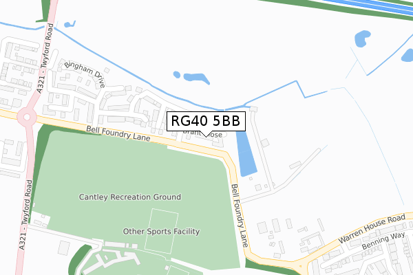
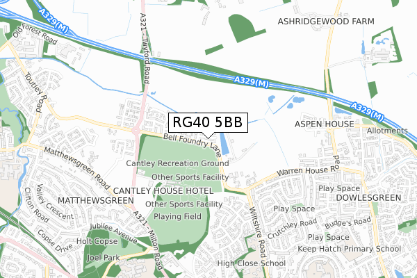
RG40 5BB maps


Source: OS Open Zoomstack (Ordnance Survey)
Licence: Open Government Licence (requires attribution)
Attribution: Contains OS data © Crown copyright and database right 2025
Source: Open Postcode Geo
Licence: Open Government Licence (requires attribution)
Attribution: Contains OS data © Crown copyright and database right 2025; Contains Royal Mail data © Royal Mail copyright and database right 2025; Source: Office for National Statistics licensed under the Open Government Licence v.3.0
Licence: Open Government Licence (requires attribution)
Attribution: Contains OS data © Crown copyright and database right 2025
Source: Open Postcode Geo
Licence: Open Government Licence (requires attribution)
Attribution: Contains OS data © Crown copyright and database right 2025; Contains Royal Mail data © Royal Mail copyright and database right 2025; Source: Office for National Statistics licensed under the Open Government Licence v.3.0
RG40 5BB geodata
| Easting | 481139 |
| Northing | 169999 |
| Latitude | 51.423205 |
| Longitude | -0.834413 |
Where is RG40 5BB?
| Country | England |
| Postcode District | RG40 |
Politics
| Ward | Norreys |
|---|---|
| Constituency | Wokingham |
Transport
Nearest bus stops to RG40 5BB
| Matthewsgreen East (Matthews Green Road) | Matthews Green | 653m |
| Matthewsgreen East (Matthews Green Road) | Matthews Green | 675m |
| Ashridge Road | Wokingham | 693m |
| Jubilee Avenue (Milton Road) | Wokingham | 710m |
| Sarum Crescent (Crutchley Drive) | Wokingham | 725m |
Nearest railway stations to RG40 5BB
| Wokingham Station | 1.4km |
| Winnersh Station | 3.1km |
| Winnersh Triangle Station | 4.2km |
Deprivation
12.5% of English postcodes are less deprived than RG40 5BB:Food Standards Agency
Three nearest food hygiene ratings to RG40 5BB (metres)
The Cantley House Hotel
Cantley House Hotel & Country Club
337m
Cleverchefs at Cantley Park Cafe

Pavilion Cantley Recreation Ground
341m
Co-operative Food

Unit 1 Paley Court
762m
➜ Get more ratings from the Food Standards Agency
Nearest post box to RG40 5BB
| Last Collection | |||
|---|---|---|---|
| Location | Mon-Fri | Sat | Distance |
| Wiltshire Road | 16:45 | 11:15 | 619m |
| Milton Road | 16:00 | 11:00 | 738m |
| Valley Cresent | 16:00 | 11:00 | 1,047m |
RG40 5BB ITL and RG40 5BB LAU
The below table lists the International Territorial Level (ITL) codes (formerly Nomenclature of Territorial Units for Statistics (NUTS) codes) and Local Administrative Units (LAU) codes for RG40 5BB:
| ITL 1 Code | Name |
|---|---|
| TLJ | South East (England) |
| ITL 2 Code | Name |
| TLJ1 | Berkshire, Buckinghamshire and Oxfordshire |
| ITL 3 Code | Name |
| TLJ11 | Berkshire |
| LAU 1 Code | Name |
| E06000041 | Wokingham |
RG40 5BB census areas
The below table lists the Census Output Area (OA), Lower Layer Super Output Area (LSOA), and Middle Layer Super Output Area (MSOA) for RG40 5BB:
| Code | Name | |
|---|---|---|
| OA | E00084140 | |
| LSOA | E01016674 | Wokingham 013D |
| MSOA | E02003451 | Wokingham 013 |
Nearest postcodes to RG40 5BB
| RG40 5QE | Bell Foundry Lane | 176m |
| RG40 5QB | Bell Foundry Lane | 370m |
| RG40 1WF | Deacon Close | 436m |
| RG40 5QD | Wiltshire Road | 454m |
| RG40 1XX | Benning Way | 491m |
| RG40 1WE | All Saints Close | 553m |
| RG40 1TF | Bowyer Crescent | 558m |
| RG40 1YL | Leney Close | 567m |
| RG40 1TE | Headington Close | 568m |
| RG40 1XB | Headington Drive | 597m |