RG27 9QW maps, stats, and open data
- Home
- Postcode
- RG
- RG27
- RG27 9
RG27 9QW is located in the Hook electoral ward, within the local authority district of Hart and the English Parliamentary constituency of North East Hampshire. The Sub Integrated Care Board (ICB) Location is NHS Hampshire and Isle of Wight ICB - D9Y0V and the police force is Hampshire. This postcode has been in use since January 2019.
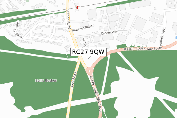
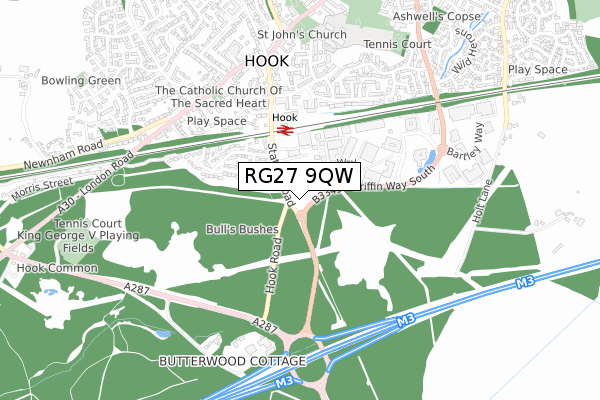
RG27 9QW maps


Source: OS Open Zoomstack (Ordnance Survey)
Licence: Open Government Licence (requires attribution)
Attribution: Contains OS data © Crown copyright and database right 2025
Source: Open Postcode GeoLicence: Open Government Licence (requires attribution)
Attribution: Contains OS data © Crown copyright and database right 2025; Contains Royal Mail data © Royal Mail copyright and database right 2025; Source: Office for National Statistics licensed under the Open Government Licence v.3.0
RG27 9QW geodata
| Easting | 472589 |
| Northing | 153632 |
| Latitude | 51.277218 |
| Longitude | -0.960692 |
Where is RG27 9QW?
| Country | England |
| Postcode District | RG27 |
Politics
| Ward | Hook |
|---|
| Constituency | North East Hampshire |
|---|
Transport
Nearest bus stops to RG27 9QW
| Berry Court (Station Road) | Hook | 115m |
| Berry Court (Station Road) | Hook | 129m |
| Tesco Store (Osborn Way) | Hook | 216m |
| Rail Station (Station Road) | Hook | 372m |
| Rail Station (Station Road) | Hook | 426m |
Nearest railway stations to RG27 9QW
| Hook Station | 0.3km |
| Winchfield Station | 3.8km |
Broadband
Broadband access in RG27 9QW (2020 data)
| Percentage of properties with Next Generation Access | 100.0% |
| Percentage of properties with Superfast Broadband | 100.0% |
| Percentage of properties with Ultrafast Broadband | 0.0% |
| Percentage of properties with Full Fibre Broadband | 0.0% |
Superfast Broadband is between 30Mbps and 300Mbps
Ultrafast Broadband is > 300Mbps
Broadband limitations in RG27 9QW (2020 data)
| Percentage of properties unable to receive 2Mbps | 0.0% |
| Percentage of properties unable to receive 5Mbps | 0.0% |
| Percentage of properties unable to receive 10Mbps | 0.0% |
| Percentage of properties unable to receive 30Mbps | 0.0% |
Deprivation
13.1% of English postcodes are less deprived than
RG27 9QW:
Food Standards Agency
Three nearest food hygiene ratings to RG27 9QW (metres)
Tesco
Sweet Coffee
Raven Hotel
➜ Get more ratings from the Food Standards Agency
Nearest post box to RG27 9QW
| | Last Collection | |
|---|
| Location | Mon-Fri | Sat | Distance |
|---|
| Hook Delivery Office | 18:30 | 10:45 | 197m |
| Rectory Road | 16:45 | 07:30 | 208m |
| Hook Delivery Office | | | 227m |
RG27 9QW ITL and RG27 9QW LAU
The below table lists the International Territorial Level (ITL) codes (formerly Nomenclature of Territorial Units for Statistics (NUTS) codes) and Local Administrative Units (LAU) codes for RG27 9QW:
| ITL 1 Code | Name |
|---|
| TLJ | South East (England) |
| ITL 2 Code | Name |
|---|
| TLJ3 | Hampshire and Isle of Wight |
| ITL 3 Code | Name |
|---|
| TLJ37 | North Hampshire |
| LAU 1 Code | Name |
|---|
| E07000089 | Hart |
RG27 9QW census areas
The below table lists the Census Output Area (OA), Lower Layer Super Output Area (LSOA), and Middle Layer Super Output Area (MSOA) for RG27 9QW:
| Code | Name |
|---|
| OA | E00116282 | |
|---|
| LSOA | E01022881 | Hart 006A |
|---|
| MSOA | E02004756 | Hart 006 |
|---|
Nearest postcodes to RG27 9QW


