RG24 8JE maps, stats, and open data
RG24 8JE is located in the Bramley electoral ward, within the local authority district of Basingstoke and Deane and the English Parliamentary constituency of North East Hampshire. The Sub Integrated Care Board (ICB) Location is NHS Hampshire and Isle of Wight ICB - D9Y0V and the police force is Hampshire. This postcode has been in use since June 2018.
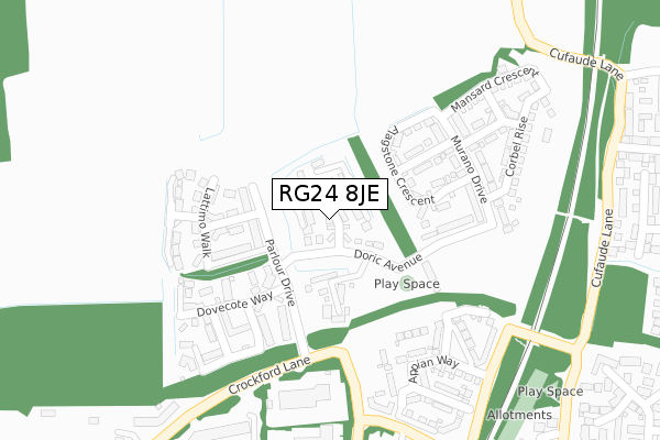
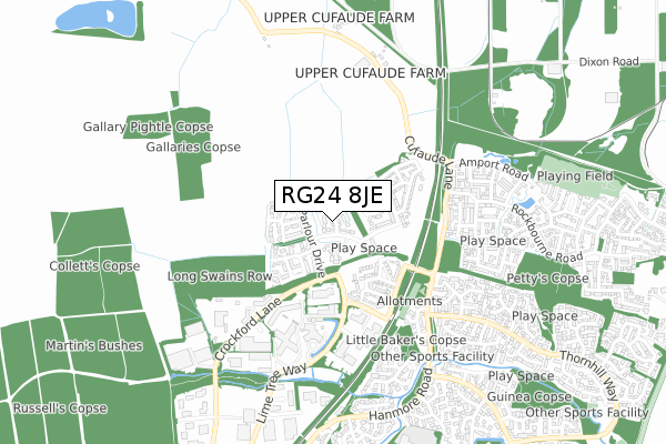
RG24 8JE maps


Licence: Open Government Licence (requires attribution)
Attribution: Contains OS data © Crown copyright and database right 2025
Source: Open Postcode Geo
Licence: Open Government Licence (requires attribution)
Attribution: Contains OS data © Crown copyright and database right 2025; Contains Royal Mail data © Royal Mail copyright and database right 2025; Source: Office for National Statistics licensed under the Open Government Licence v.3.0
RG24 8JE geodata
| Easting | 465534 |
| Northing | 156266 |
| Latitude | 51.301754 |
| Longitude | -1.061336 |
Where is RG24 8JE?
| Country | England |
| Postcode District | RG24 |
Politics
| Ward | Bramley |
|---|---|
| Constituency | North East Hampshire |
House Prices
Sales of detached houses in RG24 8JE
2021 1 SEP £407,500 |
6, PORTICO WAY, CHINEHAM, BASINGSTOKE, RG24 8JE 2018 20 DEC £513,950 |
10, PORTICO WAY, CHINEHAM, BASINGSTOKE, RG24 8JE 2018 16 NOV £422,500 |
9, PORTICO WAY, CHINEHAM, BASINGSTOKE, RG24 8JE 2018 16 NOV £429,950 |
8, PORTICO WAY, CHINEHAM, BASINGSTOKE, RG24 8JE 2018 9 NOV £384,950 |
2018 26 OCT £369,950 |
7, PORTICO WAY, CHINEHAM, BASINGSTOKE, RG24 8JE 2018 18 OCT £384,950 |
5, PORTICO WAY, CHINEHAM, BASINGSTOKE, RG24 8JE 2018 5 OCT £384,950 |
3, PORTICO WAY, CHINEHAM, BASINGSTOKE, RG24 8JE 2018 24 SEP £389,950 |
Licence: Contains HM Land Registry data © Crown copyright and database right 2025. This data is licensed under the Open Government Licence v3.0.
Transport
Nearest bus stops to RG24 8JE
| Shire (Lime Tree Way) | Chineham Business Park | 360m |
| Air Products (Crockford Lane) | Chineham Business Park | 469m |
| Sauter (Lime Tree Way) | Chineham Business Park | 526m |
| Thyme Close (Thornhill Way) | Chineham | 549m |
| Chineham Arms (Hanmore Road) | Chineham | 634m |
Nearest railway stations to RG24 8JE
| Bramley (Hants) Station | 3.2km |
| Basingstoke Station | 4.1km |
Broadband
Broadband access in RG24 8JE (2020 data)
| Percentage of properties with Next Generation Access | 100.0% |
| Percentage of properties with Superfast Broadband | 100.0% |
| Percentage of properties with Ultrafast Broadband | 100.0% |
| Percentage of properties with Full Fibre Broadband | 100.0% |
Superfast Broadband is between 30Mbps and 300Mbps
Ultrafast Broadband is > 300Mbps
Broadband limitations in RG24 8JE (2020 data)
| Percentage of properties unable to receive 2Mbps | 0.0% |
| Percentage of properties unable to receive 5Mbps | 0.0% |
| Percentage of properties unable to receive 10Mbps | 0.0% |
| Percentage of properties unable to receive 30Mbps | 0.0% |
Deprivation
15% of English postcodes are less deprived than RG24 8JE:Food Standards Agency
Three nearest food hygiene ratings to RG24 8JE (metres)


➜ Get more ratings from the Food Standards Agency
Nearest post box to RG24 8JE
| Last Collection | |||
|---|---|---|---|
| Location | Mon-Fri | Sat | Distance |
| Hanmore Road | 16:00 | 10:30 | 761m |
| Thornhill Way | 16:00 | 10:30 | 918m |
| Cufaude Lane | 16:00 | 10:30 | 1,167m |
RG24 8JE ITL and RG24 8JE LAU
The below table lists the International Territorial Level (ITL) codes (formerly Nomenclature of Territorial Units for Statistics (NUTS) codes) and Local Administrative Units (LAU) codes for RG24 8JE:
| ITL 1 Code | Name |
|---|---|
| TLJ | South East (England) |
| ITL 2 Code | Name |
| TLJ3 | Hampshire and Isle of Wight |
| ITL 3 Code | Name |
| TLJ37 | North Hampshire |
| LAU 1 Code | Name |
| E07000084 | Basingstoke and Deane |
RG24 8JE census areas
The below table lists the Census Output Area (OA), Lower Layer Super Output Area (LSOA), and Middle Layer Super Output Area (MSOA) for RG24 8JE:
| Code | Name | |
|---|---|---|
| OA | E00114618 | |
| LSOA | E01022546 | Basingstoke and Deane 005D |
| MSOA | E02004679 | Basingstoke and Deane 005 |
Nearest postcodes to RG24 8JE
| RG24 8WH | Crockford Lane | 281m |
| RG27 0FL | Cufaude Lane | 453m |
| RG24 8XA | Ajax Close | 474m |
| RG27 0FT | Brockham Grange | 492m |
| RG27 0BP | Bransbury Grove | 514m |
| RG24 8XG | Thyme Close | 545m |
| RG27 0FN | Avington Way | 549m |
| RG24 8XB | Achilles Close | 554m |
| RG27 0FJ | Eling Crescent | 560m |
| RG27 0FH | Woolston Place | 584m |