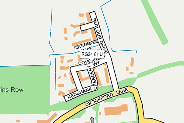
RG24 8HU is located in the Chineham electoral ward, within the local authority district of Basingstoke and Deane and the English Parliamentary constituency of Basingstoke. The Sub Integrated Care Board (ICB) Location is NHS Hampshire and Isle of Wight ICB - D9Y0V and the police force is Hampshire. This postcode has been in use since April 2017.


GetTheData
Source: OS OpenMap – Local (Ordnance Survey)
Source: OS VectorMap District (Ordnance Survey)
Licence: Open Government Licence (requires attribution)
| Easting | 465364 |
| Northing | 156143 |
| Latitude | 51.300668 |
| Longitude | -1.063797 |
GetTheData
Source: Open Postcode Geo
Licence: Open Government Licence
| Country | England |
| Postcode District | RG24 |
➜ See where RG24 is on a map ➜ Where is Basingstoke? | |
GetTheData
Source: Land Registry Price Paid Data
Licence: Open Government Licence
| Ward | Chineham |
| Constituency | Basingstoke |
GetTheData
Source: ONS Postcode Database
Licence: Open Government Licence
2023 20 JAN £490,000 |
2022 5 AUG £535,000 |
2022 8 MAR £435,000 |
2021 17 NOV £595,000 |
2021 5 MAR £685,000 |
2020 4 SEP £685,000 |
12, DOVECOTE WAY, CHINEHAM, BASINGSTOKE, RG24 8HU 2018 20 DEC £560,000 |
8, DOVECOTE WAY, CHINEHAM, BASINGSTOKE, RG24 8HU 2018 27 SEP £594,950 |
32, DOVECOTE WAY, CHINEHAM, BASINGSTOKE, RG24 8HU 2018 24 SEP £564,950 |
10, DOVECOTE WAY, CHINEHAM, BASINGSTOKE, RG24 8HU 2018 6 SEP £479,950 |
GetTheData
Source: HM Land Registry Price Paid Data
Licence: Contains HM Land Registry data © Crown copyright and database right 2025. This data is licensed under the Open Government Licence v3.0.
| Air Products (Crockford Lane) | Chineham Business Park | 272m |
| Shire (Lime Tree Way) | Chineham Business Park | 319m |
| Sauter (Lime Tree Way) | Chineham Business Park | 413m |
| Thyme Close (Thornhill Way) | Chineham | 636m |
| Larchwood (Hanmore Road) | Chineham | 661m |
| Bramley (Hants) Station | 3.3km |
| Basingstoke Station | 3.9km |
GetTheData
Source: NaPTAN
Licence: Open Government Licence
| Percentage of properties with Next Generation Access | 100.0% |
| Percentage of properties with Superfast Broadband | 100.0% |
| Percentage of properties with Ultrafast Broadband | 100.0% |
| Percentage of properties with Full Fibre Broadband | 100.0% |
Superfast Broadband is between 30Mbps and 300Mbps
Ultrafast Broadband is > 300Mbps
| Percentage of properties unable to receive 2Mbps | 0.0% |
| Percentage of properties unable to receive 5Mbps | 0.0% |
| Percentage of properties unable to receive 10Mbps | 0.0% |
| Percentage of properties unable to receive 30Mbps | 0.0% |
GetTheData
Source: Ofcom
Licence: Ofcom Terms of Use (requires attribution)
GetTheData
Source: ONS Postcode Database
Licence: Open Government Licence


➜ Get more ratings from the Food Standards Agency
GetTheData
Source: Food Standards Agency
Licence: FSA terms & conditions
| Last Collection | |||
|---|---|---|---|
| Location | Mon-Fri | Sat | Distance |
| Hanmore Road | 16:00 | 10:30 | 717m |
| Thornhill Way | 16:00 | 10:30 | 1,018m |
| Crockford Lane | 18:30 | 1,118m | |
GetTheData
Source: Dracos
Licence: Creative Commons Attribution-ShareAlike
The below table lists the International Territorial Level (ITL) codes (formerly Nomenclature of Territorial Units for Statistics (NUTS) codes) and Local Administrative Units (LAU) codes for RG24 8HU:
| ITL 1 Code | Name |
|---|---|
| TLJ | South East (England) |
| ITL 2 Code | Name |
| TLJ3 | Hampshire and Isle of Wight |
| ITL 3 Code | Name |
| TLJ37 | North Hampshire |
| LAU 1 Code | Name |
| E07000084 | Basingstoke and Deane |
GetTheData
Source: ONS Postcode Directory
Licence: Open Government Licence
The below table lists the Census Output Area (OA), Lower Layer Super Output Area (LSOA), and Middle Layer Super Output Area (MSOA) for RG24 8HU:
| Code | Name | |
|---|---|---|
| OA | E00114590 | |
| LSOA | E01032851 | Basingstoke and Deane 007J |
| MSOA | E02004681 | Basingstoke and Deane 007 |
GetTheData
Source: ONS Postcode Directory
Licence: Open Government Licence
| RG24 8WH | Crockford Lane | 189m |
| RG24 8XA | Ajax Close | 533m |
| RG24 8XB | Achilles Close | 542m |
| RG24 8XD | Renown Way | 596m |
| RG27 0FL | Cufaude Lane | 651m |
| RG24 8ST | Maybrook | 660m |
| RG24 8XG | Thyme Close | 663m |
| RG27 0BP | Bransbury Grove | 668m |
| RG27 0FT | Brockham Grange | 676m |
| RG24 8XT | Bowman Road | 693m |
GetTheData
Source: Open Postcode Geo; Land Registry Price Paid Data
Licence: Open Government Licence