RG2 9YY maps, stats, and open data
RG2 9YY is located in the Barkham electoral ward, within the unitary authority of Wokingham and the English Parliamentary constituency of Wokingham. The Sub Integrated Care Board (ICB) Location is NHS Buckinghamshire, Oxfordshire and Berkshire West ICB - 15A and the police force is Thames Valley. This postcode has been in use since February 2020.
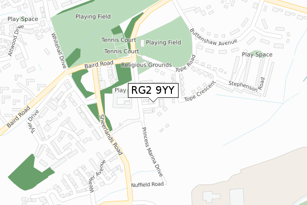
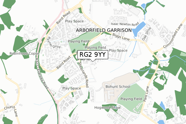
RG2 9YY maps


Licence: Open Government Licence (requires attribution)
Attribution: Contains OS data © Crown copyright and database right 2025
Source: Open Postcode Geo
Licence: Open Government Licence (requires attribution)
Attribution: Contains OS data © Crown copyright and database right 2025; Contains Royal Mail data © Royal Mail copyright and database right 2025; Source: Office for National Statistics licensed under the Open Government Licence v.3.0
RG2 9YY geodata
| Easting | 476808 |
| Northing | 165412 |
| Latitude | 51.382570 |
| Longitude | -0.897679 |
Where is RG2 9YY?
| Country | England |
| Postcode District | RG2 |
Politics
| Ward | Barkham |
|---|---|
| Constituency | Wokingham |
House Prices
Sales of detached houses in RG2 9YY
2022 24 JUN £662,500 |
25, LANCE WAY, ARBORFIELD GREEN, READING, RG2 9YY 2021 29 JUN £510,000 |
8, LANCE WAY, ARBORFIELD GREEN, READING, RG2 9YY 2021 31 MAR £512,500 |
27, LANCE WAY, ARBORFIELD GREEN, READING, RG2 9YY 2021 5 FEB £505,000 |
6, LANCE WAY, ARBORFIELD GREEN, READING, RG2 9YY 2020 18 DEC £507,500 |
23, LANCE WAY, ARBORFIELD GREEN, READING, RG2 9YY 2020 13 NOV £475,000 |
11, LANCE WAY, ARBORFIELD GREEN, READING, RG2 9YY 2020 20 OCT £500,000 |
21, LANCE WAY, ARBORFIELD GREEN, READING, RG2 9YY 2020 16 OCT £487,375 |
15, LANCE WAY, ARBORFIELD GREEN, READING, RG2 9YY 2020 4 SEP £525,000 |
2020 21 AUG £595,000 |
➜ Arborfield Garrison house prices
Licence: Contains HM Land Registry data © Crown copyright and database right 2025. This data is licensed under the Open Government Licence v3.0.
Transport
Nearest bus stops to RG2 9YY
| Rowcroft Road (Sheerlands Road) | Arborfield Garrison | 177m |
| Rowcroft Road (Sheerlands Road) | Arborfield Garrison | 187m |
| Sheerlands Road | Arborfield Garrison | 196m |
| Sheerlands Road (Baird Road) | Arborfield Garrison | 199m |
| Faraday Close (Baird Road) | Arborfield Garrison | 375m |
Nearest railway stations to RG2 9YY
| Wokingham Station | 5km |
Deprivation
12.2% of English postcodes are less deprived than RG2 9YY:Food Standards Agency
Three nearest food hygiene ratings to RG2 9YY (metres)


➜ Get more ratings from the Food Standards Agency
Nearest post box to RG2 9YY
| Last Collection | |||
|---|---|---|---|
| Location | Mon-Fri | Sat | Distance |
| Baird Road | 16:30 | 09:00 | 170m |
| Arborfield Camp | 16:30 | 07:45 | 180m |
| Arborfield Camp Post Office | 16:45 | 08:15 | 488m |
RG2 9YY ITL and RG2 9YY LAU
The below table lists the International Territorial Level (ITL) codes (formerly Nomenclature of Territorial Units for Statistics (NUTS) codes) and Local Administrative Units (LAU) codes for RG2 9YY:
| ITL 1 Code | Name |
|---|---|
| TLJ | South East (England) |
| ITL 2 Code | Name |
| TLJ1 | Berkshire, Buckinghamshire and Oxfordshire |
| ITL 3 Code | Name |
| TLJ11 | Berkshire |
| LAU 1 Code | Name |
| E06000041 | Wokingham |
RG2 9YY census areas
The below table lists the Census Output Area (OA), Lower Layer Super Output Area (LSOA), and Middle Layer Super Output Area (MSOA) for RG2 9YY:
| Code | Name | |
|---|---|---|
| OA | E00083873 | |
| LSOA | E01016611 | Wokingham 018B |
| MSOA | E02003456 | Wokingham 018 |
Nearest postcodes to RG2 9YY
| RG2 9ND | Sheerlands Road | 243m |
| RG2 9NG | Tyler Drive | 317m |
| RG2 9NZ | Gerring Road | 319m |
| RG2 9NQ | Barker Close | 345m |
| RG2 9LU | Venning Road | 441m |
| RG2 9FF | Mabett Close | 443m |
| RG2 9QQ | Valon Road | 466m |
| RG2 9QL | Bramshill Close | 502m |
| RG2 9FE | Attwood Drive | 505m |
| RG2 9LT | Valon Road | 545m |