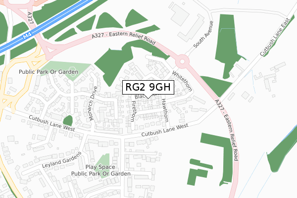
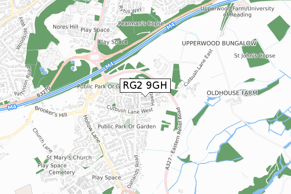
RG2 9GH is located in the Shinfield South electoral ward, within the unitary authority of Wokingham and the English Parliamentary constituency of Wokingham. The Sub Integrated Care Board (ICB) Location is NHS Buckinghamshire, Oxfordshire and Berkshire West ICB - 15A and the police force is Thames Valley. This postcode has been in use since July 2018.


GetTheData
Source: OS Open Zoomstack (Ordnance Survey)
Licence: Open Government Licence (requires attribution)
Attribution: Contains OS data © Crown copyright and database right 2025
Source: Open Postcode Geo
Licence: Open Government Licence (requires attribution)
Attribution: Contains OS data © Crown copyright and database right 2025; Contains Royal Mail data © Royal Mail copyright and database right 2025; Source: Office for National Statistics licensed under the Open Government Licence v.3.0
| Easting | 473625 |
| Northing | 168725 |
| Latitude | 51.412776 |
| Longitude | -0.942722 |
GetTheData
Source: Open Postcode Geo
Licence: Open Government Licence
| Country | England |
| Postcode District | RG2 |
➜ See where RG2 is on a map ➜ Where is Shinfield? | |
GetTheData
Source: Land Registry Price Paid Data
Licence: Open Government Licence
| Ward | Shinfield South |
| Constituency | Wokingham |
GetTheData
Source: ONS Postcode Database
Licence: Open Government Licence
2023 24 JUL £505,000 |
2, BLACKTHORN, SHINFIELD, READING, RG2 9GH 2018 9 OCT £440,000 |
9, BLACKTHORN, SHINFIELD, READING, RG2 9GH 2018 27 JUL £425,000 |
2018 29 JUN £440,000 |
15, BLACKTHORN, SHINFIELD, READING, RG2 9GH 2018 29 JUN £540,000 |
GetTheData
Source: HM Land Registry Price Paid Data
Licence: Contains HM Land Registry data © Crown copyright and database right 2025. This data is licensed under the Open Government Licence v3.0.
| Lower Earley Way West (Lower Earley Way (West)) | Shinfield | 454m |
| The Black Boy (Hollow Lane) | Shinfield | 505m |
| The Black Boy (Hollow Lane) | Shinfield | 513m |
| Church Lane (Hollow Lane) | Shinfield | 582m |
| Church Lane (Hollow Lane) | Shinfield | 589m |
| Earley Station | 3.6km |
| Winnersh Triangle Station | 4.5km |
| Winnersh Station | 5km |
GetTheData
Source: NaPTAN
Licence: Open Government Licence
| Percentage of properties with Next Generation Access | 100.0% |
| Percentage of properties with Superfast Broadband | 100.0% |
| Percentage of properties with Ultrafast Broadband | 0.0% |
| Percentage of properties with Full Fibre Broadband | 0.0% |
Superfast Broadband is between 30Mbps and 300Mbps
Ultrafast Broadband is > 300Mbps
| Median download speed | 39.1Mbps |
| Average download speed | 36.1Mbps |
| Maximum download speed | 52.44Mbps |
| Median upload speed | 9.0Mbps |
| Average upload speed | 7.0Mbps |
| Maximum upload speed | 10.00Mbps |
| Percentage of properties unable to receive 2Mbps | 0.0% |
| Percentage of properties unable to receive 5Mbps | 0.0% |
| Percentage of properties unable to receive 10Mbps | 0.0% |
| Percentage of properties unable to receive 30Mbps | 0.0% |
GetTheData
Source: Ofcom
Licence: Ofcom Terms of Use (requires attribution)
GetTheData
Source: ONS Postcode Database
Licence: Open Government Licence


➜ Get more ratings from the Food Standards Agency
GetTheData
Source: Food Standards Agency
Licence: FSA terms & conditions
| Last Collection | |||
|---|---|---|---|
| Location | Mon-Fri | Sat | Distance |
| Shinfield Road Post Office | 17:00 | 12:00 | 178m |
| Shinfield Church | 17:15 | 08:00 | 812m |
| Whitley Wood Post Office | 17:00 | 13:30 | 1,371m |
GetTheData
Source: Dracos
Licence: Creative Commons Attribution-ShareAlike
The below table lists the International Territorial Level (ITL) codes (formerly Nomenclature of Territorial Units for Statistics (NUTS) codes) and Local Administrative Units (LAU) codes for RG2 9GH:
| ITL 1 Code | Name |
|---|---|
| TLJ | South East (England) |
| ITL 2 Code | Name |
| TLJ1 | Berkshire, Buckinghamshire and Oxfordshire |
| ITL 3 Code | Name |
| TLJ11 | Berkshire |
| LAU 1 Code | Name |
| E06000041 | Wokingham |
GetTheData
Source: ONS Postcode Directory
Licence: Open Government Licence
The below table lists the Census Output Area (OA), Lower Layer Super Output Area (LSOA), and Middle Layer Super Output Area (MSOA) for RG2 9GH:
| Code | Name | |
|---|---|---|
| OA | E00167031 | |
| LSOA | E01032759 | Wokingham 012H |
| MSOA | E02003450 | Wokingham 012 |
GetTheData
Source: ONS Postcode Directory
Licence: Open Government Licence
| RG2 9EZ | Grenadier Close | 124m |
| RG2 9AG | Cutbush Lane | 149m |
| RG2 9EW | Monarch Drive | 197m |
| RG2 9BZ | Carnation Close | 251m |
| RG2 9FZ | Dearlove Place | 263m |
| RG2 9AW | Leyland Gardens | 265m |
| RG2 9ED | Pippin Grove | 277m |
| RG2 9AR | Kendal Avenue | 288m |
| RG2 9DZ | Chrysanthemum Drive | 296m |
| RG2 9AH | Cutbush Lane | 298m |
GetTheData
Source: Open Postcode Geo; Land Registry Price Paid Data
Licence: Open Government Licence