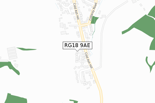
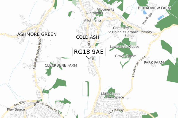
RG18 9AE is located in the Chieveley & Cold Ash electoral ward, within the unitary authority of West Berkshire and the English Parliamentary constituency of Newbury. The Sub Integrated Care Board (ICB) Location is NHS Buckinghamshire, Oxfordshire and Berkshire West ICB - 15A and the police force is Thames Valley. This postcode has been in use since January 2018.


GetTheData
Source: OS Open Zoomstack (Ordnance Survey)
Licence: Open Government Licence (requires attribution)
Attribution: Contains OS data © Crown copyright and database right 2025
Source: Open Postcode Geo
Licence: Open Government Licence (requires attribution)
Attribution: Contains OS data © Crown copyright and database right 2025; Contains Royal Mail data © Royal Mail copyright and database right 2025; Source: Office for National Statistics licensed under the Open Government Licence v.3.0
| Easting | 451257 |
| Northing | 169151 |
| Latitude | 51.419063 |
| Longitude | -1.264253 |
GetTheData
Source: Open Postcode Geo
Licence: Open Government Licence
| Country | England |
| Postcode District | RG18 |
➜ See where RG18 is on a map ➜ Where is Cold Ash? | |
GetTheData
Source: Land Registry Price Paid Data
Licence: Open Government Licence
| Ward | Chieveley & Cold Ash |
| Constituency | Newbury |
GetTheData
Source: ONS Postcode Database
Licence: Open Government Licence
| Hatchgate Close (Cold Ash Hill) | Cold Ash | 124m |
| Hatchgate Close (Cold Ash Hill) | Cold Ash | 183m |
| Cold Ash Post Office (Cold Ash Hill) | Cold Ash | 274m |
| Cold Ash Post Office (Cold Ash Hill) | Cold Ash | 281m |
| Cold Ash Hill Southend (Cold Ash Hill) | Thatcham | 588m |
| Thatcham Station | 3.2km |
| Newbury Racecourse Station | 3.8km |
| Newbury Station | 4.7km |
GetTheData
Source: NaPTAN
Licence: Open Government Licence
GetTheData
Source: ONS Postcode Database
Licence: Open Government Licence


➜ Get more ratings from the Food Standards Agency
GetTheData
Source: Food Standards Agency
Licence: FSA terms & conditions
| Last Collection | |||
|---|---|---|---|
| Location | Mon-Fri | Sat | Distance |
| Cold Ash Post Office | 16:30 | 11:15 | 291m |
| Convent | 16:15 | 08:30 | 714m |
| Bath Road | 17:30 | 07:30 | 1,599m |
GetTheData
Source: Dracos
Licence: Creative Commons Attribution-ShareAlike
The below table lists the International Territorial Level (ITL) codes (formerly Nomenclature of Territorial Units for Statistics (NUTS) codes) and Local Administrative Units (LAU) codes for RG18 9AE:
| ITL 1 Code | Name |
|---|---|
| TLJ | South East (England) |
| ITL 2 Code | Name |
| TLJ1 | Berkshire, Buckinghamshire and Oxfordshire |
| ITL 3 Code | Name |
| TLJ11 | Berkshire |
| LAU 1 Code | Name |
| E06000037 | West Berkshire |
GetTheData
Source: ONS Postcode Directory
Licence: Open Government Licence
The below table lists the Census Output Area (OA), Lower Layer Super Output Area (LSOA), and Middle Layer Super Output Area (MSOA) for RG18 9AE:
| Code | Name | |
|---|---|---|
| OA | E00082256 | |
| LSOA | E01016284 | West Berkshire 007D |
| MSOA | E02003373 | West Berkshire 007 |
GetTheData
Source: ONS Postcode Directory
Licence: Open Government Licence
| RG18 9NX | Cold Ash Hill | 42m |
| RG18 9PA | Cold Ash Hill | 92m |
| RG18 9NY | Hatchgate Close | 144m |
| RG18 9PY | Corner Mead | 164m |
| RG18 9PQ | Strouds Meadow | 318m |
| RG18 9PH | Cold Ash Hill | 319m |
| RG18 9PB | Collaroy Road | 326m |
| RG18 9PD | The Rise | 347m |
| RG18 9PJ | Cold Ash Hill | 381m |
| RG18 9LD | Hazels Paddock | 412m |
GetTheData
Source: Open Postcode Geo; Land Registry Price Paid Data
Licence: Open Government Licence