Property/Postcode Data Search:
RG12 9TH maps, stats, and open data
RG12 9TH is located in the Town Centre & The Parks electoral ward, within the unitary authority of Bracknell Forest and the English Parliamentary constituency of Bracknell. The Sub Integrated Care Board (ICB) Location is NHS Frimley ICB - D4U1Y and the police force is Thames Valley. This postcode has been in use since September 2019.
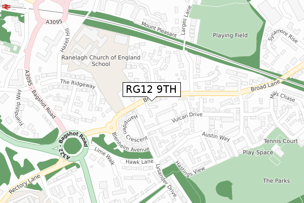
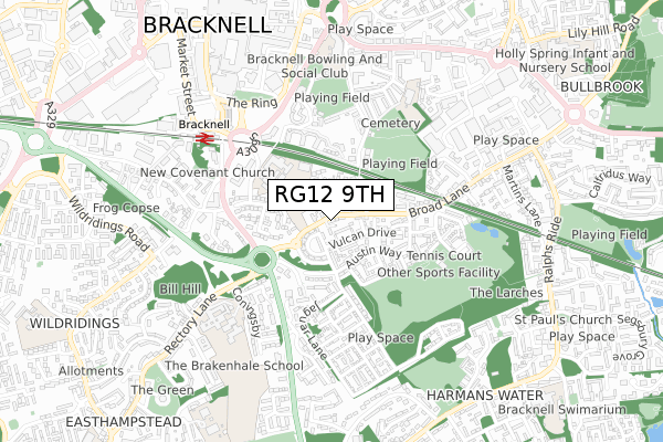
RG12 9TH maps


Source: OS Open Zoomstack (Ordnance Survey)
Licence: Open Government Licence (requires attribution)
Attribution: Contains OS data © Crown copyright and database right 2025
Source: Open Postcode Geo
Licence: Open Government Licence (requires attribution)
Attribution: Contains OS data © Crown copyright and database right 2025; Contains Royal Mail data © Royal Mail copyright and database right 2025; Source: Office for National Statistics licensed under the Open Government Licence v.3.0
Licence: Open Government Licence (requires attribution)
Attribution: Contains OS data © Crown copyright and database right 2025
Source: Open Postcode Geo
Licence: Open Government Licence (requires attribution)
Attribution: Contains OS data © Crown copyright and database right 2025; Contains Royal Mail data © Royal Mail copyright and database right 2025; Source: Office for National Statistics licensed under the Open Government Licence v.3.0
RG12 9TH geodata
| Easting | 487379 |
| Northing | 168645 |
| Latitude | 51.410106 |
| Longitude | -0.745024 |
Where is RG12 9TH?
| Country | England |
| Postcode District | RG12 |
Politics
| Ward | Town Centre & The Parks |
|---|---|
| Constituency | Bracknell |
Transport
Nearest bus stops to RG12 9TH
| Larges Bridge Drive (Broad Lane) | The Parks | 143m |
| Hastings View (Austin Way) | The Parks | 182m |
| Ramslade House (Austin Way) | The Parks | 262m |
| Horse And Groom (Bagshot Road) | Easthampstead | 339m |
| Horse And Groom (Bagshot Road) | Easthampstead | 344m |
Nearest railway stations to RG12 9TH
| Bracknell Station | 0.6km |
| Martins Heron Station | 1.5km |
| Ascot Station | 4.8km |
Deprivation
30% of English postcodes are less deprived than RG12 9TH:Food Standards Agency
Three nearest food hygiene ratings to RG12 9TH (metres)
Harrison Catering At Ranelagh School

Ranelagh School Ranelagh Drive
182m
BFC Supported Housing Unit
Glenfield House Rectory Close
426m
Astbury Manor Residential Home

Astbury Manor Retirement Home Crowthorne Road North
447m
➜ Get more ratings from the Food Standards Agency
Nearest post box to RG12 9TH
| Last Collection | |||
|---|---|---|---|
| Location | Mon-Fri | Sat | Distance |
| Beedon Drive | 16:00 | 12:00 | 93m |
| Old Bracknell Lane | 16:45 | 12:00 | 507m |
| Railway Station | 17:15 | 11:45 | 568m |
RG12 9TH ITL and RG12 9TH LAU
The below table lists the International Territorial Level (ITL) codes (formerly Nomenclature of Territorial Units for Statistics (NUTS) codes) and Local Administrative Units (LAU) codes for RG12 9TH:
| ITL 1 Code | Name |
|---|---|
| TLJ | South East (England) |
| ITL 2 Code | Name |
| TLJ1 | Berkshire, Buckinghamshire and Oxfordshire |
| ITL 3 Code | Name |
| TLJ11 | Berkshire |
| LAU 1 Code | Name |
| E06000036 | Bracknell Forest |
RG12 9TH census areas
The below table lists the Census Output Area (OA), Lower Layer Super Output Area (LSOA), and Middle Layer Super Output Area (MSOA) for RG12 9TH:
| Code | Name | |
|---|---|---|
| OA | E00166643 | |
| LSOA | E01016225 | Bracknell Forest 007A |
| MSOA | E02003358 | Bracknell Forest 007 |
Nearest postcodes to RG12 9TH
| RG12 9DE | Broad Lane | 35m |
| RG12 9BY | Broad Lane | 67m |
| RG12 9DA | Ranelagh Drive | 86m |
| RG12 9FZ | Valiant Place | 95m |
| RG12 9FY | Halifax Road | 109m |
| RG12 9GN | Vulcan Drive | 125m |
| RG12 9NW | Hampden Crescent | 140m |
| RG12 9DQ | Buttermere Gardens | 161m |
| RG12 9SJ | Poneys Close | 166m |
| RG12 9GJ | Victor Walk | 174m |