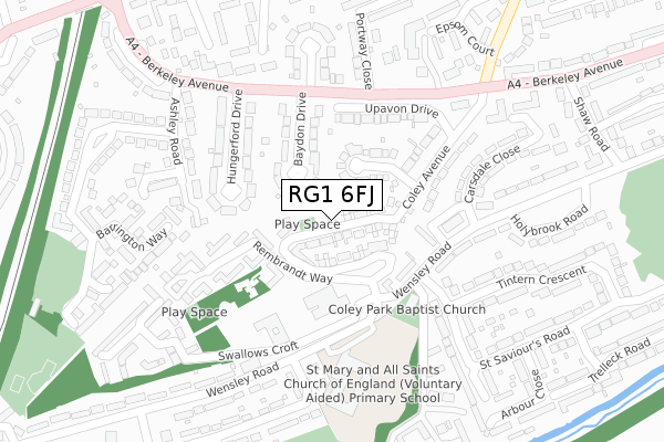
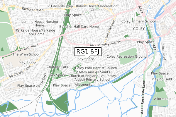
RG1 6FJ is located in the Coley electoral ward, within the unitary authority of Reading and the English Parliamentary constituency of Reading West. The Sub Integrated Care Board (ICB) Location is NHS Buckinghamshire, Oxfordshire and Berkshire West ICB - 15A and the police force is Thames Valley. This postcode has been in use since December 2017.


GetTheData
Source: OS Open Zoomstack (Ordnance Survey)
Licence: Open Government Licence (requires attribution)
Attribution: Contains OS data © Crown copyright and database right 2025
Source: Open Postcode Geo
Licence: Open Government Licence (requires attribution)
Attribution: Contains OS data © Crown copyright and database right 2025; Contains Royal Mail data © Royal Mail copyright and database right 2025; Source: Office for National Statistics licensed under the Open Government Licence v.3.0
| Easting | 470416 |
| Northing | 172331 |
| Latitude | 51.445602 |
| Longitude | -0.988139 |
GetTheData
Source: Open Postcode Geo
Licence: Open Government Licence
| Country | England |
| Postcode District | RG1 |
➜ See where RG1 is on a map ➜ Where is Reading? | |
GetTheData
Source: Land Registry Price Paid Data
Licence: Open Government Licence
| Ward | Coley |
| Constituency | Reading West |
GetTheData
Source: ONS Postcode Database
Licence: Open Government Licence
| Roundhead (Wensley Road) | Coley Park | 163m |
| Hungerford Drive (Berkeley Avenue) | Coley | 212m |
| Roundhead (Wensley Road) | Coley Park | 234m |
| Coley Park House (Lesford Road) | Coley Park | 241m |
| Coley Park House (Wensley Road) | Coley Park | 243m |
| Reading West Station | 1.1km |
| Reading Station | 1.9km |
| Tilehurst Station | 4.1km |
GetTheData
Source: NaPTAN
Licence: Open Government Licence
| Percentage of properties with Next Generation Access | 100.0% |
| Percentage of properties with Superfast Broadband | 100.0% |
| Percentage of properties with Ultrafast Broadband | 54.5% |
| Percentage of properties with Full Fibre Broadband | 54.5% |
Superfast Broadband is between 30Mbps and 300Mbps
Ultrafast Broadband is > 300Mbps
| Median download speed | 360.0Mbps |
| Average download speed | 360.0Mbps |
| Maximum download speed | 360.00Mbps |
| Median upload speed | 360.0Mbps |
| Average upload speed | 360.0Mbps |
| Maximum upload speed | 360.00Mbps |
| Percentage of properties unable to receive 2Mbps | 0.0% |
| Percentage of properties unable to receive 5Mbps | 0.0% |
| Percentage of properties unable to receive 10Mbps | 0.0% |
| Percentage of properties unable to receive 30Mbps | 0.0% |
GetTheData
Source: Ofcom
Licence: Ofcom Terms of Use (requires attribution)
GetTheData
Source: ONS Postcode Database
Licence: Open Government Licence


➜ Get more ratings from the Food Standards Agency
GetTheData
Source: Food Standards Agency
Licence: FSA terms & conditions
| Last Collection | |||
|---|---|---|---|
| Location | Mon-Fri | Sat | Distance |
| Ashley Road | 16:45 | 13:15 | 303m |
| Coley Avenue | 16:30 | 13:00 | 313m |
| Hay Road | 16:15 | 13:00 | 370m |
GetTheData
Source: Dracos
Licence: Creative Commons Attribution-ShareAlike
The below table lists the International Territorial Level (ITL) codes (formerly Nomenclature of Territorial Units for Statistics (NUTS) codes) and Local Administrative Units (LAU) codes for RG1 6FJ:
| ITL 1 Code | Name |
|---|---|
| TLJ | South East (England) |
| ITL 2 Code | Name |
| TLJ1 | Berkshire, Buckinghamshire and Oxfordshire |
| ITL 3 Code | Name |
| TLJ11 | Berkshire |
| LAU 1 Code | Name |
| E06000038 | Reading |
GetTheData
Source: ONS Postcode Directory
Licence: Open Government Licence
The below table lists the Census Output Area (OA), Lower Layer Super Output Area (LSOA), and Middle Layer Super Output Area (MSOA) for RG1 6FJ:
| Code | Name | |
|---|---|---|
| OA | E00082799 | |
| LSOA | E01016393 | Reading 013E |
| MSOA | E02003401 | Reading 013 |
GetTheData
Source: ONS Postcode Directory
Licence: Open Government Licence
| RG1 6QY | Rembrandt Way | 107m |
| RG1 6LS | Coley Avenue | 107m |
| RG1 6QW | Rembrandt Way | 113m |
| RG1 6LR | Froxfield Avenue | 115m |
| RG1 6JB | Baydon Drive | 123m |
| RG1 6QP | Rembrandt Way | 128m |
| RG1 6QX | Rembrandt Way | 137m |
| RG1 6JA | Hungerford Drive | 159m |
| RG1 6LN | Coley Avenue | 168m |
| RG1 6LP | Upavon Drive | 169m |
GetTheData
Source: Open Postcode Geo; Land Registry Price Paid Data
Licence: Open Government Licence