PR8 5QB maps, stats, and open data
PR8 5QB is located in the Kew electoral ward, within the metropolitan district of Sefton and the English Parliamentary constituency of Southport. The Sub Integrated Care Board (ICB) Location is NHS Cheshire and Merseyside ICB - 01V and the police force is Merseyside. This postcode has been in use since June 2019.
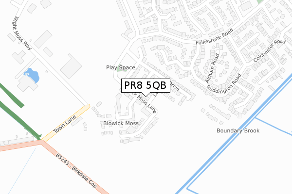
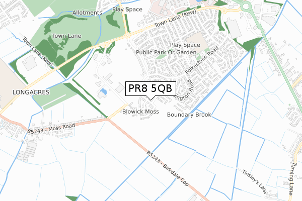
PR8 5QB maps


Licence: Open Government Licence (requires attribution)
Attribution: Contains OS data © Crown copyright and database right 2025
Source: Open Postcode Geo
Licence: Open Government Licence (requires attribution)
Attribution: Contains OS data © Crown copyright and database right 2025; Contains Royal Mail data © Royal Mail copyright and database right 2025; Source: Office for National Statistics licensed under the Open Government Licence v.3.0
PR8 5QB geodata
| Easting | 335074 |
| Northing | 414697 |
| Latitude | 53.624779 |
| Longitude | -2.983138 |
Where is PR8 5QB?
| Country | England |
| Postcode District | PR8 |
Politics
| Ward | Kew |
|---|---|
| Constituency | Southport |
House Prices
Sales of detached houses in PR8 5QB
2024 11 OCT £164,000 |
203, BLOWICK MOSS LANE, SOUTHPORT, PR8 5QB 2022 24 JUN £322,500 |
201, BLOWICK MOSS LANE, SOUTHPORT, PR8 5QB 2022 24 JUN £320,000 |
2022 31 MAR £155,000 |
153, BLOWICK MOSS LANE, SOUTHPORT, PR8 5QB 2022 25 FEB £257,500 |
149, BLOWICK MOSS LANE, SOUTHPORT, PR8 5QB 2021 24 SEP £293,000 |
133, BLOWICK MOSS LANE, SOUTHPORT, PR8 5QB 2020 26 JUN £275,495 |
85, BLOWICK MOSS LANE, SOUTHPORT, PR8 5QB 2019 28 JUN £216,995 |
83, BLOWICK MOSS LANE, SOUTHPORT, PR8 5QB 2019 28 JUN £209,995 |
81, BLOWICK MOSS LANE, SOUTHPORT, PR8 5QB 2019 27 JUN £211,995 |
Licence: Contains HM Land Registry data © Crown copyright and database right 2025. This data is licensed under the Open Government Licence v3.0.
Transport
Nearest bus stops to PR8 5QB
| County Boundary (Town Lane) | Blowick Moss | 258m |
| County Boundary (Town Lane) | Blowick Moss | 269m |
| County Boundary (Birkdale Cop) | Blowick Moss | 289m |
| County Boundary (Birkdale Cop) | Blowick Moss | 301m |
| Blowick Moss Industrial Estate | Blowick Moss | 375m |
Nearest railway stations to PR8 5QB
| Birkdale Station | 2.3km |
| Meols Cop Station | 2.4km |
| Southport Station | 2.7km |
Broadband
Broadband access in PR8 5QB (2020 data)
| Percentage of properties with Next Generation Access | 100.0% |
| Percentage of properties with Superfast Broadband | 100.0% |
| Percentage of properties with Ultrafast Broadband | 100.0% |
| Percentage of properties with Full Fibre Broadband | 100.0% |
Superfast Broadband is between 30Mbps and 300Mbps
Ultrafast Broadband is > 300Mbps
Broadband limitations in PR8 5QB (2020 data)
| Percentage of properties unable to receive 2Mbps | 0.0% |
| Percentage of properties unable to receive 5Mbps | 0.0% |
| Percentage of properties unable to receive 10Mbps | 0.0% |
| Percentage of properties unable to receive 30Mbps | 0.0% |
Deprivation
22.1% of English postcodes are less deprived than PR8 5QB:Food Standards Agency
Three nearest food hygiene ratings to PR8 5QB (metres)


➜ Get more ratings from the Food Standards Agency
Nearest post box to PR8 5QB
| Last Collection | |||
|---|---|---|---|
| Location | Mon-Fri | Sat | Distance |
| Southport Delivery Office | 17:00 | 12:00 | 341m |
| Ovington Drive Post Office | 17:45 | 11:30 | 643m |
| 58 Moss Road | 16:00 | 11:30 | 752m |
PR8 5QB ITL and PR8 5QB LAU
The below table lists the International Territorial Level (ITL) codes (formerly Nomenclature of Territorial Units for Statistics (NUTS) codes) and Local Administrative Units (LAU) codes for PR8 5QB:
| ITL 1 Code | Name |
|---|---|
| TLD | North West (England) |
| ITL 2 Code | Name |
| TLD7 | Merseyside |
| ITL 3 Code | Name |
| TLD73 | Sefton |
| LAU 1 Code | Name |
| E08000014 | Sefton |
PR8 5QB census areas
The below table lists the Census Output Area (OA), Lower Layer Super Output Area (LSOA), and Middle Layer Super Output Area (MSOA) for PR8 5QB:
| Code | Name | |
|---|---|---|
| OA | E00035465 | |
| LSOA | E01007002 | Sefton 008F |
| MSOA | E02001436 | Sefton 008 |
Nearest postcodes to PR8 5QB
| PR8 6XT | Winston Crescent | 331m |
| PR8 4JA | Moss Road | 413m |
| PR8 6XD | Ruddington Road | 429m |
| PR8 6XL | Altham Road | 432m |
| PR8 5PP | Folkestone Road | 435m |
| PR8 6XR | Markham Drive | 455m |
| PR8 6US | Sangness Drive | 467m |
| PR8 6QB | Cheriton Park | 477m |
| PR8 6UR | Foxdale Close | 523m |
| PR8 6UJ | Westwood Close | 549m |