PR7 7LP maps, stats, and open data
PR7 7LP is located in the Buckshaw & Whittle electoral ward, within the local authority district of Chorley and the English Parliamentary constituency of Chorley. The Sub Integrated Care Board (ICB) Location is NHS Lancashire and South Cumbria ICB - 00X and the police force is Lancashire. This postcode has been in use since December 2017.
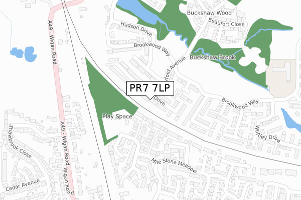
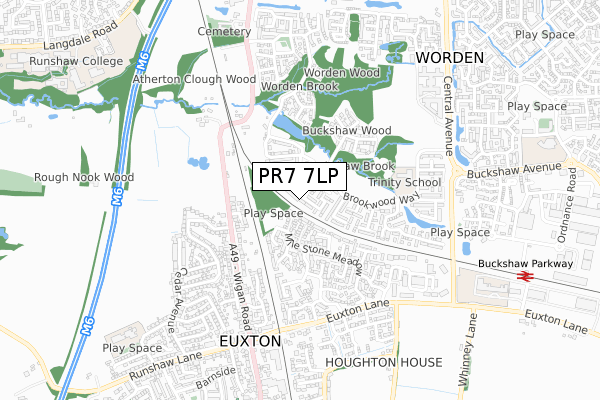
PR7 7LP maps


Licence: Open Government Licence (requires attribution)
Attribution: Contains OS data © Crown copyright and database right 2025
Source: Open Postcode Geo
Licence: Open Government Licence (requires attribution)
Attribution: Contains OS data © Crown copyright and database right 2025; Contains Royal Mail data © Royal Mail copyright and database right 2025; Source: Office for National Statistics licensed under the Open Government Licence v.3.0
PR7 7LP geodata
| Easting | 355624 |
| Northing | 420124 |
| Latitude | 53.675705 |
| Longitude | -2.673231 |
Where is PR7 7LP?
| Country | England |
| Postcode District | PR7 |
Politics
| Ward | Buckshaw & Whittle |
|---|---|
| Constituency | Chorley |
House Prices
Sales of detached houses in PR7 7LP
2022 27 JUL £347,000 |
2022 29 APR £330,000 |
2021 27 AUG £275,000 |
36, HALIFAX DRIVE, BUCKSHAW VILLAGE, CHORLEY, PR7 7LP 2019 26 APR £259,995 |
38, HALIFAX DRIVE, BUCKSHAW VILLAGE, CHORLEY, PR7 7LP 2019 26 APR £259,995 |
42, HALIFAX DRIVE, BUCKSHAW VILLAGE, CHORLEY, PR7 7LP 2019 29 MAR £259,995 |
40, HALIFAX DRIVE, BUCKSHAW VILLAGE, CHORLEY, PR7 7LP 2019 28 MAR £239,995 |
44, HALIFAX DRIVE, BUCKSHAW VILLAGE, CHORLEY, PR7 7LP 2019 20 FEB £239,995 |
46, HALIFAX DRIVE, BUCKSHAW VILLAGE, CHORLEY, PR7 7LP 2019 31 JAN £259,995 |
2018 27 DEC £259,995 |
Licence: Contains HM Land Registry data © Crown copyright and database right 2025. This data is licensed under the Open Government Licence v3.0.
Transport
Nearest bus stops to PR7 7LP
| Shawbrook Close (Wigan Road) | Euxton | 308m |
| Shawbrook Close (Wigan Road) | Euxton | 312m |
| Chestnut Avenue | Euxton | 473m |
| Wentworth Drive (Euxton Lane) | Euxton | 501m |
| Junction Terrace (Wigan Road) | Euxton | 525m |
Nearest railway stations to PR7 7LP
| Buckshaw Parkway Station | 0.9km |
| Euxton Balshaw Lane Station | 1.7km |
| Leyland Station | 2.7km |
Broadband
Broadband access in PR7 7LP (2020 data)
| Percentage of properties with Next Generation Access | 100.0% |
| Percentage of properties with Superfast Broadband | 100.0% |
| Percentage of properties with Ultrafast Broadband | 100.0% |
| Percentage of properties with Full Fibre Broadband | 100.0% |
Superfast Broadband is between 30Mbps and 300Mbps
Ultrafast Broadband is > 300Mbps
Broadband limitations in PR7 7LP (2020 data)
| Percentage of properties unable to receive 2Mbps | 0.0% |
| Percentage of properties unable to receive 5Mbps | 0.0% |
| Percentage of properties unable to receive 10Mbps | 0.0% |
| Percentage of properties unable to receive 30Mbps | 0.0% |
Deprivation
41.5% of English postcodes are less deprived than PR7 7LP:Food Standards Agency
Three nearest food hygiene ratings to PR7 7LP (metres)


➜ Get more ratings from the Food Standards Agency
Nearest post box to PR7 7LP
| Last Collection | |||
|---|---|---|---|
| Location | Mon-Fri | Sat | Distance |
| Euxton Post Office | 17:15 | 11:00 | 692m |
| 28 Langdale Road | 17:30 | 12:00 | 1,206m |
| 93 Dalehead Road | 17:30 | 12:00 | 1,397m |
PR7 7LP ITL and PR7 7LP LAU
The below table lists the International Territorial Level (ITL) codes (formerly Nomenclature of Territorial Units for Statistics (NUTS) codes) and Local Administrative Units (LAU) codes for PR7 7LP:
| ITL 1 Code | Name |
|---|---|
| TLD | North West (England) |
| ITL 2 Code | Name |
| TLD4 | Lancashire |
| ITL 3 Code | Name |
| TLD47 | Chorley and West Lancashire |
| LAU 1 Code | Name |
| E07000118 | Chorley |
PR7 7LP census areas
The below table lists the Census Output Area (OA), Lower Layer Super Output Area (LSOA), and Middle Layer Super Output Area (MSOA) for PR7 7LP:
| Code | Name | |
|---|---|---|
| OA | E00170496 | |
| LSOA | E01024919 | Chorley 008A |
| MSOA | E02005196 | Chorley 008 |
Nearest postcodes to PR7 7LP
| PR7 6FW | Hunstanton Close | 64m |
| PR7 7LB | Heyford Avenue | 106m |
| PR7 7JX | Brookwood Way | 116m |
| PR7 6FU | Lomond Close | 125m |
| PR7 6FS | Troon Close | 165m |
| PR7 7JS | Brookwood Way | 184m |
| PR7 6FX | Muirfield Close | 190m |
| PR7 6GX | Springfield Gardens | 243m |
| PR7 6FR | Carnoustie Drive | 264m |
| PR7 6LA | Wigan Road | 279m |