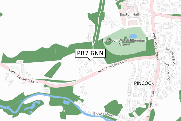
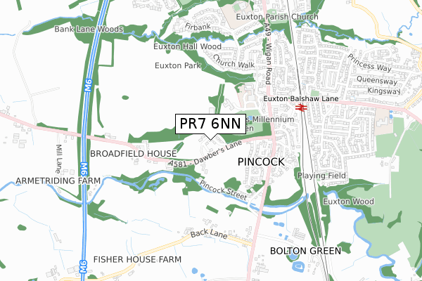
PR7 6NN is located in the Croston, Mawdesley & Euxton South electoral ward, within the local authority district of Chorley and the English Parliamentary constituency of Chorley. The Sub Integrated Care Board (ICB) Location is NHS Lancashire and South Cumbria ICB - 00X and the police force is Lancashire. This postcode has been in use since April 2019.


GetTheData
Source: OS Open Zoomstack (Ordnance Survey)
Licence: Open Government Licence (requires attribution)
Attribution: Contains OS data © Crown copyright and database right 2025
Source: Open Postcode Geo
Licence: Open Government Licence (requires attribution)
Attribution: Contains OS data © Crown copyright and database right 2025; Contains Royal Mail data © Royal Mail copyright and database right 2025; Source: Office for National Statistics licensed under the Open Government Licence v.3.0
| Easting | 355168 |
| Northing | 418233 |
| Latitude | 53.658670 |
| Longitude | -2.679860 |
GetTheData
Source: Open Postcode Geo
Licence: Open Government Licence
| Country | England |
| Postcode District | PR7 |
➜ See where PR7 is on a map ➜ Where is Euxton? | |
GetTheData
Source: Land Registry Price Paid Data
Licence: Open Government Licence
| Ward | Croston, Mawdesley & Euxton South |
| Constituency | Chorley |
GetTheData
Source: ONS Postcode Database
Licence: Open Government Licence
8, GLEADHILL HOUSE GARDENS, EUXTON, CHORLEY, PR7 6NN 2020 24 JAN £320,000 |
2019 23 DEC £605,000 |
7, GLEADHILL HOUSE GARDENS, EUXTON, CHORLEY, PR7 6NN 2019 25 JUN £320,000 |
4, GLEADHILL HOUSE GARDENS, EUXTON, CHORLEY, PR7 6NN 2019 30 MAY £280,000 |
2, GLEADHILL HOUSE GARDENS, EUXTON, CHORLEY, PR7 6NN 2018 3 DEC £280,000 |
2018 30 NOV £280,000 |
5, GLEADHILL HOUSE GARDENS, EUXTON, CHORLEY, PR7 6NN 2018 27 JUL £280,000 |
GetTheData
Source: HM Land Registry Price Paid Data
Licence: Contains HM Land Registry data © Crown copyright and database right 2025. This data is licensed under the Open Government Licence v3.0.
| Euxton Mills (Dawbers Lane) | Pincock | 348m |
| Euxton Mills (Dawbers Lane) | Pincock | 349m |
| Anderton Road (Wigan Road) | Euxton | 380m |
| Rail Station (Balshaw Lane) | Euxton | 449m |
| Old Dawbers Lane | Pincock | 465m |
| Euxton Balshaw Lane Station | 0.6km |
| Buckshaw Parkway Station | 2.1km |
| Chorley Station | 3.6km |
GetTheData
Source: NaPTAN
Licence: Open Government Licence
| Percentage of properties with Next Generation Access | 100.0% |
| Percentage of properties with Superfast Broadband | 100.0% |
| Percentage of properties with Ultrafast Broadband | 85.7% |
| Percentage of properties with Full Fibre Broadband | 85.7% |
Superfast Broadband is between 30Mbps and 300Mbps
Ultrafast Broadband is > 300Mbps
| Percentage of properties unable to receive 2Mbps | 0.0% |
| Percentage of properties unable to receive 5Mbps | 0.0% |
| Percentage of properties unable to receive 10Mbps | 0.0% |
| Percentage of properties unable to receive 30Mbps | 0.0% |
GetTheData
Source: Ofcom
Licence: Ofcom Terms of Use (requires attribution)
GetTheData
Source: ONS Postcode Database
Licence: Open Government Licence


➜ Get more ratings from the Food Standards Agency
GetTheData
Source: Food Standards Agency
Licence: FSA terms & conditions
| Last Collection | |||
|---|---|---|---|
| Location | Mon-Fri | Sat | Distance |
| 139 Wigan Road, Euxton | 16:15 | 11:00 | 531m |
| Highways Post Office | 17:00 | 11:00 | 842m |
| Euxton Post Office | 17:15 | 11:00 | 1,305m |
GetTheData
Source: Dracos
Licence: Creative Commons Attribution-ShareAlike
The below table lists the International Territorial Level (ITL) codes (formerly Nomenclature of Territorial Units for Statistics (NUTS) codes) and Local Administrative Units (LAU) codes for PR7 6NN:
| ITL 1 Code | Name |
|---|---|
| TLD | North West (England) |
| ITL 2 Code | Name |
| TLD4 | Lancashire |
| ITL 3 Code | Name |
| TLD47 | Chorley and West Lancashire |
| LAU 1 Code | Name |
| E07000118 | Chorley |
GetTheData
Source: ONS Postcode Directory
Licence: Open Government Licence
The below table lists the Census Output Area (OA), Lower Layer Super Output Area (LSOA), and Middle Layer Super Output Area (MSOA) for PR7 6NN:
| Code | Name | |
|---|---|---|
| OA | E00126738 | |
| LSOA | E01024971 | Chorley 005E |
| MSOA | E02005193 | Chorley 005 |
GetTheData
Source: ONS Postcode Directory
Licence: Open Government Licence
| PR7 6EA | Dawbers Lane | 179m |
| PR7 6DZ | Dawbers Lane | 230m |
| PR7 6LR | Pincock Street | 290m |
| PR7 6JF | Fieldside Avenue | 295m |
| PR7 6JB | Hillside Close | 326m |
| PR7 6DY | Wigan Road | 347m |
| PR7 6JD | Wigan Road | 364m |
| PR7 6EH | Old Dawbers Lane | 376m |
| PR7 6EB | Dawbers Lane | 387m |
| PR7 6HZ | Wigan Road | 397m |
GetTheData
Source: Open Postcode Geo; Land Registry Price Paid Data
Licence: Open Government Licence