Property/Postcode Data Search:
PR5 5YG maps, stats, and open data
PR5 5YG is located in the Farington East electoral ward, within the local authority district of South Ribble and the English Parliamentary constituency of Ribble Valley. The Sub Integrated Care Board (ICB) Location is NHS Lancashire and South Cumbria ICB - 00X and the police force is Lancashire. This postcode has been in use since October 2018.
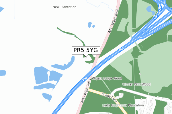
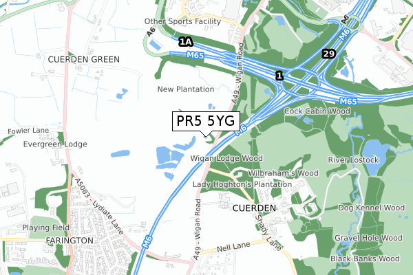
PR5 5YG maps


Source: OS Open Zoomstack (Ordnance Survey)
Licence: Open Government Licence (requires attribution)
Attribution: Contains OS data © Crown copyright and database right 2025
Source: Open Postcode Geo
Licence: Open Government Licence (requires attribution)
Attribution: Contains OS data © Crown copyright and database right 2025; Contains Royal Mail data © Royal Mail copyright and database right 2025; Source: Office for National Statistics licensed under the Open Government Licence v.3.0
Licence: Open Government Licence (requires attribution)
Attribution: Contains OS data © Crown copyright and database right 2025
Source: Open Postcode Geo
Licence: Open Government Licence (requires attribution)
Attribution: Contains OS data © Crown copyright and database right 2025; Contains Royal Mail data © Royal Mail copyright and database right 2025; Source: Office for National Statistics licensed under the Open Government Licence v.3.0
PR5 5YG geodata
| Easting | 355867 |
| Northing | 424237 |
| Latitude | 53.712690 |
| Longitude | -2.670140 |
Where is PR5 5YG?
| Country | England |
| Postcode District | PR5 |
Politics
| Ward | Farington East |
|---|---|
| Constituency | Ribble Valley |
Transport
Nearest bus stops to PR5 5YG
| Residential Park (Wigan Road) | Cuerden | 830m |
| Residential Park (Wigan Road) | Cuerden | 835m |
| Fowler Lane (Stanifield Lane) | Farington | 858m |
| Fowler Lane (Stanifield Lane) | Farington | 868m |
| Woodcock Estate (Stanifield Lane) | Farington | 932m |
Nearest railway stations to PR5 5YG
| Bamber Bridge Station | 1.7km |
| Lostock Hall Station | 1.7km |
| Leyland Station | 1.9km |
Deprivation
32.8% of English postcodes are less deprived than PR5 5YG:Food Standards Agency
Three nearest food hygiene ratings to PR5 5YG (metres)
Cuerden View 2 U (Mobile Establishment)

Cuerden View 2 U
623m
Cuerden Valley Cafe

Cuerden Valley Park Trust
659m
Walton Fox (vintage Inns)

Walton Fox
739m
➜ Get more ratings from the Food Standards Agency
Nearest post box to PR5 5YG
| Last Collection | |||
|---|---|---|---|
| Location | Mon-Fri | Sat | Distance |
| 2 Stanley Road, Farington | 17:15 | 11:30 | 1,014m |
| Dewhurst Row | 16:15 | 10:30 | 1,020m |
| Walton Summit (2) | 18:30 | 1,342m | |
PR5 5YG ITL and PR5 5YG LAU
The below table lists the International Territorial Level (ITL) codes (formerly Nomenclature of Territorial Units for Statistics (NUTS) codes) and Local Administrative Units (LAU) codes for PR5 5YG:
| ITL 1 Code | Name |
|---|---|
| TLD | North West (England) |
| ITL 2 Code | Name |
| TLD4 | Lancashire |
| ITL 3 Code | Name |
| TLD45 | Mid Lancashire |
| LAU 1 Code | Name |
| E07000126 | South Ribble |
PR5 5YG census areas
The below table lists the Census Output Area (OA), Lower Layer Super Output Area (LSOA), and Middle Layer Super Output Area (MSOA) for PR5 5YG:
| Code | Name | |
|---|---|---|
| OA | E00128995 | |
| LSOA | E01025417 | South Ribble 012A |
| MSOA | E02005298 | South Ribble 012 |
Nearest postcodes to PR5 5YG
| PR5 6BX | Cuerden Close | 497m |
| PR5 6EF | Momentum Place | 651m |
| PR5 6BY | Berkeley Drive | 661m |
| PR5 6AU | Shady Lane | 667m |
| PR25 5TB | Nell Lane | 700m |
| PR25 5SA | Lydiate Lane | 757m |
| PR5 5XQ | Stoney Lane | 769m |
| PR5 6AS | Wigan Road | 774m |
| PR25 4QZ | Bristol Avenue | 795m |
| PR25 4GT | Woodside | 845m |