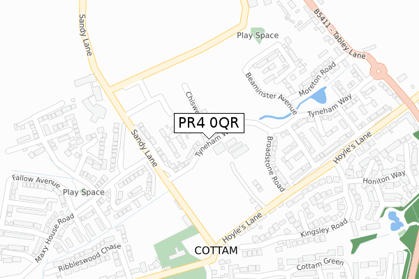
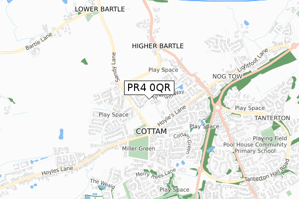
PR4 0QR is located in the Preston Rural North electoral ward, within the local authority district of Preston and the English Parliamentary constituency of Wyre and Preston North. The Sub Integrated Care Board (ICB) Location is NHS Lancashire and South Cumbria ICB - 01E and the police force is Lancashire. This postcode has been in use since December 2019.


GetTheData
Source: OS Open Zoomstack (Ordnance Survey)
Licence: Open Government Licence (requires attribution)
Attribution: Contains OS data © Crown copyright and database right 2025
Source: Open Postcode Geo
Licence: Open Government Licence (requires attribution)
Attribution: Contains OS data © Crown copyright and database right 2025; Contains Royal Mail data © Royal Mail copyright and database right 2025; Source: Office for National Statistics licensed under the Open Government Licence v.3.0
| Easting | 350143 |
| Northing | 432998 |
| Latitude | 53.790911 |
| Longitude | -2.758275 |
GetTheData
Source: Open Postcode Geo
Licence: Open Government Licence
| Country | England |
| Postcode District | PR4 |
➜ See where PR4 is on a map ➜ Where is Cottam? | |
GetTheData
Source: Land Registry Price Paid Data
Licence: Open Government Licence
| Ward | Preston Rural North |
| Constituency | Wyre And Preston North |
GetTheData
Source: ONS Postcode Database
Licence: Open Government Licence
27, CHISWELL ROAD, COTTAM, PRESTON, PR4 0QR 2021 22 NOV £232,995 |
14, CHISWELL ROAD, COTTAM, PRESTON, PR4 0QR 2021 19 NOV £252,000 |
24, CHISWELL ROAD, COTTAM, PRESTON, PR4 0QR 2021 19 NOV £252,000 |
26, CHISWELL ROAD, COTTAM, PRESTON, PR4 0QR 2021 19 NOV £249,000 |
21, CHISWELL ROAD, COTTAM, PRESTON, PR4 0QR 2021 19 NOV £252,000 |
23, CHISWELL ROAD, COTTAM, PRESTON, PR4 0QR 2021 5 NOV £231,995 |
25, CHISWELL ROAD, COTTAM, PRESTON, PR4 0QR 2021 29 OCT £247,995 |
13, CHISWELL ROAD, COTTAM, PRESTON, PR4 0QR 2021 27 AUG £278,995 |
8, CHISWELL ROAD, COTTAM, PRESTON, PR4 0QR 2021 27 AUG £104,798 |
6, CHISWELL ROAD, COTTAM, PRESTON, PR4 0QR 2021 9 JUL £249,000 |
GetTheData
Source: HM Land Registry Price Paid Data
Licence: Contains HM Land Registry data © Crown copyright and database right 2025. This data is licensed under the Open Government Licence v3.0.
| Post Office (Hoyles Lane) | Cottam | 299m |
| Post Ofice (Hoyles Lane) | Cottam | 327m |
| Wembley Residence (Hoyles Lane) | Cottam | 402m |
| Hoyles Lane Green (Hoyles Lane) | Cottam | 409m |
| Miller Lane (Hoyles Lane) | Cottam | 453m |
| Salwick Station | 4km |
| Preston Station | 5km |
GetTheData
Source: NaPTAN
Licence: Open Government Licence
GetTheData
Source: ONS Postcode Database
Licence: Open Government Licence


➜ Get more ratings from the Food Standards Agency
GetTheData
Source: Food Standards Agency
Licence: FSA terms & conditions
| Last Collection | |||
|---|---|---|---|
| Location | Mon-Fri | Sat | Distance |
| Nog Tow | 16:00 | 10:30 | 494m |
| Whitehouse | 16:00 | 08:30 | 1,531m |
| Lea School | 16:00 | 08:00 | 1,566m |
GetTheData
Source: Dracos
Licence: Creative Commons Attribution-ShareAlike
The below table lists the International Territorial Level (ITL) codes (formerly Nomenclature of Territorial Units for Statistics (NUTS) codes) and Local Administrative Units (LAU) codes for PR4 0QR:
| ITL 1 Code | Name |
|---|---|
| TLD | North West (England) |
| ITL 2 Code | Name |
| TLD4 | Lancashire |
| ITL 3 Code | Name |
| TLD45 | Mid Lancashire |
| LAU 1 Code | Name |
| E07000123 | Preston |
GetTheData
Source: ONS Postcode Directory
Licence: Open Government Licence
The below table lists the Census Output Area (OA), Lower Layer Super Output Area (LSOA), and Middle Layer Super Output Area (MSOA) for PR4 0QR:
| Code | Name | |
|---|---|---|
| OA | E00128321 | |
| LSOA | E01025280 | Preston 002C |
| MSOA | E02005254 | Preston 002 |
GetTheData
Source: ONS Postcode Directory
Licence: Open Government Licence
| PR4 0LE | Sandy Lane | 208m |
| PR4 0LB | Hoyles Lane | 352m |
| PR4 0JE | Sandringham Way | 368m |
| PR4 0JF | Blenheim Way | 374m |
| PR4 0LH | Tabley Lane | 403m |
| PR4 0LT | Kingsley Road | 407m |
| PR4 0LU | Bude Close | 441m |
| PR4 0DG | Sandyfields | 480m |
| PR4 0AB | Cottam Green | 488m |
| PR4 0LX | Bideford Way | 495m |
GetTheData
Source: Open Postcode Geo; Land Registry Price Paid Data
Licence: Open Government Licence