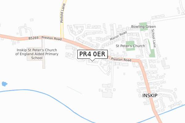
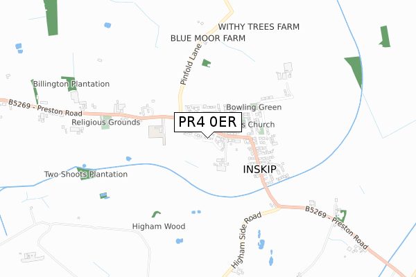
PR4 0ER is located in the Great Eccleston electoral ward, within the local authority district of Wyre and the English Parliamentary constituency of Wyre and Preston North. The Sub Integrated Care Board (ICB) Location is NHS Lancashire and South Cumbria ICB - 02M and the police force is Lancashire. This postcode has been in use since March 2018.


GetTheData
Source: OS Open Zoomstack (Ordnance Survey)
Licence: Open Government Licence (requires attribution)
Attribution: Contains OS data © Crown copyright and database right 2025
Source: Open Postcode Geo
Licence: Open Government Licence (requires attribution)
Attribution: Contains OS data © Crown copyright and database right 2025; Contains Royal Mail data © Royal Mail copyright and database right 2025; Source: Office for National Statistics licensed under the Open Government Licence v.3.0
| Easting | 346098 |
| Northing | 437854 |
| Latitude | 53.834147 |
| Longitude | -2.820520 |
GetTheData
Source: Open Postcode Geo
Licence: Open Government Licence
| Country | England |
| Postcode District | PR4 |
➜ See where PR4 is on a map ➜ Where is Inskip? | |
GetTheData
Source: Land Registry Price Paid Data
Licence: Open Government Licence
| Ward | Great Eccleston |
| Constituency | Wyre And Preston North |
GetTheData
Source: ONS Postcode Database
Licence: Open Government Licence
1, GREENFIELD ROAD, INSKIP, PRESTON, PR4 0ER 2018 16 FEB £294,950 |
GetTheData
Source: HM Land Registry Price Paid Data
Licence: Contains HM Land Registry data © Crown copyright and database right 2025. This data is licensed under the Open Government Licence v3.0.
| St Peters Church (School Lane) | Inskip | 157m |
| Pinfold Lane (Inskip Lane) | Inskip | 168m |
| St Peters Church (Inskip Lane) | Inskip | 169m |
| Pinfold Lane (School Lane) | Inskip | 174m |
| Mill Close (Mill Lane) | Inskip | 313m |
GetTheData
Source: NaPTAN
Licence: Open Government Licence
| Percentage of properties with Next Generation Access | 100.0% |
| Percentage of properties with Superfast Broadband | 100.0% |
| Percentage of properties with Ultrafast Broadband | 100.0% |
| Percentage of properties with Full Fibre Broadband | 100.0% |
Superfast Broadband is between 30Mbps and 300Mbps
Ultrafast Broadband is > 300Mbps
| Percentage of properties unable to receive 2Mbps | 0.0% |
| Percentage of properties unable to receive 5Mbps | 0.0% |
| Percentage of properties unable to receive 10Mbps | 0.0% |
| Percentage of properties unable to receive 30Mbps | 0.0% |
GetTheData
Source: Ofcom
Licence: Ofcom Terms of Use (requires attribution)
GetTheData
Source: ONS Postcode Database
Licence: Open Government Licence


➜ Get more ratings from the Food Standards Agency
GetTheData
Source: Food Standards Agency
Licence: FSA terms & conditions
| Last Collection | |||
|---|---|---|---|
| Location | Mon-Fri | Sat | Distance |
| Blackleach | 16:00 | 08:30 | 3,672m |
| Bilsborrow Post Office | 17:00 | 09:30 | 5,356m |
| Catterall Post Office | 17:00 | 10:30 | 5,994m |
GetTheData
Source: Dracos
Licence: Creative Commons Attribution-ShareAlike
The below table lists the International Territorial Level (ITL) codes (formerly Nomenclature of Territorial Units for Statistics (NUTS) codes) and Local Administrative Units (LAU) codes for PR4 0ER:
| ITL 1 Code | Name |
|---|---|
| TLD | North West (England) |
| ITL 2 Code | Name |
| TLD4 | Lancashire |
| ITL 3 Code | Name |
| TLD44 | Lancaster and Wyre |
| LAU 1 Code | Name |
| E07000128 | Wyre |
GetTheData
Source: ONS Postcode Directory
Licence: Open Government Licence
The below table lists the Census Output Area (OA), Lower Layer Super Output Area (LSOA), and Middle Layer Super Output Area (MSOA) for PR4 0ER:
| Code | Name | |
|---|---|---|
| OA | E00129714 | |
| LSOA | E01025561 | Wyre 009A |
| MSOA | E02005327 | Wyre 009 |
GetTheData
Source: ONS Postcode Directory
Licence: Open Government Licence
| PR4 0UU | West Drive | 94m |
| PR4 0UJ | Manor Road | 136m |
| PR4 0UP | Manor Road | 139m |
| PR4 0US | North Drive | 198m |
| PR4 0UT | South Drive | 206m |
| PR4 0UL | Manor Road | 266m |
| PR4 0UR | Manor Road | 271m |
| PR4 0TR | Nelson Gardens | 301m |
| PR4 0TW | Mill Close | 309m |
| PR4 0UE | Highfield Avenue | 328m |
GetTheData
Source: Open Postcode Geo; Land Registry Price Paid Data
Licence: Open Government Licence