Property/Postcode Data Search:
PR3 5BQ maps, stats, and open data
PR3 5BQ is located in the Preston Rural East electoral ward, within the local authority district of Preston and the English Parliamentary constituency of Wyre and Preston North. The Sub Integrated Care Board (ICB) Location is NHS Lancashire and South Cumbria ICB - 01E and the police force is Lancashire. This postcode has been in use since September 2019.
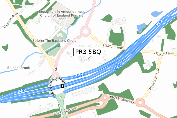
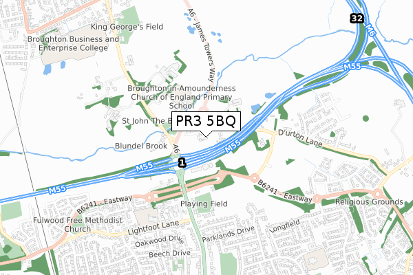
PR3 5BQ maps


Source: OS Open Zoomstack (Ordnance Survey)
Licence: Open Government Licence (requires attribution)
Attribution: Contains OS data © Crown copyright and database right 2025
Source: Open Postcode Geo
Licence: Open Government Licence (requires attribution)
Attribution: Contains OS data © Crown copyright and database right 2025; Contains Royal Mail data © Royal Mail copyright and database right 2025; Source: Office for National Statistics licensed under the Open Government Licence v.3.0
Licence: Open Government Licence (requires attribution)
Attribution: Contains OS data © Crown copyright and database right 2025
Source: Open Postcode Geo
Licence: Open Government Licence (requires attribution)
Attribution: Contains OS data © Crown copyright and database right 2025; Contains Royal Mail data © Royal Mail copyright and database right 2025; Source: Office for National Statistics licensed under the Open Government Licence v.3.0
PR3 5BQ geodata
| Easting | 353029 |
| Northing | 434223 |
| Latitude | 53.802189 |
| Longitude | -2.714659 |
Where is PR3 5BQ?
| Country | England |
| Postcode District | PR3 |
Politics
| Ward | Preston Rural East |
|---|---|
| Constituency | Wyre And Preston North |
House Prices
Sales of detached houses in PR3 5BQ
3, D'URTON YARD, BROUGHTON, PRESTON, PR3 5BQ 2022 6 MAY £520,000 |
4, D'URTON YARD, BROUGHTON, PRESTON, PR3 5BQ 2021 25 JUN £535,000 |
2019 6 SEP £574,950 |
2, D'URTON YARD, BROUGHTON, PRESTON, PR3 5BQ 2019 30 AUG £574,950 |
2016 30 NOV £590,000 |
Source: HM Land Registry Price Paid Data
Licence: Contains HM Land Registry data © Crown copyright and database right 2025. This data is licensed under the Open Government Licence v3.0.
Licence: Contains HM Land Registry data © Crown copyright and database right 2025. This data is licensed under the Open Government Licence v3.0.
Transport
Nearest bus stops to PR3 5BQ
| St John The Baptist Church (Garstang Road) | Broughton | 244m |
| St John The Baptist Church (Garstang Road) | Broughton | 282m |
| Marriotts Hotel (Garstang Road) | Broughton | 491m |
| Lightfoot Close (Lightfoot Lane) | Fulwood | 519m |
| Marriotts Hotel (Garstang Road) | Broughton | 548m |
Deprivation
19.5% of English postcodes are less deprived than PR3 5BQ:Food Standards Agency
Three nearest food hygiene ratings to PR3 5BQ (metres)
First Trust Hospital

Durton Lane
175m
Campus and Co (The Wenning Company)

421 Garstang Road
306m
Fulwood and Broughton Cricket Club

Garstang Road
396m
➜ Get more ratings from the Food Standards Agency
Nearest post box to PR3 5BQ
| Last Collection | |||
|---|---|---|---|
| Location | Mon-Fri | Sat | Distance |
| 8 South Drive, Fulwood | 17:45 | 11:30 | 582m |
| 1 Parklands Drive, Fulwood | 17:45 | 11:30 | 596m |
| Durton Lane, Warwick House | 17:00 | 10:00 | 632m |
PR3 5BQ ITL and PR3 5BQ LAU
The below table lists the International Territorial Level (ITL) codes (formerly Nomenclature of Territorial Units for Statistics (NUTS) codes) and Local Administrative Units (LAU) codes for PR3 5BQ:
| ITL 1 Code | Name |
|---|---|
| TLD | North West (England) |
| ITL 2 Code | Name |
| TLD4 | Lancashire |
| ITL 3 Code | Name |
| TLD45 | Mid Lancashire |
| LAU 1 Code | Name |
| E07000123 | Preston |
PR3 5BQ census areas
The below table lists the Census Output Area (OA), Lower Layer Super Output Area (LSOA), and Middle Layer Super Output Area (MSOA) for PR3 5BQ:
| Code | Name | |
|---|---|---|
| OA | E00128290 | |
| LSOA | E01025277 | Preston 002B |
| MSOA | E02005254 | Preston 002 |
Nearest postcodes to PR3 5BQ
| PR3 5LD | Durton Lane | 252m |
| PR3 5JD | Garstang Road | 302m |
| PR3 5JE | Garstang Road | 409m |
| PR2 3NJ | Lightfoot Close | 493m |
| PR2 3LJ | Old Croft | 500m |
| PR2 9SD | Highfield Drive | 506m |
| PR2 9SE | Hillcrest Avenue | 551m |
| PR2 9SW | Moorfield Close | 564m |
| PR2 3LP | Lightfoot Lane | 570m |
| PR2 9SL | Parklands Grove | 570m |