Property/Postcode Data Search:
PR3 3UP maps, stats, and open data
PR3 3UP is located in the Dilworth electoral ward, within the local authority district of Ribble Valley and the English Parliamentary constituency of Ribble Valley. The Sub Integrated Care Board (ICB) Location is NHS Lancashire and South Cumbria ICB - 01E and the police force is Lancashire. This postcode has been in use since January 2020.
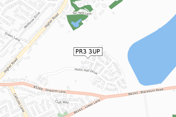
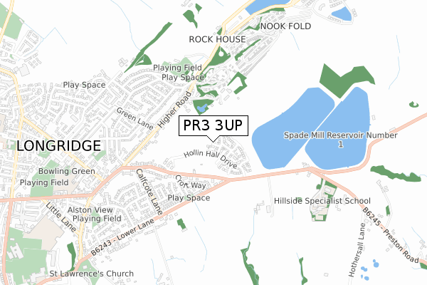
PR3 3UP maps


Source: OS Open Zoomstack (Ordnance Survey)
Licence: Open Government Licence (requires attribution)
Attribution: Contains OS data © Crown copyright and database right 2025
Source: Open Postcode Geo
Licence: Open Government Licence (requires attribution)
Attribution: Contains OS data © Crown copyright and database right 2025; Contains Royal Mail data © Royal Mail copyright and database right 2025; Source: Office for National Statistics licensed under the Open Government Licence v.3.0
Licence: Open Government Licence (requires attribution)
Attribution: Contains OS data © Crown copyright and database right 2025
Source: Open Postcode Geo
Licence: Open Government Licence (requires attribution)
Attribution: Contains OS data © Crown copyright and database right 2025; Contains Royal Mail data © Royal Mail copyright and database right 2025; Source: Office for National Statistics licensed under the Open Government Licence v.3.0
PR3 3UP geodata
| Easting | 361278 |
| Northing | 437434 |
| Latitude | 53.831727 |
| Longitude | -2.589826 |
Where is PR3 3UP?
| Country | England |
| Postcode District | PR3 |
Politics
| Ward | Dilworth |
|---|---|
| Constituency | Ribble Valley |
House Prices
Sales of detached houses in PR3 3UP
2025 30 JUN £249,950 |
2023 8 FEB £340,000 |
3, CHAPEL RISE, LONGRIDGE, PRESTON, PR3 3UP 2020 26 JUN £270,995 |
5, CHAPEL RISE, LONGRIDGE, PRESTON, PR3 3UP 2020 27 MAR £249,995 |
2020 27 MAR £225,995 |
7, CHAPEL RISE, LONGRIDGE, PRESTON, PR3 3UP 2020 25 MAR £284,995 |
2019 19 DEC £265,995 |
Source: HM Land Registry Price Paid Data
Licence: Contains HM Land Registry data © Crown copyright and database right 2025. This data is licensed under the Open Government Licence v3.0.
Licence: Contains HM Land Registry data © Crown copyright and database right 2025. This data is licensed under the Open Government Licence v3.0.
Transport
Nearest bus stops to PR3 3UP
| Gardeners Cottage (Dilworth Lane) | Longridge | 215m |
| Gardeners Cottage (Dilworth Lane) | Longridge | 223m |
| The Cabin (Higher Road) | Longridge | 325m |
| Caravan Park (Higher Road) | Longridge | 332m |
| White Bull (Higher Road) | Longridge | 413m |
Deprivation
9.8% of English postcodes are less deprived than PR3 3UP:Food Standards Agency
Three nearest food hygiene ratings to PR3 3UP (metres)
Ivy Farm Fudge
4 Ivy Farm Close
212m
The Longridge Nursery
104-106 Higher Road
314m
Longridge Local

53 Higher Road
348m
➜ Get more ratings from the Food Standards Agency
Nearest post box to PR3 3UP
| Last Collection | |||
|---|---|---|---|
| Location | Mon-Fri | Sat | Distance |
| Tootal Heights | 17:30 | 12:00 | 346m |
| Willow Park Lane, Longridge | 17:45 | 12:00 | 786m |
| Longridge Post Office | 18:00 | 12:00 | 805m |
PR3 3UP ITL and PR3 3UP LAU
The below table lists the International Territorial Level (ITL) codes (formerly Nomenclature of Territorial Units for Statistics (NUTS) codes) and Local Administrative Units (LAU) codes for PR3 3UP:
| ITL 1 Code | Name |
|---|---|
| TLD | North West (England) |
| ITL 2 Code | Name |
| TLD4 | Lancashire |
| ITL 3 Code | Name |
| TLD45 | Mid Lancashire |
| LAU 1 Code | Name |
| E07000124 | Ribble Valley |
PR3 3UP census areas
The below table lists the Census Output Area (OA), Lower Layer Super Output Area (LSOA), and Middle Layer Super Output Area (MSOA) for PR3 3UP:
| Code | Name | |
|---|---|---|
| OA | E00128549 | |
| LSOA | E01025328 | Ribble Valley 006D |
| MSOA | E02005275 | Ribble Valley 006 |
Nearest postcodes to PR3 3UP
| PR3 3SG | Dilworth Court | 219m |
| PR3 3AG | Croft Way | 241m |
| PR3 3AH | Meadow Close | 278m |
| PR3 3TA | Hollin Hall | 278m |
| PR3 3SY | Higher Road | 293m |
| PR3 3RZ | Ridge Court | 311m |
| PR3 3AW | Pasture Grove | 314m |
| PR3 3ST | Dilworth Lane | 327m |
| PR3 3UB | Valley Road | 345m |
| PR3 3UE | Wyndene Close | 350m |