PR3 3DF maps, stats, and open data
PR3 3DF is located in the Alston & Hothersall electoral ward, within the local authority district of Ribble Valley and the English Parliamentary constituency of Ribble Valley. The Sub Integrated Care Board (ICB) Location is NHS Lancashire and South Cumbria ICB - 01E and the police force is Lancashire. This postcode has been in use since June 2019.
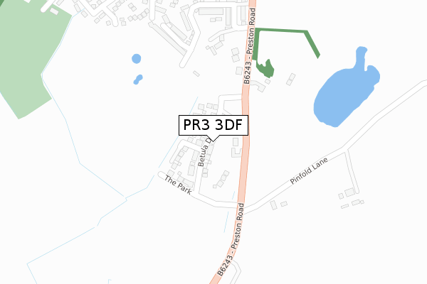
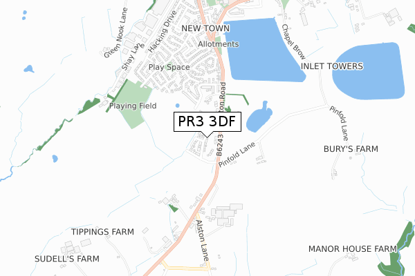
PR3 3DF maps


Licence: Open Government Licence (requires attribution)
Attribution: Contains OS data © Crown copyright and database right 2025
Source: Open Postcode Geo
Licence: Open Government Licence (requires attribution)
Attribution: Contains OS data © Crown copyright and database right 2025; Contains Royal Mail data © Royal Mail copyright and database right 2025; Source: Office for National Statistics licensed under the Open Government Licence v.3.0
PR3 3DF geodata
| Easting | 360115 |
| Northing | 435813 |
| Latitude | 53.817071 |
| Longitude | -2.607284 |
Where is PR3 3DF?
| Country | England |
| Postcode District | PR3 |
Politics
| Ward | Alston & Hothersall |
|---|---|
| Constituency | Ribble Valley |
House Prices
Sales of detached houses in PR3 3DF
2025 13 JUN £320,000 |
2024 17 DEC £345,000 |
2024 30 MAY £420,000 |
2024 2 MAY £325,000 |
10, BETULA DRIVE, LONGRIDGE, PRESTON, PR3 3DF 2021 30 APR £299,995 |
11, BETULA DRIVE, LONGRIDGE, PRESTON, PR3 3DF 2020 22 DEC £349,995 |
15, BETULA DRIVE, LONGRIDGE, PRESTON, PR3 3DF 2020 18 DEC £409,500 |
12, BETULA DRIVE, LONGRIDGE, PRESTON, PR3 3DF 2020 23 OCT £299,995 |
16, BETULA DRIVE, LONGRIDGE, PRESTON, PR3 3DF 2020 23 OCT £349,995 |
2020 25 SEP £299,995 |
Licence: Contains HM Land Registry data © Crown copyright and database right 2025. This data is licensed under the Open Government Licence v3.0.
Transport
Nearest bus stops to PR3 3DF
| Pinfold Lane (Preston Road) | Longridge | 120m |
| Pinfold Lane (Preston Road) | Longridge | 174m |
| College Court (Preston Road) | Longridge | 395m |
| White Bull (Preston Road) | Longridge | 510m |
| White Bull (Preston Road) | Longridge | 547m |
Broadband
Broadband access in PR3 3DF (2020 data)
| Percentage of properties with Next Generation Access | 100.0% |
| Percentage of properties with Superfast Broadband | 100.0% |
| Percentage of properties with Ultrafast Broadband | 80.0% |
| Percentage of properties with Full Fibre Broadband | 50.0% |
Superfast Broadband is between 30Mbps and 300Mbps
Ultrafast Broadband is > 300Mbps
Broadband limitations in PR3 3DF (2020 data)
| Percentage of properties unable to receive 2Mbps | 0.0% |
| Percentage of properties unable to receive 5Mbps | 0.0% |
| Percentage of properties unable to receive 10Mbps | 0.0% |
| Percentage of properties unable to receive 30Mbps | 0.0% |
Deprivation
9.8% of English postcodes are less deprived than PR3 3DF:Food Standards Agency
Three nearest food hygiene ratings to PR3 3DF (metres)

➜ Get more ratings from the Food Standards Agency
Nearest post box to PR3 3DF
| Last Collection | |||
|---|---|---|---|
| Location | Mon-Fri | Sat | Distance |
| Longridge Post Office | 18:00 | 12:00 | 1,603m |
| Willow Park Lane, Longridge | 17:45 | 12:00 | 1,802m |
| Grimsargh Post Office | 18:30 | 12:30 | 2,030m |
PR3 3DF ITL and PR3 3DF LAU
The below table lists the International Territorial Level (ITL) codes (formerly Nomenclature of Territorial Units for Statistics (NUTS) codes) and Local Administrative Units (LAU) codes for PR3 3DF:
| ITL 1 Code | Name |
|---|---|
| TLD | North West (England) |
| ITL 2 Code | Name |
| TLD4 | Lancashire |
| ITL 3 Code | Name |
| TLD45 | Mid Lancashire |
| LAU 1 Code | Name |
| E07000124 | Ribble Valley |
PR3 3DF census areas
The below table lists the Census Output Area (OA), Lower Layer Super Output Area (LSOA), and Middle Layer Super Output Area (MSOA) for PR3 3DF:
| Code | Name | |
|---|---|---|
| OA | E00128496 | |
| LSOA | E01025316 | Ribble Valley 006A |
| MSOA | E02005275 | Ribble Valley 006 |
Nearest postcodes to PR3 3DF
| PR3 3BF | Lake View | 217m |
| PR3 3BD | Preston Road | 240m |
| PR3 3BW | Water Meadows | 297m |
| PR3 3BY | Water Meadows | 319m |
| PR3 3LQ | Milbeck Close | 367m |
| PR3 3LE | Thirlmere Drive | 399m |
| PR3 3FT | Lindale Road | 412m |
| PR3 3FX | Ennerdale Road | 457m |
| PR3 3FY | Buttermere Road | 460m |
| PR3 3AX | College Close | 461m |