Property/Postcode Data Search:
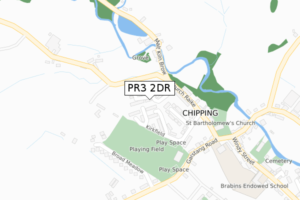
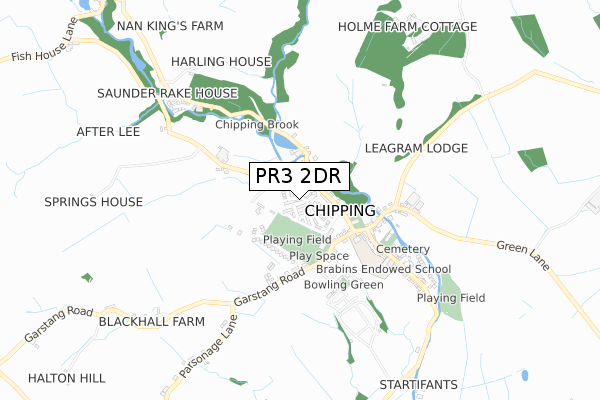
PR3 2DR maps, stats, and open data
PR3 2DR is located in the Chipping electoral ward, within the local authority district of Ribble Valley and the English Parliamentary constituency of Ribble Valley. The Sub Integrated Care Board (ICB) Location is NHS Lancashire and South Cumbria ICB - 01E and the police force is Lancashire. This postcode has been in use since December 2019.
PR3 2DR maps


Source: OS Open Zoomstack (Ordnance Survey)
Licence: Open Government Licence (requires attribution)
Attribution: Contains OS data © Crown copyright and database right 2025
Source: Open Postcode Geo
Licence: Open Government Licence (requires attribution)
Attribution: Contains OS data © Crown copyright and database right 2025; Contains Royal Mail data © Royal Mail copyright and database right 2025; Source: Office for National Statistics licensed under the Open Government Licence v.3.0
Licence: Open Government Licence (requires attribution)
Attribution: Contains OS data © Crown copyright and database right 2025
Source: Open Postcode Geo
Licence: Open Government Licence (requires attribution)
Attribution: Contains OS data © Crown copyright and database right 2025; Contains Royal Mail data © Royal Mail copyright and database right 2025; Source: Office for National Statistics licensed under the Open Government Licence v.3.0
PR3 2DR geodata
| Easting | 361928 |
| Northing | 443402 |
| Latitude | 53.885411 |
| Longitude | -2.580694 |
Where is PR3 2DR?
| Country | England |
| Postcode District | PR3 |
Politics
| Ward | Chipping |
|---|---|
| Constituency | Ribble Valley |
House Prices
Sales of detached houses in PR3 2DR
2022 18 NOV £525,000 |
2022 10 NOV £445,000 |
20, WOLFS FELL CLOSE, CHIPPING, PRESTON, PR3 2DR 2022 18 MAR £450,000 |
18, WOLFS FELL CLOSE, CHIPPING, PRESTON, PR3 2DR 2022 11 MAR £475,000 |
12, WOLFS FELL CLOSE, CHIPPING, PRESTON, PR3 2DR 2022 3 MAR £340,000 |
14, WOLFS FELL CLOSE, CHIPPING, PRESTON, PR3 2DR 2022 24 FEB £335,000 |
16, WOLFS FELL CLOSE, CHIPPING, PRESTON, PR3 2DR 2021 10 DEC £400,000 |
45, WOLFS FELL CLOSE, CHIPPING, PRESTON, PR3 2DR 2021 30 NOV £335,000 |
10, WOLFS FELL CLOSE, CHIPPING, PRESTON, PR3 2DR 2021 16 NOV £390,000 |
39, WOLFS FELL CLOSE, CHIPPING, PRESTON, PR3 2DR 2021 5 NOV £440,000 |
Source: HM Land Registry Price Paid Data
Licence: Contains HM Land Registry data © Crown copyright and database right 2025. This data is licensed under the Open Government Licence v3.0.
Licence: Contains HM Land Registry data © Crown copyright and database right 2025. This data is licensed under the Open Government Licence v3.0.
Transport
Nearest bus stops to PR3 2DR
| Kirklands Estate (Malt Kiln Brow) | Chipping | 208m |
| St Marys Rcps (Garstang Road) | Chipping | 297m |
| Church Raike (Talbot Strreet) | Chipping | 335m |
| Sun Inn (Longridge Road) | Chipping | 359m |
| Brabins School (Longridge Road) | Chipping | 471m |
Deprivation
36.5% of English postcodes are less deprived than PR3 2DR:Food Standards Agency
Three nearest food hygiene ratings to PR3 2DR (metres)
The Cobbled Corner Cafe
2 Club Lane
294m
Chipping Farm Shop

Wilsden
294m
St Mary's RC Primary School

St Marys Rc Primary School
294m
➜ Get more ratings from the Food Standards Agency
PR3 2DR ITL and PR3 2DR LAU
The below table lists the International Territorial Level (ITL) codes (formerly Nomenclature of Territorial Units for Statistics (NUTS) codes) and Local Administrative Units (LAU) codes for PR3 2DR:
| ITL 1 Code | Name |
|---|---|
| TLD | North West (England) |
| ITL 2 Code | Name |
| TLD4 | Lancashire |
| ITL 3 Code | Name |
| TLD45 | Mid Lancashire |
| LAU 1 Code | Name |
| E07000124 | Ribble Valley |
PR3 2DR census areas
The below table lists the Census Output Area (OA), Lower Layer Super Output Area (LSOA), and Middle Layer Super Output Area (MSOA) for PR3 2DR:
| Code | Name | |
|---|---|---|
| OA | E00128524 | |
| LSOA | E01025322 | Ribble Valley 004A |
| MSOA | E02005273 | Ribble Valley 004 |
Nearest postcodes to PR3 2DR
| PR3 2GL | Kirkfield | 71m |
| PR3 2QN | Kirk Cottages | 159m |
| PR3 2GN | Kirklands | 160m |
| PR3 2QQ | Old Hive | 178m |
| PR3 2QP | The Grove | 180m |
| PR3 2GH | Broad Meadow | 197m |
| PR3 2QL | Church Raike | 208m |
| PR3 2GP | Grove Square | 239m |
| PR3 2QH | Garstang Road | 294m |
| PR3 2GE | Stanley Court | 384m |