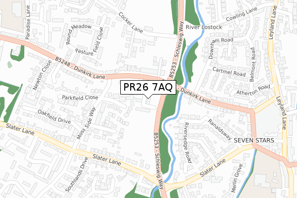
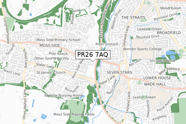
PR26 7AQ is located in the Earnshaw Bridge electoral ward, within the local authority district of South Ribble and the English Parliamentary constituency of South Ribble. The Sub Integrated Care Board (ICB) Location is NHS Lancashire and South Cumbria ICB - 00X and the police force is Lancashire. This postcode has been in use since February 2019.


GetTheData
Source: OS Open Zoomstack (Ordnance Survey)
Licence: Open Government Licence (requires attribution)
Attribution: Contains OS data © Crown copyright and database right 2025
Source: Open Postcode Geo
Licence: Open Government Licence (requires attribution)
Attribution: Contains OS data © Crown copyright and database right 2025; Contains Royal Mail data © Royal Mail copyright and database right 2025; Source: Office for National Statistics licensed under the Open Government Licence v.3.0
| Easting | 352313 |
| Northing | 421844 |
| Latitude | 53.690870 |
| Longitude | -2.723613 |
GetTheData
Source: Open Postcode Geo
Licence: Open Government Licence
| Country | England |
| Postcode District | PR26 |
➜ See where PR26 is on a map ➜ Where is Leyland? | |
GetTheData
Source: Land Registry Price Paid Data
Licence: Open Government Licence
| Ward | Earnshaw Bridge |
| Constituency | South Ribble |
GetTheData
Source: ONS Postcode Database
Licence: Open Government Licence
| Downham Road (Dunkirk Lane) | Seven Stars | 112m |
| Downham Road (Dunkirk Lane) | Seven Stars | 115m |
| Southlands Drive (Slater Lane) | Moss Side | 266m |
| Southland Drive (Slater Lane) | Moss Side | 277m |
| Newton Close (Dunkirk Lane) | Moss Side | 282m |
| Leyland Station | 2.6km |
| Lostock Hall Station | 4.4km |
| Croston Station | 4.4km |
GetTheData
Source: NaPTAN
Licence: Open Government Licence
GetTheData
Source: ONS Postcode Database
Licence: Open Government Licence


➜ Get more ratings from the Food Standards Agency
GetTheData
Source: Food Standards Agency
Licence: FSA terms & conditions
| Last Collection | |||
|---|---|---|---|
| Location | Mon-Fri | Sat | Distance |
| Leyland Lane Post Office | 17:15 | 12:00 | 483m |
| Cowling Lane | 17:30 | 12:00 | 546m |
| 169 Fox Lane | 17:15 | 11:30 | 763m |
GetTheData
Source: Dracos
Licence: Creative Commons Attribution-ShareAlike
The below table lists the International Territorial Level (ITL) codes (formerly Nomenclature of Territorial Units for Statistics (NUTS) codes) and Local Administrative Units (LAU) codes for PR26 7AQ:
| ITL 1 Code | Name |
|---|---|
| TLD | North West (England) |
| ITL 2 Code | Name |
| TLD4 | Lancashire |
| ITL 3 Code | Name |
| TLD45 | Mid Lancashire |
| LAU 1 Code | Name |
| E07000126 | South Ribble |
GetTheData
Source: ONS Postcode Directory
Licence: Open Government Licence
The below table lists the Census Output Area (OA), Lower Layer Super Output Area (LSOA), and Middle Layer Super Output Area (MSOA) for PR26 7AQ:
| Code | Name | |
|---|---|---|
| OA | E00129206 | |
| LSOA | E01025459 | South Ribble 017C |
| MSOA | E02005303 | South Ribble 017 |
GetTheData
Source: ONS Postcode Directory
Licence: Open Government Licence
| PR26 7XH | Bretherton Close | 92m |
| PR26 7SQ | Dunkirk Lane | 121m |
| PR26 7XD | Langton Close | 157m |
| PR25 1TR | Moorfield Road | 165m |
| PR26 7SD | Cocker Court | 175m |
| PR25 1TX | Dunkirk Lane | 196m |
| PR25 1TQ | Riversedge Road | 212m |
| PR26 7XL | Moss Side Way | 217m |
| PR26 7SE | Slater Lane | 222m |
| PR25 1TP | Thornhill Road | 234m |
GetTheData
Source: Open Postcode Geo; Land Registry Price Paid Data
Licence: Open Government Licence