PR25 5AS maps, stats, and open data
PR25 5AS is located in the Clayton West & Cuerden electoral ward, within the local authority district of Chorley and the English Parliamentary constituency of Chorley. The Sub Integrated Care Board (ICB) Location is NHS Lancashire and South Cumbria ICB - 00X and the police force is Lancashire. This postcode has been in use since May 2019.
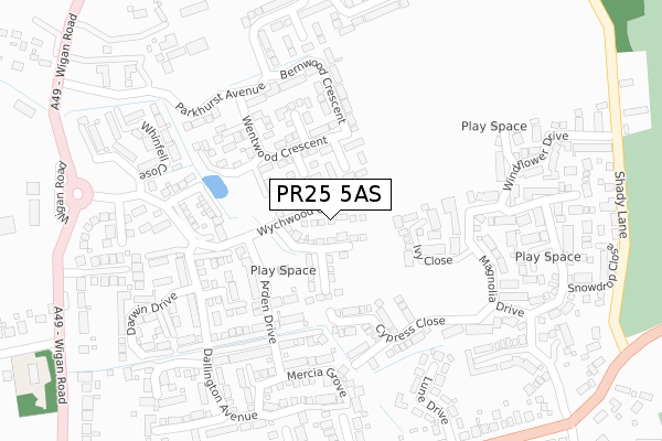
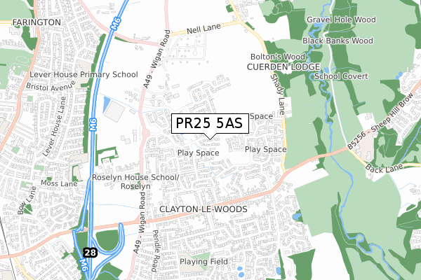
PR25 5AS maps


Licence: Open Government Licence (requires attribution)
Attribution: Contains OS data © Crown copyright and database right 2025
Source: Open Postcode Geo
Licence: Open Government Licence (requires attribution)
Attribution: Contains OS data © Crown copyright and database right 2025; Contains Royal Mail data © Royal Mail copyright and database right 2025; Source: Office for National Statistics licensed under the Open Government Licence v.3.0
PR25 5AS geodata
| Easting | 356104 |
| Northing | 422914 |
| Latitude | 53.700820 |
| Longitude | -2.666361 |
Where is PR25 5AS?
| Country | England |
| Postcode District | PR25 |
Politics
| Ward | Clayton West & Cuerden |
|---|---|
| Constituency | Chorley |
House Prices
Sales of detached houses in PR25 5AS
2024 12 JUL £340,000 |
36, WYCHWOOD GROVE, LEYLAND, PR25 5AS 2023 20 OCT £450,450 |
34, WYCHWOOD GROVE, LEYLAND, PR25 5AS 2022 27 JAN £314,995 |
32, WYCHWOOD GROVE, LEYLAND, PR25 5AS 2021 10 SEP £415,995 |
20, WYCHWOOD GROVE, LEYLAND, PR25 5AS 2020 30 JUN £237,995 |
22, WYCHWOOD GROVE, LEYLAND, PR25 5AS 2019 13 DEC £237,995 |
2019 12 DEC £299,995 |
24, WYCHWOOD GROVE, LEYLAND, PR25 5AS 2019 6 DEC £311,995 |
18, WYCHWOOD GROVE, LEYLAND, PR25 5AS 2019 26 JUL £311,995 |
16, WYCHWOOD GROVE, LEYLAND, PR25 5AS 2019 28 JUN £299,995 |
Licence: Contains HM Land Registry data © Crown copyright and database right 2025. This data is licensed under the Open Government Licence v3.0.
Transport
Nearest bus stops to PR25 5AS
| Lune Drive (Lancaster Lane) | Clayton-le-woods | 381m |
| Caton Drive (Lancaster Lane) | Clayton-le-woods | 394m |
| Lune Drive (Lancaster Lane) | Clayton-le-woods | 395m |
| Caton Drive (Lancaster Lane) | Clayton-le-woods | 395m |
| Wychwood Grove (Wigan Road) | Clayton-le-woods | 440m |
Nearest railway stations to PR25 5AS
| Leyland Station | 1.4km |
| Bamber Bridge Station | 2.9km |
| Lostock Hall Station | 3km |
Broadband
Broadband access in PR25 5AS (2020 data)
| Percentage of properties with Next Generation Access | 100.0% |
| Percentage of properties with Superfast Broadband | 100.0% |
| Percentage of properties with Ultrafast Broadband | 66.7% |
| Percentage of properties with Full Fibre Broadband | 66.7% |
Superfast Broadband is between 30Mbps and 300Mbps
Ultrafast Broadband is > 300Mbps
Broadband limitations in PR25 5AS (2020 data)
| Percentage of properties unable to receive 2Mbps | 0.0% |
| Percentage of properties unable to receive 5Mbps | 0.0% |
| Percentage of properties unable to receive 10Mbps | 0.0% |
| Percentage of properties unable to receive 30Mbps | 0.0% |
Deprivation
20.9% of English postcodes are less deprived than PR25 5AS:Food Standards Agency
Three nearest food hygiene ratings to PR25 5AS (metres)


➜ Get more ratings from the Food Standards Agency
Nearest post box to PR25 5AS
| Last Collection | |||
|---|---|---|---|
| Location | Mon-Fri | Sat | Distance |
| Lancaster Lane | 17:30 | 12:30 | 425m |
| 43 Stanfield Lane, Farington | 17:00 | 11:30 | 1,201m |
| 2 Stanley Road, Farington | 17:15 | 11:30 | 1,259m |
PR25 5AS ITL and PR25 5AS LAU
The below table lists the International Territorial Level (ITL) codes (formerly Nomenclature of Territorial Units for Statistics (NUTS) codes) and Local Administrative Units (LAU) codes for PR25 5AS:
| ITL 1 Code | Name |
|---|---|
| TLD | North West (England) |
| ITL 2 Code | Name |
| TLD4 | Lancashire |
| ITL 3 Code | Name |
| TLD47 | Chorley and West Lancashire |
| LAU 1 Code | Name |
| E07000118 | Chorley |
PR25 5AS census areas
The below table lists the Census Output Area (OA), Lower Layer Super Output Area (LSOA), and Middle Layer Super Output Area (MSOA) for PR25 5AS:
| Code | Name | |
|---|---|---|
| OA | E00126672 | |
| LSOA | E01024956 | Chorley 003D |
| MSOA | E02005191 | Chorley 003 |
Nearest postcodes to PR25 5AS
| PR25 5SG | Ivy Close | 104m |
| PR25 5TY | Cypress Close | 173m |
| PR25 5TW | Acorn Court | 216m |
| PR25 5SF | Magnolia Drive | 233m |
| PR25 5RG | Windflower Drive | 263m |
| PR25 5TF | Dahlia Close | 263m |
| PR25 5AG | Dallington Avenue | 264m |
| PR25 5RQ | Broom Close | 273m |
| PR25 5SX | Lune Drive | 285m |
| PR25 5AH | Dallington Avenue | 294m |