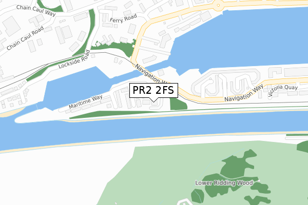
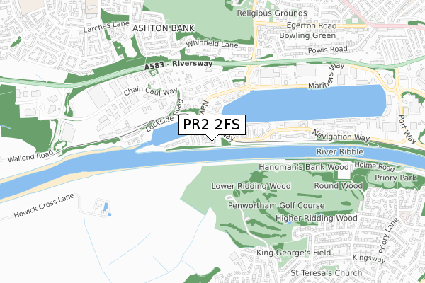
PR2 2FS is located in the Ashton electoral ward, within the local authority district of Preston and the English Parliamentary constituency of Preston. The Sub Integrated Care Board (ICB) Location is NHS Lancashire and South Cumbria ICB - 01E and the police force is Lancashire. This postcode has been in use since August 2017.


GetTheData
Source: OS Open Zoomstack (Ordnance Survey)
Licence: Open Government Licence (requires attribution)
Attribution: Contains OS data © Crown copyright and database right 2025
Source: Open Postcode Geo
Licence: Open Government Licence (requires attribution)
Attribution: Contains OS data © Crown copyright and database right 2025; Contains Royal Mail data © Royal Mail copyright and database right 2025; Source: Office for National Statistics licensed under the Open Government Licence v.3.0
| Easting | 351026 |
| Northing | 429395 |
| Latitude | 53.758614 |
| Longitude | -2.744299 |
GetTheData
Source: Open Postcode Geo
Licence: Open Government Licence
| Country | England |
| Postcode District | PR2 |
➜ See where PR2 is on a map ➜ Where is Preston? | |
GetTheData
Source: Land Registry Price Paid Data
Licence: Open Government Licence
| Ward | Ashton |
| Constituency | Preston |
GetTheData
Source: ONS Postcode Database
Licence: Open Government Licence
| Maritime Way (Navigation Way) | Riversway | 97m |
| Maritime Way (Navigation Way) | Riversway | 130m |
| Business Village (Navigation Way) | Riversway | 272m |
| Business Village (Navigation Way) | Riversway | 313m |
| Chain Caul Way | Riversway | 382m |
| Preston Station | 2.4km |
| Lostock Hall Station | 5.4km |
| Salwick Station | 5.4km |
GetTheData
Source: NaPTAN
Licence: Open Government Licence
| Percentage of properties with Next Generation Access | 100.0% |
| Percentage of properties with Superfast Broadband | 100.0% |
| Percentage of properties with Ultrafast Broadband | 0.0% |
| Percentage of properties with Full Fibre Broadband | 0.0% |
Superfast Broadband is between 30Mbps and 300Mbps
Ultrafast Broadband is > 300Mbps
| Median download speed | 39.5Mbps |
| Average download speed | 39.7Mbps |
| Maximum download speed | 64.74Mbps |
| Median upload speed | 9.9Mbps |
| Average upload speed | 10.1Mbps |
| Maximum upload speed | 19.29Mbps |
| Percentage of properties unable to receive 2Mbps | 0.0% |
| Percentage of properties unable to receive 5Mbps | 0.0% |
| Percentage of properties unable to receive 10Mbps | 0.0% |
| Percentage of properties unable to receive 30Mbps | 0.0% |
GetTheData
Source: Ofcom
Licence: Ofcom Terms of Use (requires attribution)
GetTheData
Source: ONS Postcode Database
Licence: Open Government Licence


➜ Get more ratings from the Food Standards Agency
GetTheData
Source: Food Standards Agency
Licence: FSA terms & conditions
| Last Collection | |||
|---|---|---|---|
| Location | Mon-Fri | Sat | Distance |
| Victoria Mansions | 17:00 | 11:00 | 122m |
| Navigation Way, Ashton | 17:30 | 11:30 | 281m |
| Morrisons | 16:30 | 11:00 | 687m |
GetTheData
Source: Dracos
Licence: Creative Commons Attribution-ShareAlike
The below table lists the International Territorial Level (ITL) codes (formerly Nomenclature of Territorial Units for Statistics (NUTS) codes) and Local Administrative Units (LAU) codes for PR2 2FS:
| ITL 1 Code | Name |
|---|---|
| TLD | North West (England) |
| ITL 2 Code | Name |
| TLD4 | Lancashire |
| ITL 3 Code | Name |
| TLD45 | Mid Lancashire |
| LAU 1 Code | Name |
| E07000123 | Preston |
GetTheData
Source: ONS Postcode Directory
Licence: Open Government Licence
The below table lists the Census Output Area (OA), Lower Layer Super Output Area (LSOA), and Middle Layer Super Output Area (MSOA) for PR2 2FS:
| Code | Name | |
|---|---|---|
| OA | E00128368 | |
| LSOA | E01025288 | Preston 010D |
| MSOA | E02005262 | Preston 010 |
GetTheData
Source: ONS Postcode Directory
Licence: Open Government Licence
| PR2 2HT | Maritime Way | 114m |
| PR2 2GB | Princes Reach | 172m |
| PR2 2GD | Princes Reach | 256m |
| PR2 2YS | Lockside Office Park | 268m |
| PR2 2YP | Navigation Way | 306m |
| PR2 2GA | Princes Reach | 308m |
| PR2 2YX | Navigation Way | 408m |
| PR2 2YW | Victoria Quay | 462m |
| PR2 1NR | Whinfield Place | 508m |
| PR2 2YY | Navigation Way | 511m |
GetTheData
Source: Open Postcode Geo; Land Registry Price Paid Data
Licence: Open Government Licence