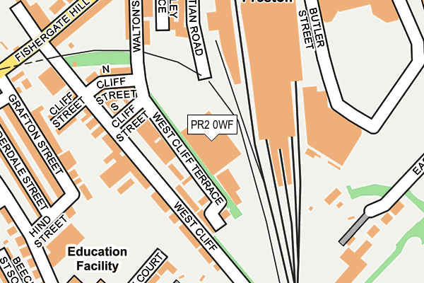
PR2 0WF is located in the City Centre electoral ward, within the local authority district of Preston and the English Parliamentary constituency of Preston. The Sub Integrated Care Board (ICB) Location is NHS Lancashire and South Cumbria ICB - 01E and the police force is Lancashire. This postcode has been in use since July 2017.


GetTheData
Source: OS OpenMap – Local (Ordnance Survey)
Source: OS VectorMap District (Ordnance Survey)
Licence: Open Government Licence (requires attribution)
| Easting | 353390 |
| Northing | 428887 |
| Latitude | 53.754266 |
| Longitude | -2.708369 |
GetTheData
Source: Open Postcode Geo
Licence: Open Government Licence
| Country | England |
| Postcode District | PR2 |
➜ See where PR2 is on a map ➜ Where is Preston? | |
GetTheData
Source: Land Registry Price Paid Data
Licence: Open Government Licence
| Ward | City Centre |
| Constituency | Preston |
GetTheData
Source: ONS Postcode Database
Licence: Open Government Licence
| Rail Station (Butler Street) | Preston City Centre | 215m |
| Westcliff (Fishergate Hill) | Broadgate | 289m |
| South Meadow Lane | Broadgate | 298m |
| Christ Church St (Bow Lane) | Preston City Centre | 306m |
| Railway Station (Fishergate Hill) | Preston City Centre | 308m |
| Preston Station | 0.3km |
| Lostock Hall Station | 3.6km |
| Bamber Bridge Station | 4.4km |
GetTheData
Source: NaPTAN
Licence: Open Government Licence
GetTheData
Source: ONS Postcode Database
Licence: Open Government Licence


➜ Get more ratings from the Food Standards Agency
GetTheData
Source: Food Standards Agency
Licence: FSA terms & conditions
| Last Collection | |||
|---|---|---|---|
| Location | Mon-Fri | Sat | Distance |
| Butler Street | 18:30 | 11:30 | 260m |
| Pedders Lane | 17:00 | 11:30 | 317m |
| Preston Post Office | 18:30 | 386m | |
GetTheData
Source: Dracos
Licence: Creative Commons Attribution-ShareAlike
The below table lists the International Territorial Level (ITL) codes (formerly Nomenclature of Territorial Units for Statistics (NUTS) codes) and Local Administrative Units (LAU) codes for PR2 0WF:
| ITL 1 Code | Name |
|---|---|
| TLD | North West (England) |
| ITL 2 Code | Name |
| TLD4 | Lancashire |
| ITL 3 Code | Name |
| TLD45 | Mid Lancashire |
| LAU 1 Code | Name |
| E07000123 | Preston |
GetTheData
Source: ONS Postcode Directory
Licence: Open Government Licence
The below table lists the Census Output Area (OA), Lower Layer Super Output Area (LSOA), and Middle Layer Super Output Area (MSOA) for PR2 0WF:
| Code | Name | |
|---|---|---|
| OA | E00128359 | |
| LSOA | E01025290 | Preston 017B |
| MSOA | E02005269 | Preston 017 |
GetTheData
Source: ONS Postcode Directory
Licence: Open Government Licence
| PR1 8HX | West Cliff | 89m |
| PR1 8HG | West Cliff Terrace | 103m |
| PR1 8HU | West Cliff | 107m |
| PR1 8JA | North Cliff Street | 164m |
| PR1 8QT | Waltons Parade | 193m |
| PR1 8NB | Christian Road | 209m |
| PR1 8HY | Cliff Street | 227m |
| PR1 8NA | Stanley Place | 228m |
| PR1 8JH | Grafton Street | 248m |
| PR1 8JB | Fishergate Hill | 250m |
GetTheData
Source: Open Postcode Geo; Land Registry Price Paid Data
Licence: Open Government Licence