PO9 5FG maps, stats, and open data
- Home
- Postcode
- PO
- PO9
- PO9 5
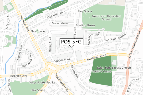
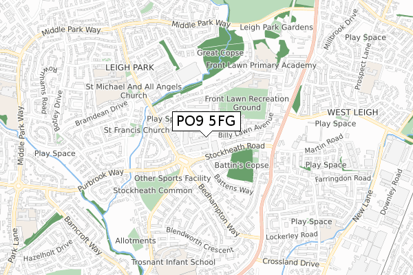
PO9 5FG is located in the Battins electoral ward, within the local authority district of Havant and the English Parliamentary constituency of Havant. The Sub Integrated Care Board (ICB) Location is NHS Hampshire and Isle of Wight ICB - D9Y0V and the police force is Hampshire. This postcode has been in use since May 2019.
PO9 5FG maps


Source: OS Open Zoomstack (Ordnance Survey)
Licence: Open Government Licence (requires attribution)
Attribution: Contains OS data © Crown copyright and database right 2025
Source: Open Postcode GeoLicence: Open Government Licence (requires attribution)
Attribution: Contains OS data © Crown copyright and database right 2025; Contains Royal Mail data © Royal Mail copyright and database right 2025; Source: Office for National Statistics licensed under the Open Government Licence v.3.0
PO9 5FG geodata
| Easting | 471639 |
| Northing | 107981 |
| Latitude | 50.866895 |
| Longitude | -0.983342 |
Where is PO9 5FG?
| Country | England |
| Postcode District | PO9 |
Politics
| Ward | Battins |
|---|
| Constituency | Havant |
|---|
Transport
Nearest bus stops to PO9 5FG
| Park Parade (Stockheath Road) | Leigh Park | 167m |
| Littleton Grove | Leigh Park | 215m |
| Park Parade (Dunsbury Way) | Leigh Park | 225m |
| Park Parade (Dunsbury Way) | Leigh Park | 231m |
| Park Parade (Dunsbury Way) | Leigh Park | 246m |
Nearest railway stations to PO9 5FG
| Havant Station | 1.4km |
| Bedhampton Station | 1.7km |
| Warblington Station | 1.9km |
Broadband
Broadband access in PO9 5FG (2020 data)
| Percentage of properties with Next Generation Access | 100.0% |
| Percentage of properties with Superfast Broadband | 100.0% |
| Percentage of properties with Ultrafast Broadband | 0.0% |
| Percentage of properties with Full Fibre Broadband | 0.0% |
Superfast Broadband is between 30Mbps and 300Mbps
Ultrafast Broadband is > 300Mbps
Broadband limitations in PO9 5FG (2020 data)
| Percentage of properties unable to receive 2Mbps | 0.0% |
| Percentage of properties unable to receive 5Mbps | 0.0% |
| Percentage of properties unable to receive 10Mbps | 0.0% |
| Percentage of properties unable to receive 30Mbps | 0.0% |
Deprivation
94.7% of English postcodes are less deprived than
PO9 5FG:
Food Standards Agency
Three nearest food hygiene ratings to PO9 5FG (metres)
New Balti Express
Graywell local store
Amazoom
➜ Get more ratings from the Food Standards Agency
Nearest post box to PO9 5FG
| | Last Collection | |
|---|
| Location | Mon-Fri | Sat | Distance |
|---|
| Leigh Park Post Office | 17:30 | 12:30 | 58m |
| Leigh Park Post Office | 17:30 | 12:30 | 63m |
| Stone Square | 16:15 | 11:45 | 383m |
PO9 5FG ITL and PO9 5FG LAU
The below table lists the International Territorial Level (ITL) codes (formerly Nomenclature of Territorial Units for Statistics (NUTS) codes) and Local Administrative Units (LAU) codes for PO9 5FG:
| ITL 1 Code | Name |
|---|
| TLJ | South East (England) |
| ITL 2 Code | Name |
|---|
| TLJ3 | Hampshire and Isle of Wight |
| ITL 3 Code | Name |
|---|
| TLJ35 | South Hampshire |
| LAU 1 Code | Name |
|---|
| E07000090 | Havant |
PO9 5FG census areas
The below table lists the Census Output Area (OA), Lower Layer Super Output Area (LSOA), and Middle Layer Super Output Area (MSOA) for PO9 5FG:
| Code | Name |
|---|
| OA | E00116385 | |
|---|
| LSOA | E01022905 | Havant 010C |
|---|
| MSOA | E02004771 | Havant 010 |
|---|
Nearest postcodes to PO9 5FG


