Property/Postcode Data Search:
PO7 5GJ maps, stats, and open data
PO7 5GJ is located in the Southwick and Wickham electoral ward, within the local authority district of Winchester and the English Parliamentary constituency of Meon Valley. The Sub Integrated Care Board (ICB) Location is NHS Hampshire and Isle of Wight ICB - D9Y0V and the police force is Hampshire. This postcode has been in use since September 2019.
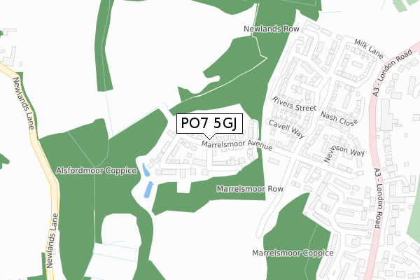
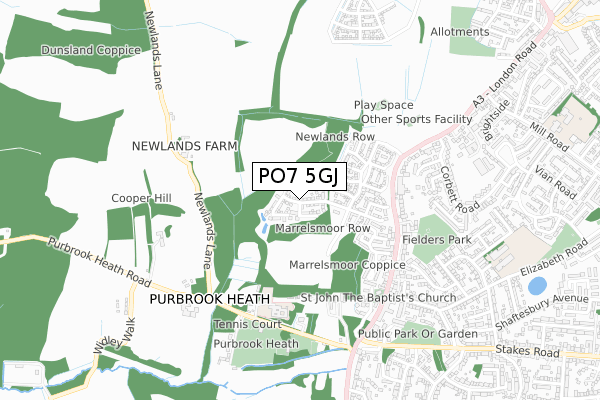
PO7 5GJ maps


Source: OS Open Zoomstack (Ordnance Survey)
Licence: Open Government Licence (requires attribution)
Attribution: Contains OS data © Crown copyright and database right 2025
Source: Open Postcode Geo
Licence: Open Government Licence (requires attribution)
Attribution: Contains OS data © Crown copyright and database right 2025; Contains Royal Mail data © Royal Mail copyright and database right 2025; Source: Office for National Statistics licensed under the Open Government Licence v.3.0
Licence: Open Government Licence (requires attribution)
Attribution: Contains OS data © Crown copyright and database right 2025
Source: Open Postcode Geo
Licence: Open Government Licence (requires attribution)
Attribution: Contains OS data © Crown copyright and database right 2025; Contains Royal Mail data © Royal Mail copyright and database right 2025; Source: Office for National Statistics licensed under the Open Government Licence v.3.0
PO7 5GJ geodata
| Easting | 466979 |
| Northing | 108436 |
| Latitude | 50.871544 |
| Longitude | -1.049469 |
Where is PO7 5GJ?
| Country | England |
| Postcode District | PO7 |
Politics
| Ward | Southwick And Wickham |
|---|---|
| Constituency | Meon Valley |
Transport
Nearest bus stops to PO7 5GJ
| Berewood (London Road) | Waterlooville | 407m |
| Campbell Crescent (London Road) | Purbrook | 447m |
| Campbell Crescent (London Road) | Purbrook | 458m |
| Church (London Road) | Purbrook | 555m |
| Church (London Road) | Purbrook | 583m |
Nearest railway stations to PO7 5GJ
| Cosham Station | 3.5km |
| Bedhampton Station | 4.3km |
| Hilsea Station | 4.9km |
Deprivation
53.2% of English postcodes are less deprived than PO7 5GJ:Food Standards Agency
Three nearest food hygiene ratings to PO7 5GJ (metres)
Deverell Hall Preschool@Deverell Hall

Deverell Hall
434m
Purbrook Heath Bowling Club
Bowls Pavilion
498m
Purbrook Day Nursery and Pre School

7 London Road
555m
➜ Get more ratings from the Food Standards Agency
Nearest post box to PO7 5GJ
| Last Collection | |||
|---|---|---|---|
| Location | Mon-Fri | Sat | Distance |
| Deverall Hall | 16:45 | 11:50 | 450m |
| Purbrook Post Office | 17:00 | 11:45 | 632m |
| Purbrook Post Office | 17:00 | 11:45 | 632m |
PO7 5GJ ITL and PO7 5GJ LAU
The below table lists the International Territorial Level (ITL) codes (formerly Nomenclature of Territorial Units for Statistics (NUTS) codes) and Local Administrative Units (LAU) codes for PO7 5GJ:
| ITL 1 Code | Name |
|---|---|
| TLJ | South East (England) |
| ITL 2 Code | Name |
| TLJ3 | Hampshire and Isle of Wight |
| ITL 3 Code | Name |
| TLJ36 | Central Hampshire |
| LAU 1 Code | Name |
| E07000094 | Winchester |
PO7 5GJ census areas
The below table lists the Census Output Area (OA), Lower Layer Super Output Area (LSOA), and Middle Layer Super Output Area (MSOA) for PO7 5GJ:
| Code | Name | |
|---|---|---|
| OA | E00117996 | |
| LSOA | E01023224 | Winchester 014A |
| MSOA | E02004842 | Winchester 014 |
Nearest postcodes to PO7 5GJ
| PO7 5FR | Rivers Street | 198m |
| PO7 5FS | Lawrence Place | 227m |
| PO7 5FL | Allenby Road | 263m |
| PO7 5FH | Newlands Avenue | 282m |
| PO7 5FN | Trenchard Close | 327m |
| PO7 5LE | Purbrook Gardens | 335m |
| PO7 5LD | Purbrook Gardens | 380m |
| PO7 5LF | London Road | 422m |
| PO7 5JU | London Road | 437m |
| PO7 5JY | London Road | 438m |