PO7 3DN maps, stats, and open data
PO7 3DN is located in the Denmead electoral ward, within the local authority district of Winchester and the English Parliamentary constituency of Meon Valley. The Sub Integrated Care Board (ICB) Location is NHS Hampshire and Isle of Wight ICB - D9Y0V and the police force is Hampshire. This postcode has been in use since April 2019.
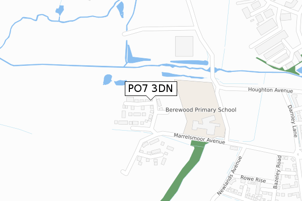
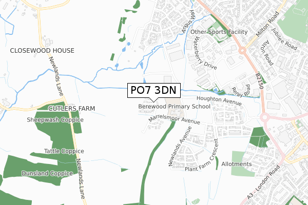
PO7 3DN maps


Licence: Open Government Licence (requires attribution)
Attribution: Contains OS data © Crown copyright and database right 2025
Source: Open Postcode Geo
Licence: Open Government Licence (requires attribution)
Attribution: Contains OS data © Crown copyright and database right 2025; Contains Royal Mail data © Royal Mail copyright and database right 2025; Source: Office for National Statistics licensed under the Open Government Licence v.3.0
PO7 3DN geodata
| Easting | 466998 |
| Northing | 109594 |
| Latitude | 50.881954 |
| Longitude | -1.048987 |
Where is PO7 3DN?
| Country | England |
| Postcode District | PO7 |
Politics
| Ward | Denmead |
|---|---|
| Constituency | Meon Valley |
House Prices
Sales of detached houses in PO7 3DN
1, NICHOLSON WAY, WATERLOOVILLE, PO7 3DN 2024 25 APR £545,000 |
2, NICHOLSON WAY, WATERLOOVILLE, PO7 3DN 2024 23 FEB £418,000 |
3, NICHOLSON WAY, WATERLOOVILLE, PO7 3DN 2023 31 MAR £454,950 |
9, NICHOLSON WAY, WATERLOOVILLE, PO7 3DN 2022 30 SEP £584,950 |
11, NICHOLSON WAY, WATERLOOVILLE, PO7 3DN 2019 22 NOV £399,950 |
15, NICHOLSON WAY, WATERLOOVILLE, PO7 3DN 2019 22 NOV £475,000 |
17, NICHOLSON WAY, WATERLOOVILLE, PO7 3DN 2019 25 OCT £384,950 |
28, NICHOLSON WAY, WATERLOOVILLE, PO7 3DN 2019 27 SEP £378,000 |
30, NICHOLSON WAY, WATERLOOVILLE, PO7 3DN 2019 27 SEP £489,950 |
Licence: Contains HM Land Registry data © Crown copyright and database right 2025. This data is licensed under the Open Government Licence v3.0.
Transport
Nearest bus stops to PO7 3DN
| The Meadows (Waterberry Drive) | Waterlooville | 491m |
| Elettra Avenue | Waterlooville | 570m |
| Berewood Development (Grainger Street) | Waterlooville | 587m |
| Brambles Enterprise Centre (Waterberry Drive) | Waterlooville | 596m |
| Berewood Development (Grainger Street) | Waterlooville | 604m |
Nearest railway stations to PO7 3DN
| Cosham Station | 4.6km |
| Bedhampton Station | 4.9km |
| Havant Station | 5.6km |
Broadband
Broadband access in PO7 3DN (2020 data)
| Percentage of properties with Next Generation Access | 100.0% |
| Percentage of properties with Superfast Broadband | 100.0% |
| Percentage of properties with Ultrafast Broadband | 100.0% |
| Percentage of properties with Full Fibre Broadband | 100.0% |
Superfast Broadband is between 30Mbps and 300Mbps
Ultrafast Broadband is > 300Mbps
Broadband limitations in PO7 3DN (2020 data)
| Percentage of properties unable to receive 2Mbps | 0.0% |
| Percentage of properties unable to receive 5Mbps | 0.0% |
| Percentage of properties unable to receive 10Mbps | 0.0% |
| Percentage of properties unable to receive 30Mbps | 0.0% |
Deprivation
53.2% of English postcodes are less deprived than PO7 3DN:Food Standards Agency
Three nearest food hygiene ratings to PO7 3DN (metres)


➜ Get more ratings from the Food Standards Agency
Nearest post box to PO7 3DN
| Last Collection | |||
|---|---|---|---|
| Location | Mon-Fri | Sat | Distance |
| Waterlooville | 18:30 | 13:00 | 700m |
| Waterlooville Delivery Office | 777m | ||
| Forest End | 17:30 | 12:30 | 887m |
PO7 3DN ITL and PO7 3DN LAU
The below table lists the International Territorial Level (ITL) codes (formerly Nomenclature of Territorial Units for Statistics (NUTS) codes) and Local Administrative Units (LAU) codes for PO7 3DN:
| ITL 1 Code | Name |
|---|---|
| TLJ | South East (England) |
| ITL 2 Code | Name |
| TLJ3 | Hampshire and Isle of Wight |
| ITL 3 Code | Name |
| TLJ36 | Central Hampshire |
| LAU 1 Code | Name |
| E07000094 | Winchester |
PO7 3DN census areas
The below table lists the Census Output Area (OA), Lower Layer Super Output Area (LSOA), and Middle Layer Super Output Area (MSOA) for PO7 3DN:
| Code | Name | |
|---|---|---|
| OA | E00117996 | |
| LSOA | E01023224 | Winchester 014A |
| MSOA | E02004842 | Winchester 014 |
Nearest postcodes to PO7 3DN
| PO7 7XN | Stratfield Park | 431m |
| PO7 7XX | Waterberry Drive | 519m |
| PO7 3AJ | Pearmain Parade | 551m |
| PO7 3AD | Crispins Crescent | 554m |
| PO7 3AG | Rosemary Lane | 557m |
| PO7 7SE | Hussar Court | 577m |
| PO7 3AF | Orchard Mead | 591m |
| PO7 7FN | Gloucestershire Way | 614m |
| PO7 7FL | Angus Way | 616m |
| PO7 7FD | Lincolnshire Road | 618m |