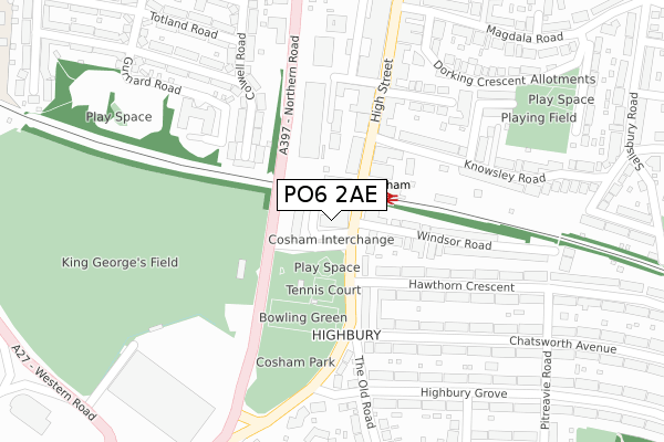
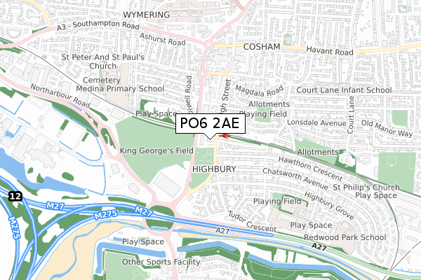
PO6 2AE is located in the Cosham electoral ward, within the unitary authority of Portsmouth and the English Parliamentary constituency of Portsmouth North. The Sub Integrated Care Board (ICB) Location is NHS Hampshire and Isle of Wight ICB - 10R and the police force is Hampshire. This postcode has been in use since April 2019.


GetTheData
Source: OS Open Zoomstack (Ordnance Survey)
Licence: Open Government Licence (requires attribution)
Attribution: Contains OS data © Crown copyright and database right 2025
Source: Open Postcode Geo
Licence: Open Government Licence (requires attribution)
Attribution: Contains OS data © Crown copyright and database right 2025; Contains Royal Mail data © Royal Mail copyright and database right 2025; Source: Office for National Statistics licensed under the Open Government Licence v.3.0
| Easting | 465677 |
| Northing | 105085 |
| Latitude | 50.841563 |
| Longitude | -1.068571 |
GetTheData
Source: Open Postcode Geo
Licence: Open Government Licence
| Country | England |
| Postcode District | PO6 |
➜ See where PO6 is on a map ➜ Where is Portsmouth? | |
GetTheData
Source: Land Registry Price Paid Data
Licence: Open Government Licence
| Ward | Cosham |
| Constituency | Portsmouth North |
GetTheData
Source: ONS Postcode Database
Licence: Open Government Licence
| Cosham Interchange (Unamed Private Road) | Cosham | 28m |
| Cosham Interchange (Unamed Private Road) | Cosham | 36m |
| Cosham Interchange (Unamed Private Road) | Cosham | 38m |
| Highbury Buildings (Portsmouth Road) | Cosham | 136m |
| King George Playing Fields (Northern Road) | Cosham | 146m |
| Cosham Station | 0.1km |
| Hilsea Station | 1.6km |
| Portchester Station | 4km |
GetTheData
Source: NaPTAN
Licence: Open Government Licence
GetTheData
Source: ONS Postcode Database
Licence: Open Government Licence


➜ Get more ratings from the Food Standards Agency
GetTheData
Source: Food Standards Agency
Licence: FSA terms & conditions
| Last Collection | |||
|---|---|---|---|
| Location | Mon-Fri | Sat | Distance |
| High Street | 18:30 | 12:00 | 228m |
| High Street | 18:30 | 12:00 | 230m |
| The Old Road | 17:00 | 11:45 | 336m |
GetTheData
Source: Dracos
Licence: Creative Commons Attribution-ShareAlike
The below table lists the International Territorial Level (ITL) codes (formerly Nomenclature of Territorial Units for Statistics (NUTS) codes) and Local Administrative Units (LAU) codes for PO6 2AE:
| ITL 1 Code | Name |
|---|---|
| TLJ | South East (England) |
| ITL 2 Code | Name |
| TLJ3 | Hampshire and Isle of Wight |
| ITL 3 Code | Name |
| TLJ31 | Portsmouth |
| LAU 1 Code | Name |
| E06000044 | Portsmouth |
GetTheData
Source: ONS Postcode Directory
Licence: Open Government Licence
The below table lists the Census Output Area (OA), Lower Layer Super Output Area (LSOA), and Middle Layer Super Output Area (MSOA) for PO6 2AE:
| Code | Name | |
|---|---|---|
| OA | E00174431 | |
| LSOA | E01017051 | Portsmouth 002A |
| MSOA | E02003525 | Portsmouth 002 |
GetTheData
Source: ONS Postcode Directory
Licence: Open Government Licence
| PO6 2SG | Portsmouth Road | 59m |
| PO6 2SH | Portsmouth Road | 68m |
| PO6 3AJ | High Street | 97m |
| PO6 2SN | Portsmouth Road | 140m |
| PO6 3FF | Meon Mews | 142m |
| PO6 3FG | High Street | 144m |
| PO6 3EQ | High Street | 155m |
| PO6 3EY | Vectis Way | 161m |
| PO6 3EG | High Street | 165m |
| PO6 3BB | Knowsley Road | 178m |
GetTheData
Source: Open Postcode Geo; Land Registry Price Paid Data
Licence: Open Government Licence