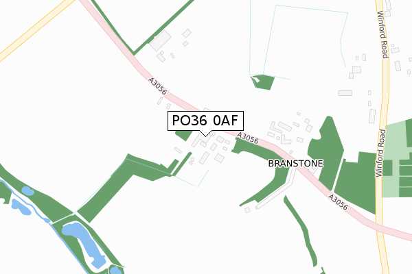
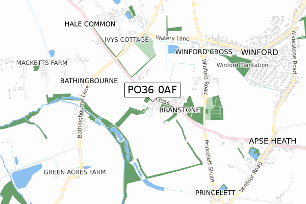
PO36 0AF is located in the Newchurch, Havenstreet & Ashey electoral ward, within the unitary authority of Isle of Wight and the English Parliamentary constituency of Isle of Wight. The Sub Integrated Care Board (ICB) Location is NHS Hampshire and Isle of Wight ICB - D9Y0V and the police force is Hampshire. This postcode has been in use since August 2018.


GetTheData
Source: OS Open Zoomstack (Ordnance Survey)
Licence: Open Government Licence (requires attribution)
Attribution: Contains OS data © Crown copyright and database right 2025
Source: Open Postcode Geo
Licence: Open Government Licence (requires attribution)
Attribution: Contains OS data © Crown copyright and database right 2025; Contains Royal Mail data © Royal Mail copyright and database right 2025; Source: Office for National Statistics licensed under the Open Government Licence v.3.0
| Easting | 455480 |
| Northing | 83674 |
| Latitude | 50.650103 |
| Longitude | -1.216602 |
GetTheData
Source: Open Postcode Geo
Licence: Open Government Licence
| Country | England |
| Postcode District | PO36 |
➜ See where PO36 is on a map ➜ Where is Branstone? | |
GetTheData
Source: Land Registry Price Paid Data
Licence: Open Government Licence
| Ward | Newchurch, Havenstreet & Ashey |
| Constituency | Isle Of Wight |
GetTheData
Source: ONS Postcode Database
Licence: Open Government Licence
| Holliers Farm (A3056 Newport Road) | Branstone | 34m |
| Branstone Cross (A3056 Newport Road) | Branstone | 432m |
| Amazon World (Watery Lane) | Newchurch | 497m |
| Amazon World (Watery Lane) | Newchurch | 512m |
| Winford Cross (Watery Lane) | Winford | 612m |
| Shanklin Station | 3.2km |
| Lake (Isle of Wight) Station | 3.6km |
| Sandown Station | 3.9km |
GetTheData
Source: NaPTAN
Licence: Open Government Licence
GetTheData
Source: ONS Postcode Database
Licence: Open Government Licence
➜ Get more ratings from the Food Standards Agency
GetTheData
Source: Food Standards Agency
Licence: FSA terms & conditions
| Last Collection | |||
|---|---|---|---|
| Location | Mon-Fri | Sat | Distance |
| Near Branstone Farm | 15:15 | 11:30 | 228m |
| Winford Cross | 14:45 | 11:15 | 625m |
| Apse Heath Post Office | 16:45 | 11:45 | 1,027m |
GetTheData
Source: Dracos
Licence: Creative Commons Attribution-ShareAlike
The below table lists the International Territorial Level (ITL) codes (formerly Nomenclature of Territorial Units for Statistics (NUTS) codes) and Local Administrative Units (LAU) codes for PO36 0AF:
| ITL 1 Code | Name |
|---|---|
| TLJ | South East (England) |
| ITL 2 Code | Name |
| TLJ3 | Hampshire and Isle of Wight |
| ITL 3 Code | Name |
| TLJ34 | Isle of Wight |
| LAU 1 Code | Name |
| E06000046 | Isle of Wight |
GetTheData
Source: ONS Postcode Directory
Licence: Open Government Licence
The below table lists the Census Output Area (OA), Lower Layer Super Output Area (LSOA), and Middle Layer Super Output Area (MSOA) for PO36 0AF:
| Code | Name | |
|---|---|---|
| OA | E00087490 | |
| LSOA | E01017324 | Isle of Wight 015D |
| MSOA | E02003595 | Isle of Wight 015 |
GetTheData
Source: ONS Postcode Directory
Licence: Open Government Licence
| PO36 0LT | 54m | |
| PO36 0JX | Winford Road | 546m |
| PO36 0LX | Watery Lane | 593m |
| PO36 0LU | Bathingbourne Lane | 669m |
| PO36 0JL | Forest Way | 790m |
| PO36 0JY | Forest Road | 823m |
| PO36 0LS | Newport Road | 847m |
| PO36 0JW | Forest Way | 897m |
| PO36 0JU | Princelett Shute | 918m |
| PO36 0JN | Forest Way | 932m |
GetTheData
Source: Open Postcode Geo; Land Registry Price Paid Data
Licence: Open Government Licence