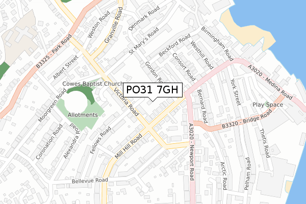
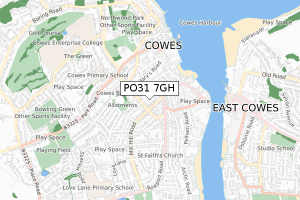
PO31 7GH is located in the Cowes North electoral ward, within the unitary authority of Isle of Wight and the English Parliamentary constituency of Isle of Wight. The Sub Integrated Care Board (ICB) Location is NHS Hampshire and Isle of Wight ICB - D9Y0V and the police force is Hampshire. This postcode has been in use since October 2018.


GetTheData
Source: OS Open Zoomstack (Ordnance Survey)
Licence: Open Government Licence (requires attribution)
Attribution: Contains OS data © Crown copyright and database right 2025
Source: Open Postcode Geo
Licence: Open Government Licence (requires attribution)
Attribution: Contains OS data © Crown copyright and database right 2025; Contains Royal Mail data © Royal Mail copyright and database right 2025; Source: Office for National Statistics licensed under the Open Government Licence v.3.0
| Easting | 449492 |
| Northing | 95649 |
| Latitude | 50.758322 |
| Longitude | -1.299692 |
GetTheData
Source: Open Postcode Geo
Licence: Open Government Licence
| Country | England |
| Postcode District | PO31 |
➜ See where PO31 is on a map ➜ Where is Cowes? | |
GetTheData
Source: Land Registry Price Paid Data
Licence: Open Government Licence
| Ward | Cowes North |
| Constituency | Isle Of Wight |
GetTheData
Source: ONS Postcode Database
Licence: Open Government Licence
1, CHURCH VIEW CLOSE, COWES, PO31 7GH 2004 9 JUL £260,000 |
GetTheData
Source: HM Land Registry Price Paid Data
Licence: Contains HM Land Registry data © Crown copyright and database right 2025. This data is licensed under the Open Government Licence v3.0.
| Victoria Road (Mill Hill Road) | Cowes | 61m |
| Fellows Road (Victoria Road) | Cowes | 70m |
| Arctic Road (Newport Road) | Cowes | 149m |
| St Marys Road (Victoria Road) | Cowes | 150m |
| St Marys Road (Victoria Road) | Cowes | 151m |
GetTheData
Source: NaPTAN
Licence: Open Government Licence
| Percentage of properties with Next Generation Access | 100.0% |
| Percentage of properties with Superfast Broadband | 100.0% |
| Percentage of properties with Ultrafast Broadband | 0.0% |
| Percentage of properties with Full Fibre Broadband | 0.0% |
Superfast Broadband is between 30Mbps and 300Mbps
Ultrafast Broadband is > 300Mbps
| Percentage of properties unable to receive 2Mbps | 0.0% |
| Percentage of properties unable to receive 5Mbps | 0.0% |
| Percentage of properties unable to receive 10Mbps | 0.0% |
| Percentage of properties unable to receive 30Mbps | 0.0% |
GetTheData
Source: Ofcom
Licence: Ofcom Terms of Use (requires attribution)
GetTheData
Source: ONS Postcode Database
Licence: Open Government Licence


➜ Get more ratings from the Food Standards Agency
GetTheData
Source: Food Standards Agency
Licence: FSA terms & conditions
| Last Collection | |||
|---|---|---|---|
| Location | Mon-Fri | Sat | Distance |
| Mill Hill Road | 17:00 | 11:45 | 95m |
| Victoria Road | 16:45 | 11:30 | 111m |
| Bellevue Road | 17:00 | 11:45 | 216m |
GetTheData
Source: Dracos
Licence: Creative Commons Attribution-ShareAlike
The below table lists the International Territorial Level (ITL) codes (formerly Nomenclature of Territorial Units for Statistics (NUTS) codes) and Local Administrative Units (LAU) codes for PO31 7GH:
| ITL 1 Code | Name |
|---|---|
| TLJ | South East (England) |
| ITL 2 Code | Name |
| TLJ3 | Hampshire and Isle of Wight |
| ITL 3 Code | Name |
| TLJ34 | Isle of Wight |
| LAU 1 Code | Name |
| E06000046 | Isle of Wight |
GetTheData
Source: ONS Postcode Directory
Licence: Open Government Licence
The below table lists the Census Output Area (OA), Lower Layer Super Output Area (LSOA), and Middle Layer Super Output Area (MSOA) for PO31 7GH:
| Code | Name | |
|---|---|---|
| OA | E00087389 | |
| LSOA | E01017303 | Isle of Wight 001B |
| MSOA | E02003581 | Isle of Wight 001 |
GetTheData
Source: ONS Postcode Directory
Licence: Open Government Licence
| PO31 7JL | Victoria Road | 74m |
| PO31 7EG | Mill Hill Road | 79m |
| PO31 7SL | Gordon Road | 94m |
| PO31 7DY | Orchard Place | 112m |
| PO31 7EE | Mill Hill Road | 114m |
| PO31 7EF | West Hill Grove | 116m |
| PO31 7DZ | Orchard Place | 120m |
| PO31 7JJ | Victoria Road | 121m |
| PO31 7HP | Victoria Road | 121m |
| PO31 7SN | Ashton Terrace | 124m |
GetTheData
Source: Open Postcode Geo; Land Registry Price Paid Data
Licence: Open Government Licence