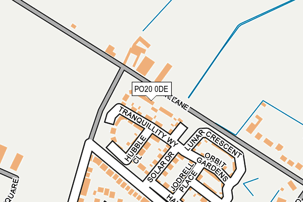
PO20 0DE is located in the Sidlesham with Selsey North electoral ward, within the local authority district of Chichester and the English Parliamentary constituency of Chichester. The Sub Integrated Care Board (ICB) Location is NHS Sussex ICB - 70F and the police force is Sussex. This postcode has been in use since May 2017.


GetTheData
Source: OS OpenMap – Local (Ordnance Survey)
Source: OS VectorMap District (Ordnance Survey)
Licence: Open Government Licence (requires attribution)
| Easting | 486528 |
| Northing | 94149 |
| Latitude | 50.740503 |
| Longitude | -0.775063 |
GetTheData
Source: Open Postcode Geo
Licence: Open Government Licence
| Country | England |
| Postcode District | PO20 |
➜ See where PO20 is on a map ➜ Where is Selsey? | |
GetTheData
Source: Land Registry Price Paid Data
Licence: Open Government Licence
| Ward | Sidlesham With Selsey North |
| Constituency | Chichester |
GetTheData
Source: ONS Postcode Database
Licence: Open Government Licence
2018 26 OCT £499,000 |
8, NEBULA RISE, SELSEY, CHICHESTER, PO20 0DE 2018 31 AUG £475,000 |
5, NEBULA RISE, SELSEY, CHICHESTER, PO20 0DE 2018 29 JUN £525,000 |
7, NEBULA RISE, SELSEY, CHICHESTER, PO20 0DE 2018 28 JUN £525,000 |
9, NEBULA RISE, SELSEY, CHICHESTER, PO20 0DE 2018 25 MAY £365,000 |
2, NEBULA RISE, SELSEY, CHICHESTER, PO20 0DE 2018 2 MAR £353,000 |
3, NEBULA RISE, SELSEY, CHICHESTER, PO20 0DE 2018 23 FEB £369,000 |
4, NEBULA RISE, SELSEY, CHICHESTER, PO20 0DE 2018 23 FEB £510,000 |
GetTheData
Source: HM Land Registry Price Paid Data
Licence: Contains HM Land Registry data © Crown copyright and database right 2025. This data is licensed under the Open Government Licence v3.0.
| Wheatfield Road (Manor Lane) | Selsey | 287m |
| Fontwell Road (Drift Road) | Selsey | 326m |
| Harcourt Way (Fontwell Road) | Selsey | 471m |
| Selsey Centre (Manor Road) | Selsey | 543m |
| Norton Corner (Chichester Road) | Selsey | 557m |
GetTheData
Source: NaPTAN
Licence: Open Government Licence
| Percentage of properties with Next Generation Access | 0.0% |
| Percentage of properties with Superfast Broadband | 0.0% |
| Percentage of properties with Ultrafast Broadband | 0.0% |
| Percentage of properties with Full Fibre Broadband | 0.0% |
Superfast Broadband is between 30Mbps and 300Mbps
Ultrafast Broadband is > 300Mbps
| Median download speed | 8.5Mbps |
| Average download speed | 8.7Mbps |
| Maximum download speed | 10.07Mbps |
| Median upload speed | 1.0Mbps |
| Average upload speed | 0.9Mbps |
| Maximum upload speed | 1.27Mbps |
| Percentage of properties unable to receive 2Mbps | 0.0% |
| Percentage of properties unable to receive 5Mbps | 0.0% |
| Percentage of properties unable to receive 10Mbps | 66.7% |
| Percentage of properties unable to receive 30Mbps | 100.0% |
GetTheData
Source: Ofcom
Licence: Ofcom Terms of Use (requires attribution)
GetTheData
Source: ONS Postcode Database
Licence: Open Government Licence


➜ Get more ratings from the Food Standards Agency
GetTheData
Source: Food Standards Agency
Licence: FSA terms & conditions
| Last Collection | |||
|---|---|---|---|
| Location | Mon-Fri | Sat | Distance |
| Drift Road | 16:50 | 11:30 | 514m |
| East Beach Post Office | 17:00 | 12:00 | 657m |
| Hanover Close | 16:15 | 11:30 | 1,102m |
GetTheData
Source: Dracos
Licence: Creative Commons Attribution-ShareAlike
The below table lists the International Territorial Level (ITL) codes (formerly Nomenclature of Territorial Units for Statistics (NUTS) codes) and Local Administrative Units (LAU) codes for PO20 0DE:
| ITL 1 Code | Name |
|---|---|
| TLJ | South East (England) |
| ITL 2 Code | Name |
| TLJ2 | Surrey, East and West Sussex |
| ITL 3 Code | Name |
| TLJ27 | West Sussex (South West) |
| LAU 1 Code | Name |
| E07000225 | Chichester |
GetTheData
Source: ONS Postcode Directory
Licence: Open Government Licence
The below table lists the Census Output Area (OA), Lower Layer Super Output Area (LSOA), and Middle Layer Super Output Area (MSOA) for PO20 0DE:
| Code | Name | |
|---|---|---|
| OA | E00160773 | |
| LSOA | E01031524 | Chichester 014C |
| MSOA | E02006574 | Chichester 014 |
GetTheData
Source: ONS Postcode Directory
Licence: Open Government Licence
| PO20 0HF | Park Lane | 159m |
| PO20 0PN | Drift Road | 167m |
| PO20 0NZ | Manor Lane | 229m |
| PO20 0PP | Drift Road | 229m |
| PO20 0HE | Park Lane | 242m |
| PO20 0NY | Wheatfield Road | 282m |
| PO20 0PQ | St Wilfreds Close | 283m |
| PO20 0PH | Roundstone Way | 300m |
| PO20 0PL | Fontwell Road | 350m |
| PO20 0PR | Park Road | 350m |
GetTheData
Source: Open Postcode Geo; Land Registry Price Paid Data
Licence: Open Government Licence