Property/Postcode Data Search:
PO19 6EP maps, stats, and open data
PO19 6EP is located in the Chichester North electoral ward, within the local authority district of Chichester and the English Parliamentary constituency of Chichester. The Sub Integrated Care Board (ICB) Location is NHS Sussex ICB - 70F and the police force is Sussex. This postcode has been in use since December 2019.
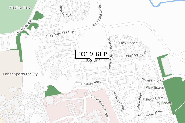
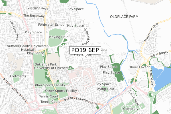
PO19 6EP maps


Source: OS Open Zoomstack (Ordnance Survey)
Licence: Open Government Licence (requires attribution)
Attribution: Contains OS data © Crown copyright and database right 2025
Source: Open Postcode Geo
Licence: Open Government Licence (requires attribution)
Attribution: Contains OS data © Crown copyright and database right 2025; Contains Royal Mail data © Royal Mail copyright and database right 2025; Source: Office for National Statistics licensed under the Open Government Licence v.3.0
Licence: Open Government Licence (requires attribution)
Attribution: Contains OS data © Crown copyright and database right 2025
Source: Open Postcode Geo
Licence: Open Government Licence (requires attribution)
Attribution: Contains OS data © Crown copyright and database right 2025; Contains Royal Mail data © Royal Mail copyright and database right 2025; Source: Office for National Statistics licensed under the Open Government Licence v.3.0
PO19 6EP geodata
| Easting | 486803 |
| Northing | 106000 |
| Latitude | 50.847010 |
| Longitude | -0.768371 |
Where is PO19 6EP?
| Country | England |
| Postcode District | PO19 |
Politics
| Ward | Chichester North |
|---|---|
| Constituency | Chichester |
House Prices
Sales of detached houses in PO19 6EP
15, BOUNDARY LANE, CHICHESTER, PO19 6EP 2020 10 JAN £540,000 |
16, BOUNDARY LANE, CHICHESTER, PO19 6EP 2020 6 JAN £585,000 |
17, BOUNDARY LANE, CHICHESTER, PO19 6EP 2019 20 DEC £600,000 |
14, BOUNDARY LANE, CHICHESTER, PO19 6EP 2019 20 DEC £603,750 |
Source: HM Land Registry Price Paid Data
Licence: Contains HM Land Registry data © Crown copyright and database right 2025. This data is licensed under the Open Government Licence v3.0.
Licence: Contains HM Land Registry data © Crown copyright and database right 2025. This data is licensed under the Open Government Licence v3.0.
Transport
Nearest bus stops to PO19 6EP
| Millfield Store (Bradshaw Road) | Chichester | 328m |
| Bradshaw Road (Barnfield Drive) | Chichester | 338m |
| Millfield Store (Bradshaw Road) | Chichester | 340m |
| Bradshaw Road (Barnfield Drive) | Chichester | 343m |
| The Pitcroft (Barnfield Drive) | Chichester | 424m |
Nearest railway stations to PO19 6EP
| Chichester Station | 1.9km |
| Fishbourne Station | 3.4km |
Deprivation
45.6% of English postcodes are less deprived than PO19 6EP:Food Standards Agency
Three nearest food hygiene ratings to PO19 6EP (metres)
Sussex Partnership NHS Trust

The Oakland's Centre
148m
Sussex Partnership NHS Trust

The Chichester Centre
190m
WHSmith

St Richards Hospital
383m
➜ Get more ratings from the Food Standards Agency
Nearest post box to PO19 6EP
| Last Collection | |||
|---|---|---|---|
| Location | Mon-Fri | Sat | Distance |
| St Richards Hospital | 17:30 | 12:20 | 382m |
| Swanfield Drive | 16:00 | 12:15 | 446m |
| Litten Terrace | 16:00 | 12:30 | 793m |
PO19 6EP ITL and PO19 6EP LAU
The below table lists the International Territorial Level (ITL) codes (formerly Nomenclature of Territorial Units for Statistics (NUTS) codes) and Local Administrative Units (LAU) codes for PO19 6EP:
| ITL 1 Code | Name |
|---|---|
| TLJ | South East (England) |
| ITL 2 Code | Name |
| TLJ2 | Surrey, East and West Sussex |
| ITL 3 Code | Name |
| TLJ27 | West Sussex (South West) |
| LAU 1 Code | Name |
| E07000225 | Chichester |
PO19 6EP census areas
The below table lists the Census Output Area (OA), Lower Layer Super Output Area (LSOA), and Middle Layer Super Output Area (MSOA) for PO19 6EP:
| Code | Name | |
|---|---|---|
| OA | E00160573 | |
| LSOA | E01031488 | Chichester 008D |
| MSOA | E02006568 | Chichester 008 |
Nearest postcodes to PO19 6EP
| PO19 6AN | Graylingwell Drive | 67m |
| PO19 6UW | Palmers Field Avenue | 81m |
| PO19 6UH | Bostock Road | 104m |
| PO19 6YE | Palmers Field Avenue | 129m |
| PO19 6UL | Bostock Road | 131m |
| PO19 6YF | Kidd Road | 155m |
| PO19 6UT | Barnfield Drive | 166m |
| PO19 6YN | Mansergh Road | 182m |
| PO19 6YW | Mansergh Road | 196m |
| PO19 6UZ | Tenacre Close | 231m |